In the same way that Rev. Henry Rix bought land in Shipdham through the Queen Anne’s Bounty scheme to supplement the income of the Deopham clergy in posterity, the parishes of Witton and Walcott purchased land in Deopham to supplement the income of their clergy.
White’s History, Gazetteer & Directory of Norfolk, 1883 states of Witton that “The vicarage … was augmented with £400 of Queen Anne’s bounty in 1767 and 1786“. It also states of Walcot that the vicarage “was augmented in 1800 and 1817 with £600 of Q.A.B.” It remains to be identified where either parish invested these sums until 1815, but it appears that they joined forces then and acquired land in Deopham.
The following extract from a map of 1814 shows the fields that were belonging to the executors of John Bousell – plots 48 and 51. As can be seen from the 1815 plan below, plot 51 was later subdivided and part sold to John Steward, the remainder being acquired for the benefit of Witton parish. Presumably the subdivision would have been necessary to acquire land that met the QAB funds available. Matching precise funds to land was a known difficulty in administering the QAB grants. Plot 48 was acquired for the benefit of Walcott parish.
1814

All rights reserved by Norfolk Record Office who hold the original; their ref is NRO C/Sca 2/86
1815
The following tracing from the deeds of May 2nd 1815 shows the land in question:
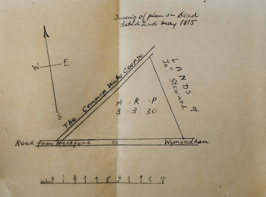
The 1815 Survey of Deopham refers to the fact that the Common Allotment North of Hackford Road was sold to “Revd George Hewitt & John Steward Esqr“. The “Common Allotment west of Hackford Road” was sold to Revd George Hewitt.
1843
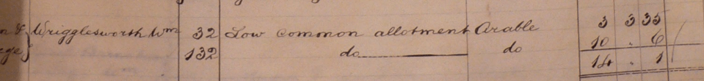
The summary page of the 1843 tithe analysis has been amended from Revd George Hewitt to show that the “Vicar of Witton and Vicar of Walcot” (presumably two persons) were the owners of the 14 acres of land occupied by William Wrigglesworth:

All rights reserved by Norfolk Record Office who hold the original; their ref is NRO PD 485/28
The detailed analysis of this 1843 survey shows that these 14 acres were made up of plots 32 and 132, both now called “Low Common Allotment”:
All rights reserved by Norfolk Record Office who hold the original; their ref is NRO PD 485/28
Plots 32 and 132 are marked in green on the 1843 tithe map below:

All rights reserved by Norfolk Record Office who hold the original; their ref is NRO DN/TA 743
1883
The following extract from the 1882 OS map LXXIII.12 shows more clearly how the Witton land (plot 462) is adjacent to the watercourse shown on the 1815 deeds. The Walcot land is plot 434 which is still regarded as a single entity although it appears to be subdivided.

1887
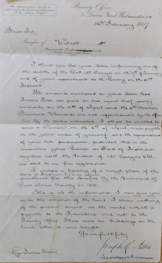
In 1887 the Bounty Office confirmed their involvement with the three acres of land identified in the 1815 deeds map reproduced above.
1895


The following calculations show that the executors of Philip Pitts paid £6 in rent for these lands up to Michaelmas 1894. Two thirds of this went to the Rev. Francis Proctor less two thirds of the year’s expenses. The balance of £1 10s 7d went to the Rev. James Slater at Happisburgh, as addressed in the above letter.

All rights reserved by Norfolk Record Office who hold the original; their ref is NRO PD 516/32
1906
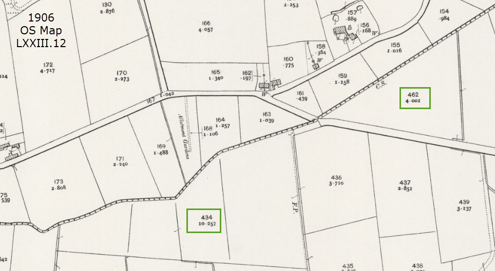
The following extract from OS Map LXXIII.12 shows the Witton and Walcott plots. The Witton land is plot 462 and the Walcot land is plot 434.
1933


All rights reserved by Norfolk Record Office who hold the original; their ref is NRO PD516/23
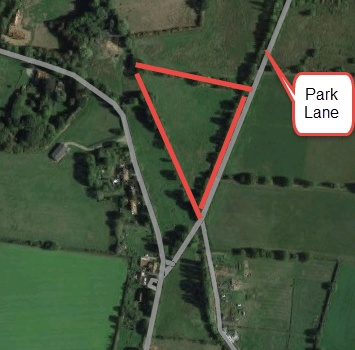
2023
The following extract from Google Maps shows the Witton field in 2023:
| Date | Change |
|---|---|
| 5/9/23 | Published |
