Contents
1814 – Post Inclosures
The red line shows the boundary of the village of Deopham. To the west of the farm is “Town House Lane“, previously called Snaylegate.
Including the two fields outside the Deopham boundary, which account for 9 acres, the total acreage of the farm at this time would have been 42 acres.
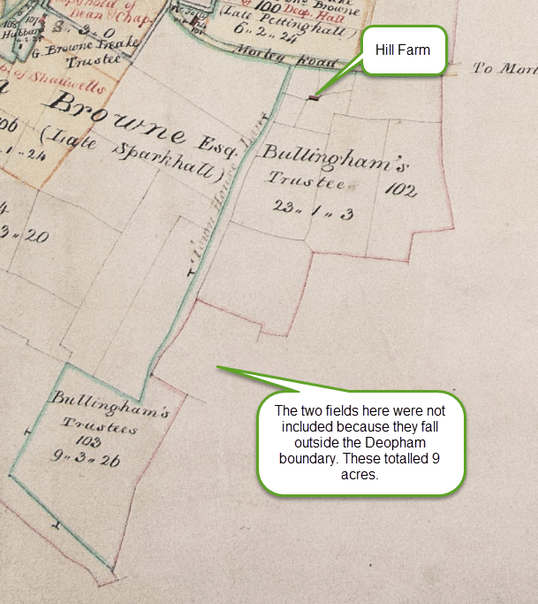
The text compiled by the Deopham Inclosure Commissioners that accompanies the above plan is as follows:
And we assign set out and allott unto Garrett Oddin Taylor as trustee of Mary the Wife of John Bullingham the two pieces of land next herein after described, namely,
First one piece of land marked on the map hereto annexed No 102 containing twenty three acres, one rood and three perches with a messuage and other buildings standing theron bounded by the Morley Road north, by the parish of Morley east and in part south by the next described allotment on the remaining part of the south and by the land allotted to John Browne west;
Second and one other piece of land marked on the map hereto annexed No 103 containing nine acres, three roods and twenty six perches bounded by the last described allotment in part north, by the parish f Morley in further part north and wholly east and by land allotted to John Browne south and west, and on the remaining part of the north;
and we direct the said Garrett Oddin Taylor as trustee of the said Mary Bullingham to make and keep in repair the fences in his said allotment next herein after described, namely,
In his first allotment against the Public Road and in his second allotment against the Bounds of Morley.
1882
The following extract is from a map surveyed in 1882 and published in 1885.
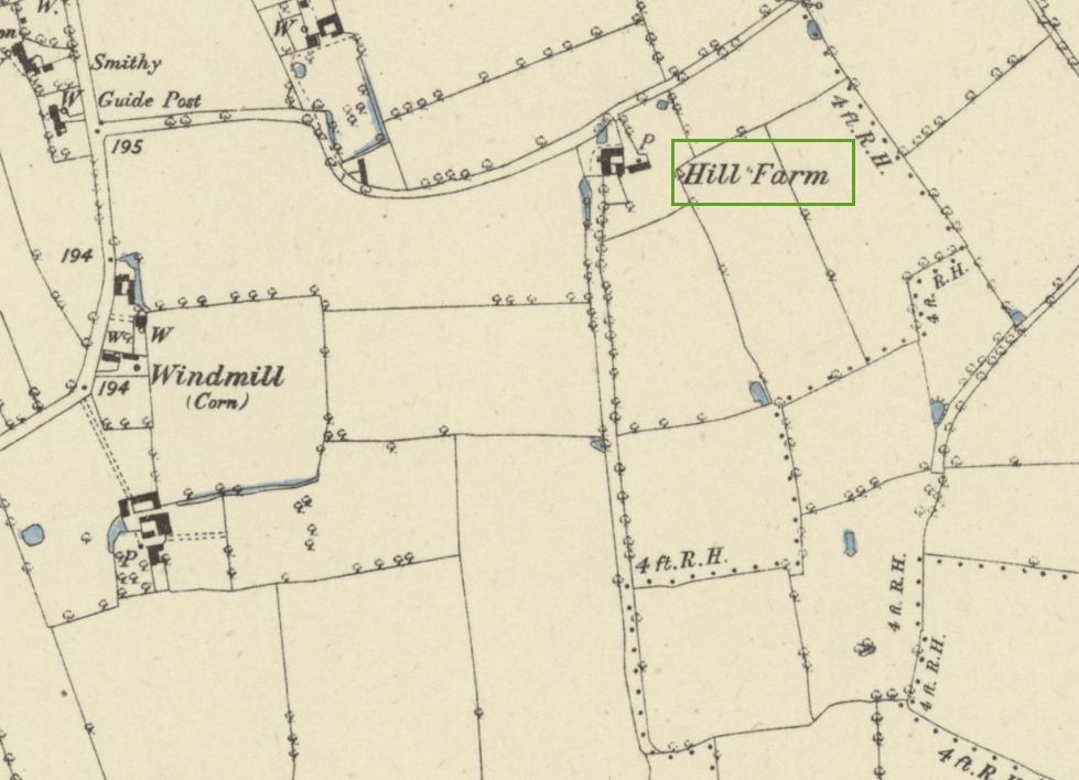
Reproduced with the permission of the National Library of Scotland
1941
There are details of the 1941 Farm Survey for Hill Farm here. These show that Eric Sizeland was the farmer at that time, with the farm comprising 45 acres of land.
1968
The following two photographs of Hill Farm were taken in March 1968. Kathleen Flowerday has noted that Eric Sizeland sold the farm to Jack Brown of Mill Farm who then sold off some of the land and buildings.
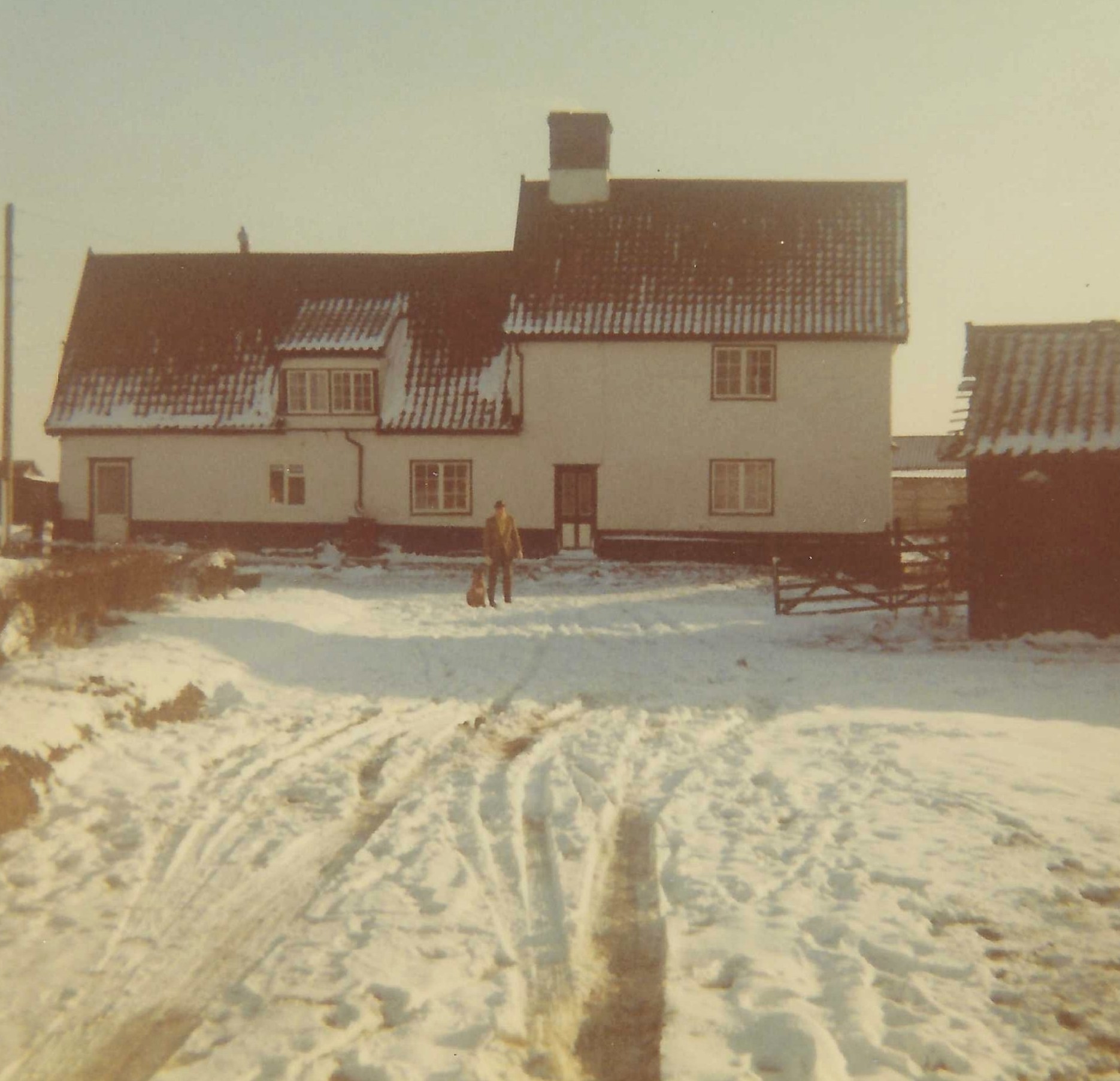
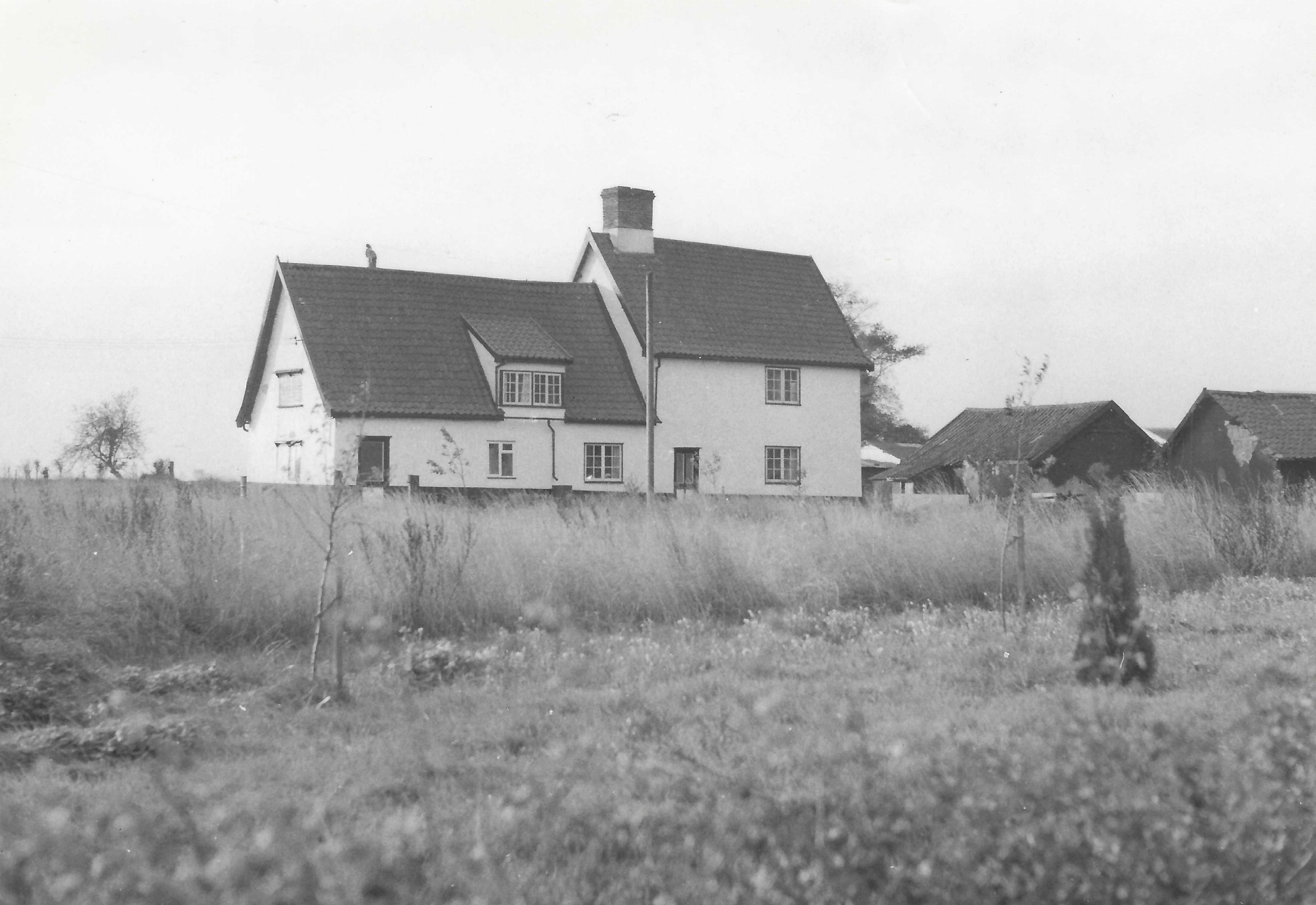
With thanks to Kathleen Flowerday for access to these two photographs.
Hill Farm in 2023

Photo: G. Sankey, July 2023
Hill Farm in 2026
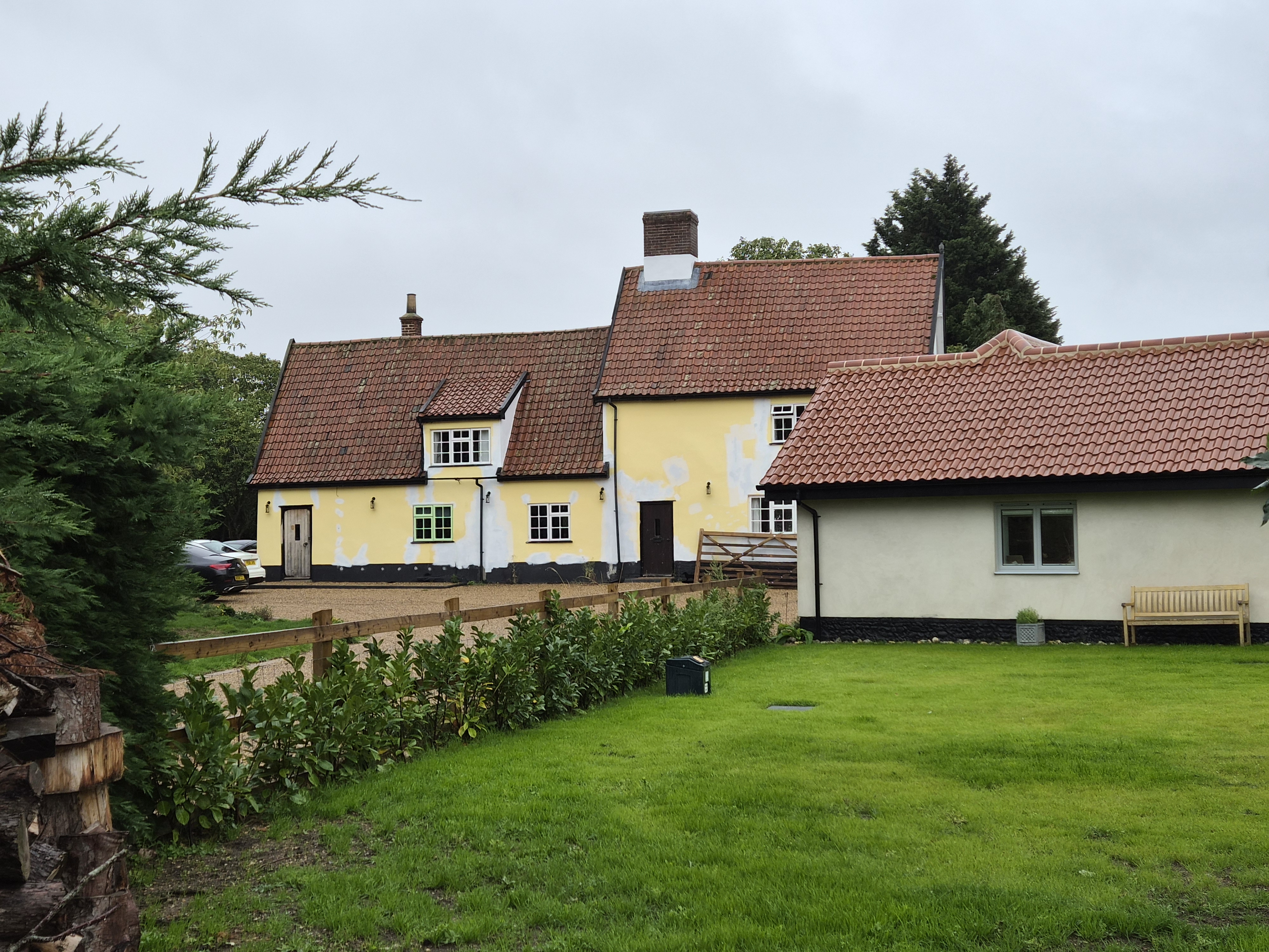
Photo: G. Sankey, September 2026
Navigation
| Date | Change |
|---|---|
| 10/9/26 | Published |

