Contents
Old Maps
1797
1797: Fadens Map of Norfolk
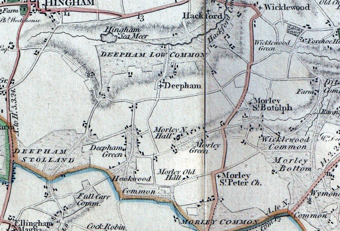
http://www.fadensmapofnorfolk.co.uk/links.asp
1813
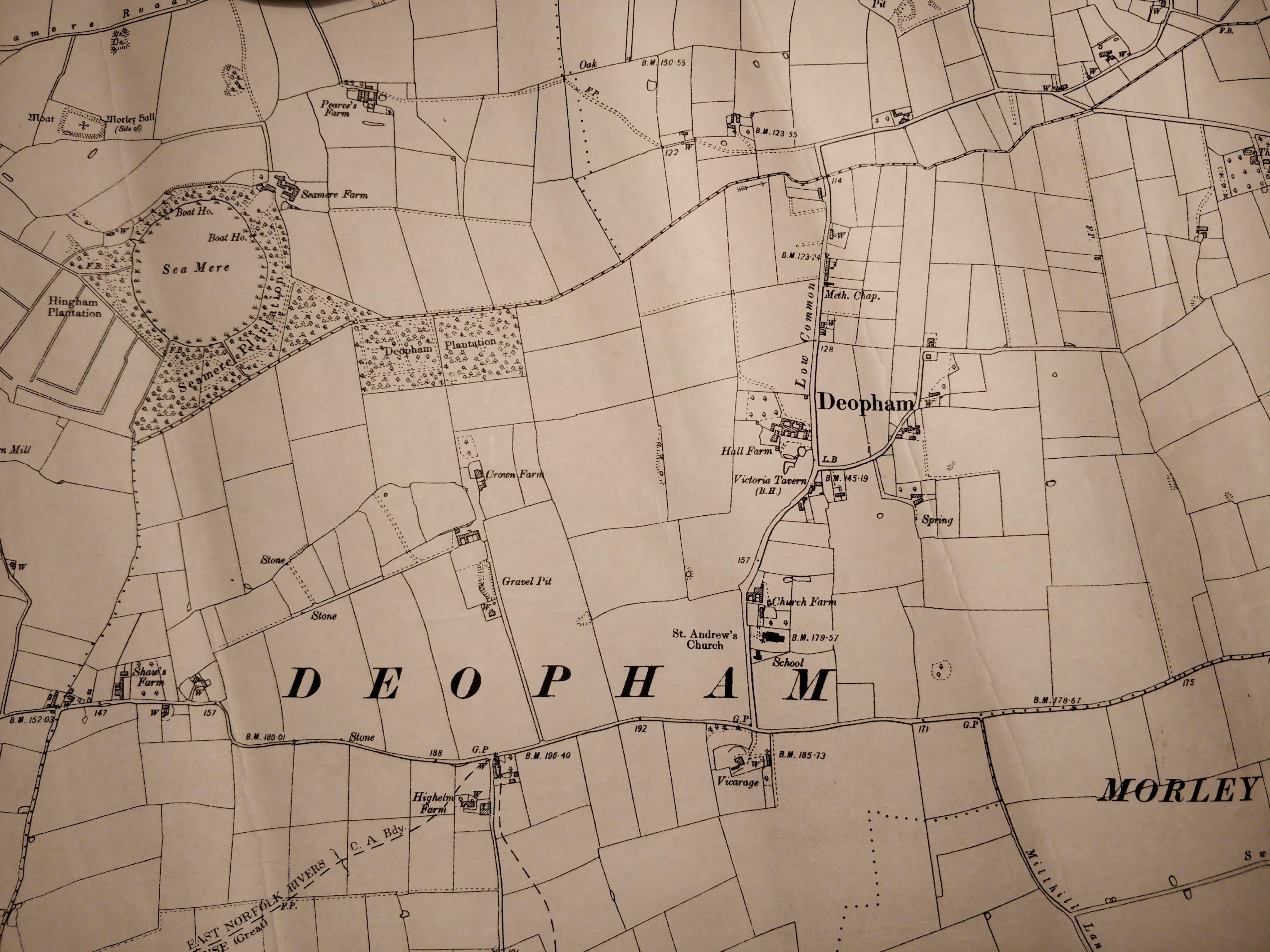
1813: Land in Deopham belonging to Lord Wodehouse which was farmed as Hall Farm (now Hall Farm, Church Road).

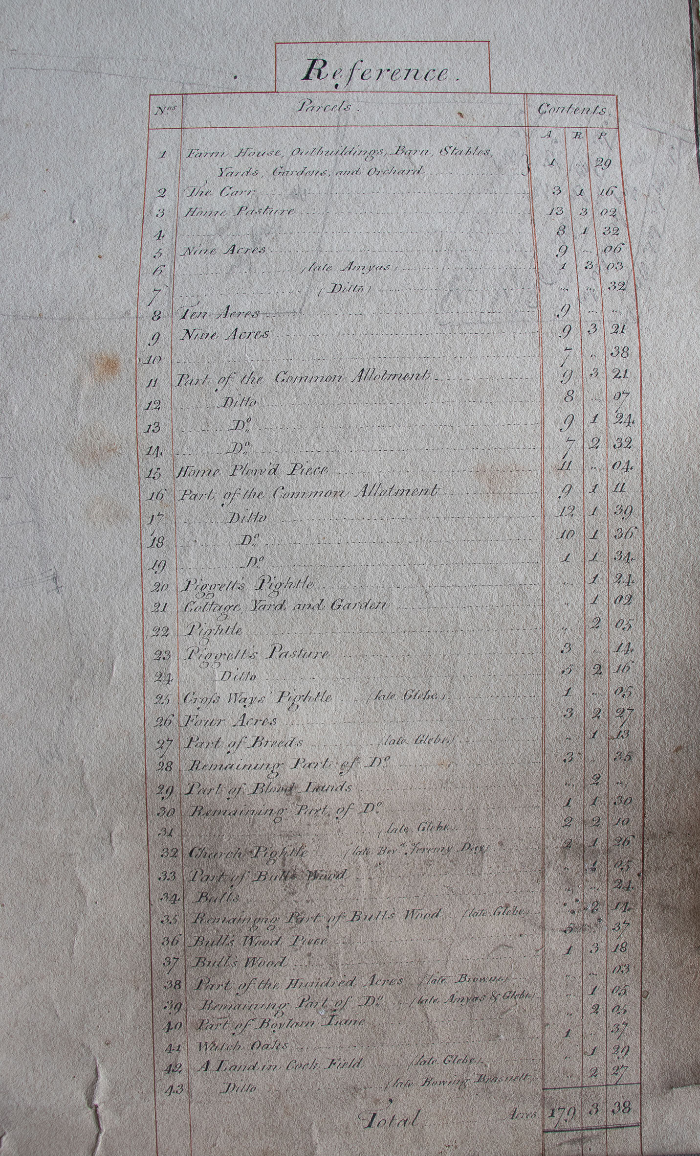
Thanks to Michael Allen for allowing sight of this map.
1814
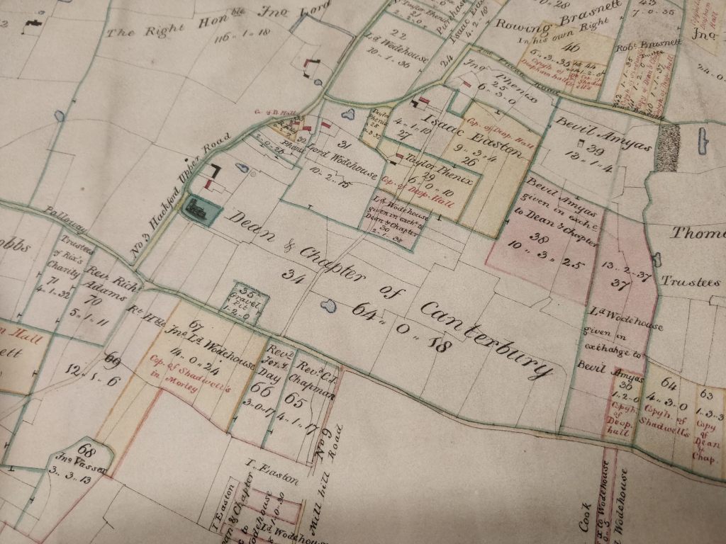
1814, Browne & Taylor.
The right-hand image is a close-up of the area around the church.
This map is particularly significant as it shows the boundaries and ownership of land following the Enclosures Act of 1814.
Click on either map to see it in more detail, then double click to zoom in further.
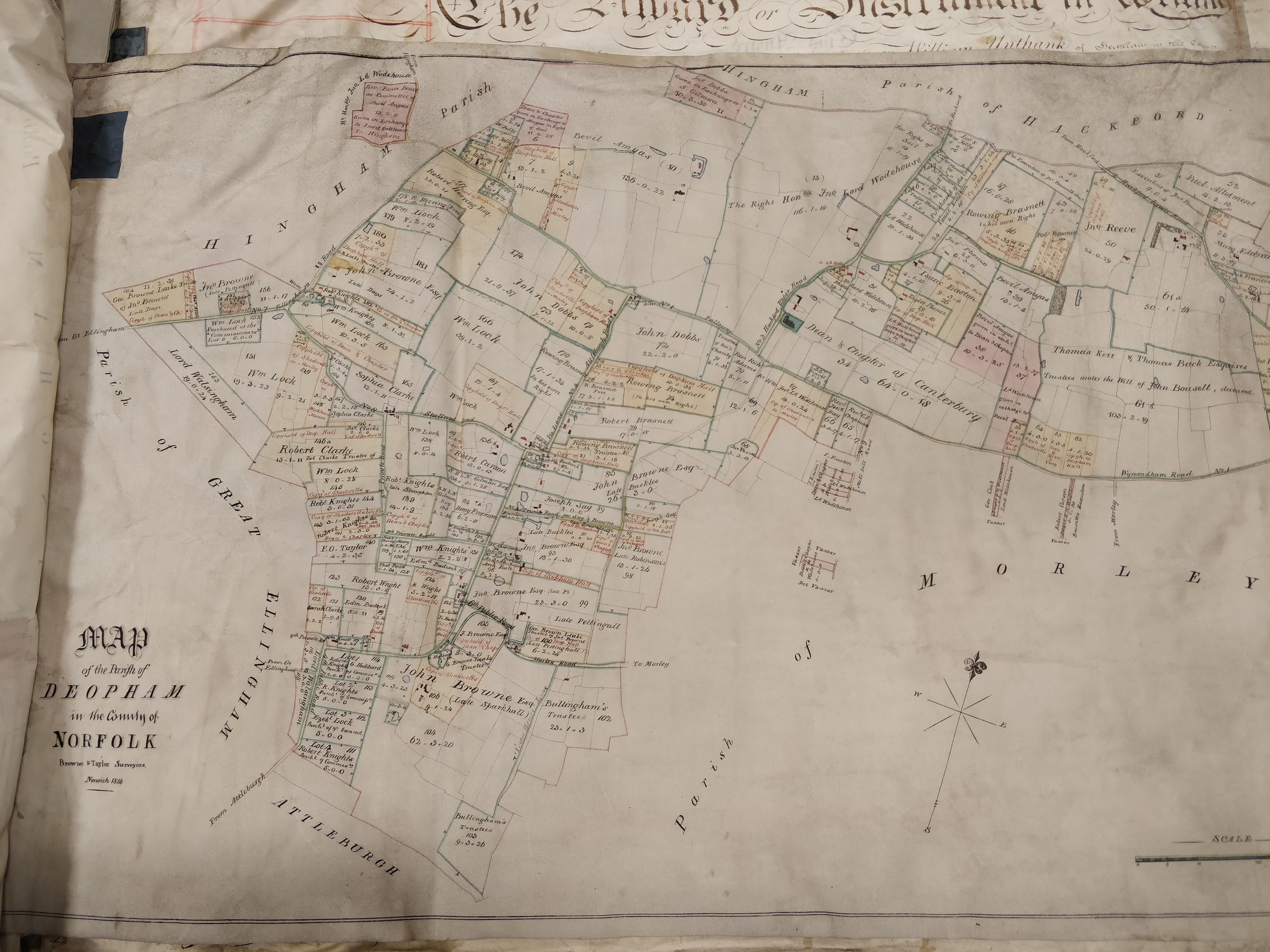
All rights reserved by Norfolk Record Office who hold the original; their ref is NRO C/Sca 2/86
1826
The following map was published by Bryants. They went out of business in 1835 due to the increasing difficulty of competing with the government-supported Ordnance Survey.

1826
1831
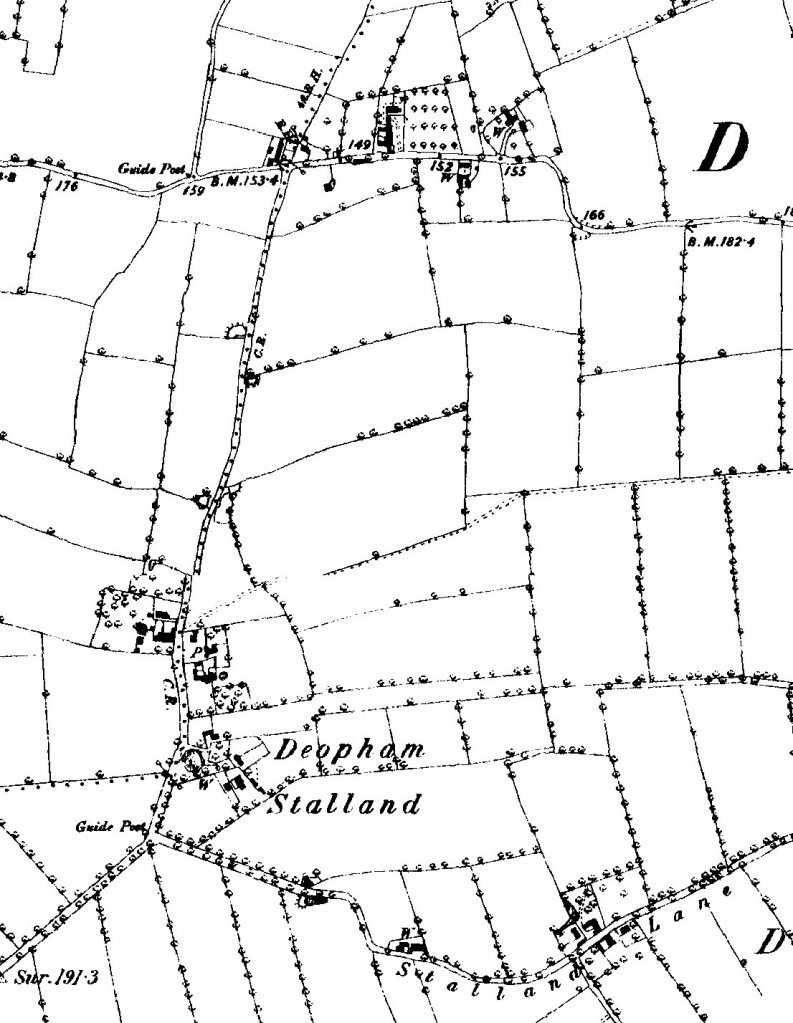
1831 Ordnance Survey
Thanks to Sarah Raper for sight of this map
1838

1838, Ordnance Survey. From a reprint published by David & Charles
1843
1843 Tithe Map by Millard & Son.
The plot numbers shown on this map are listed in the report that can be accessed here. Click on an image to open it in more detail, then double click to zoom in. The right hand version has been annotated to show the church.

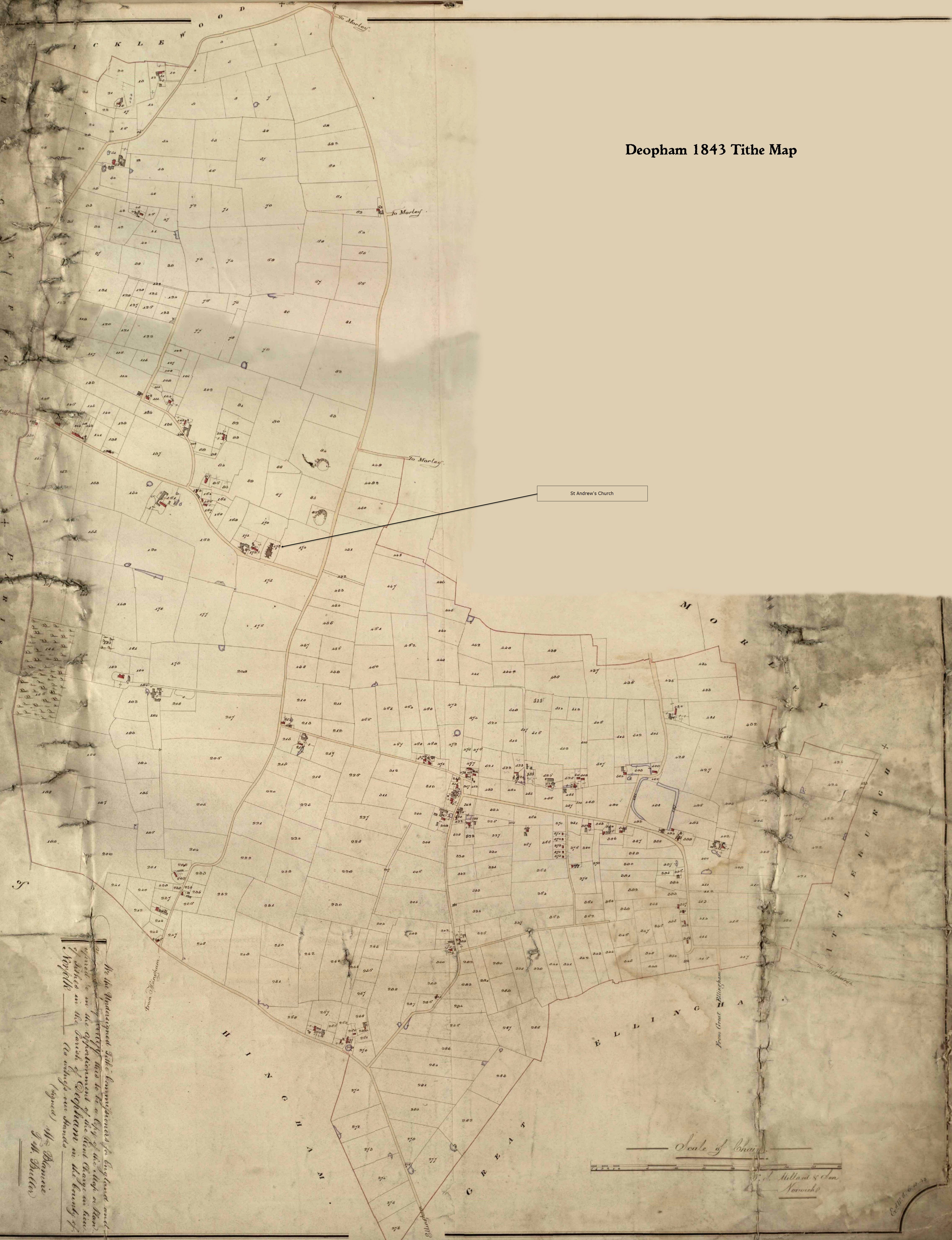
All rights reserved by Norfolk Record Office who hold the original; their ref is NRO DN/TA 743
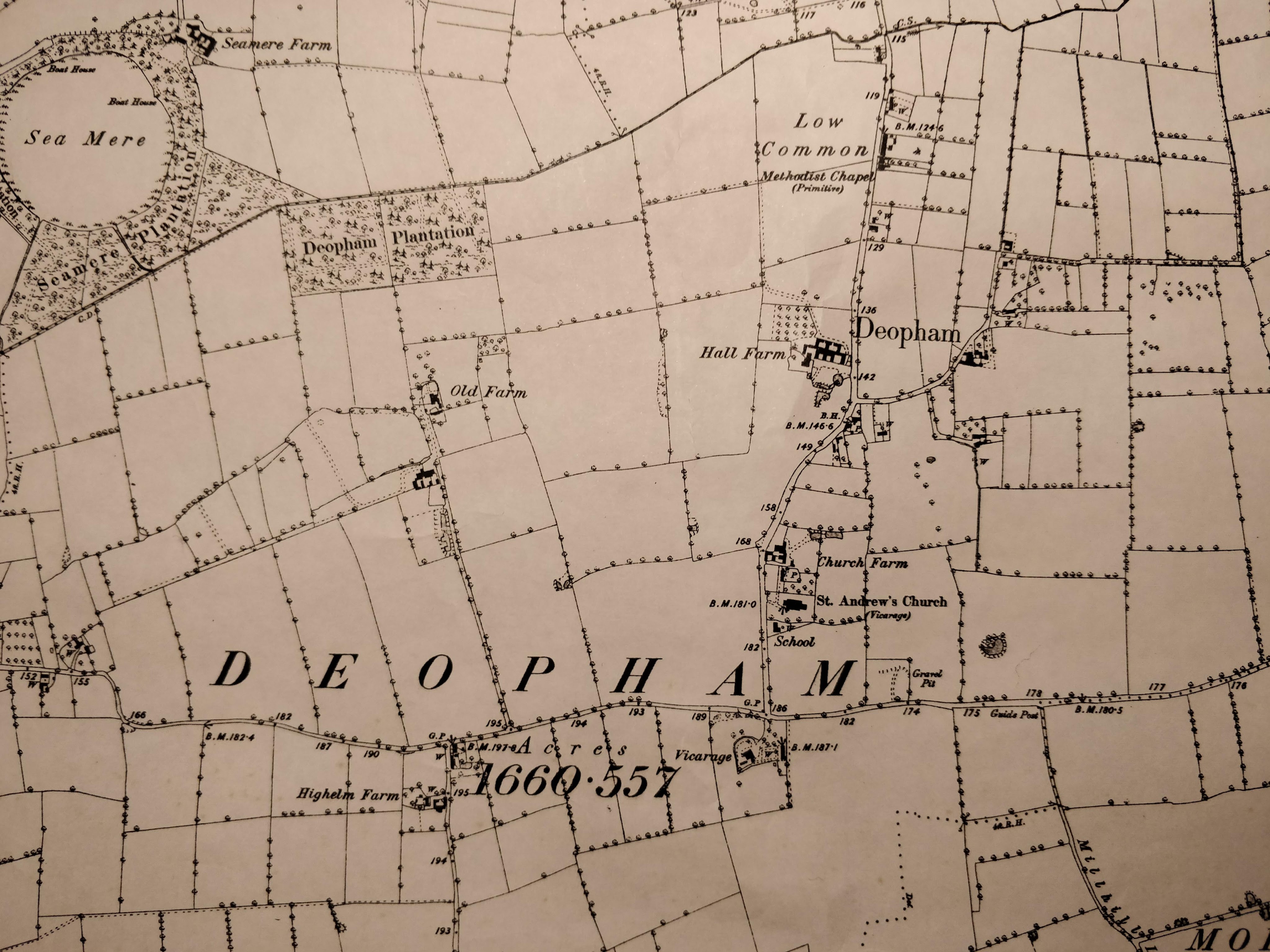
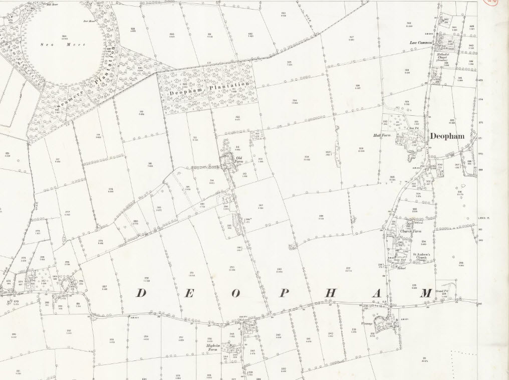
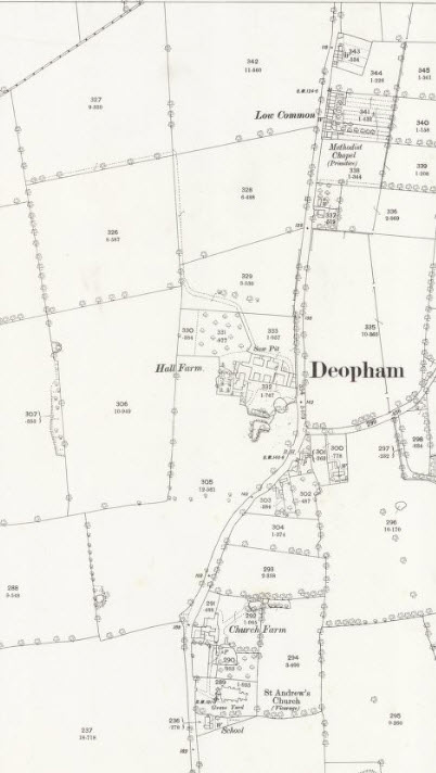
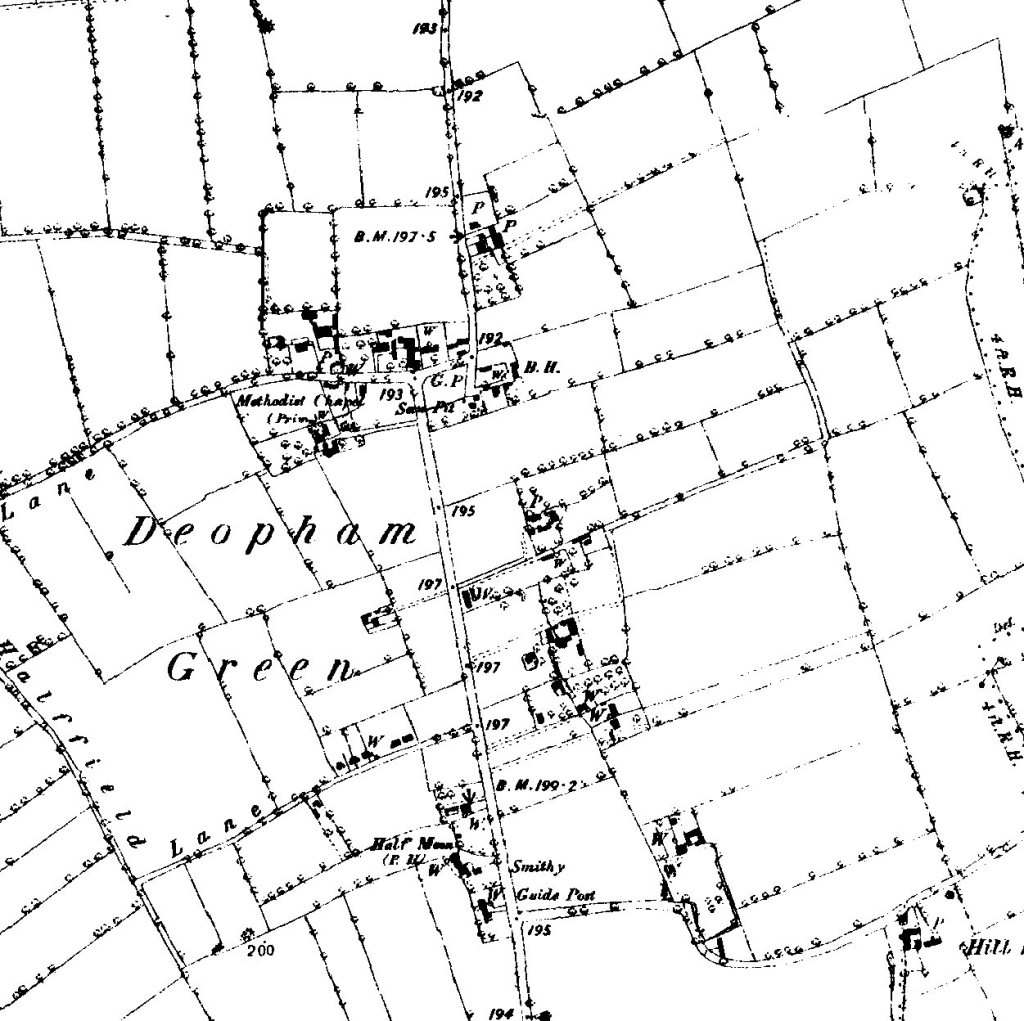
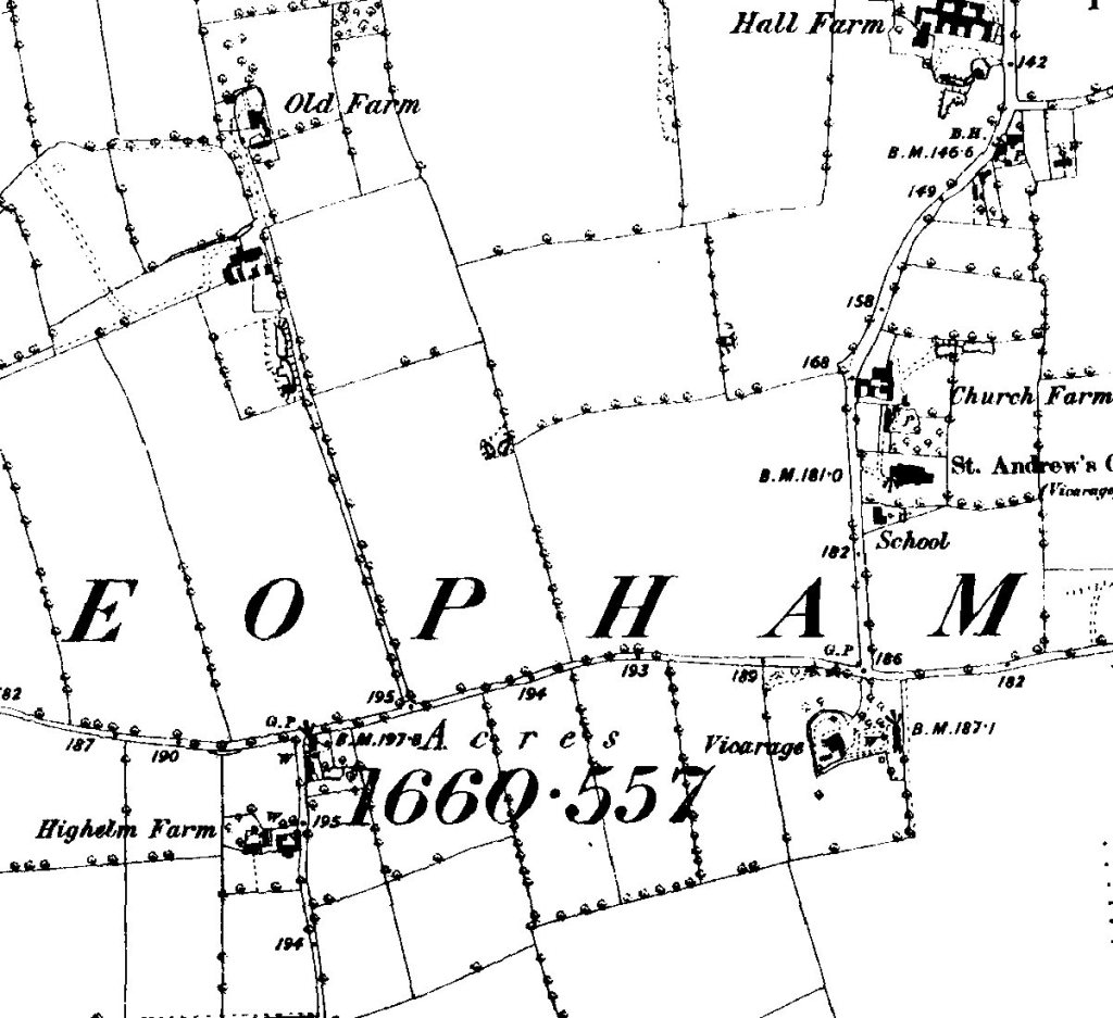
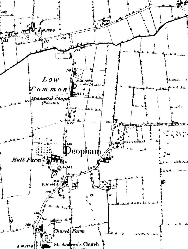
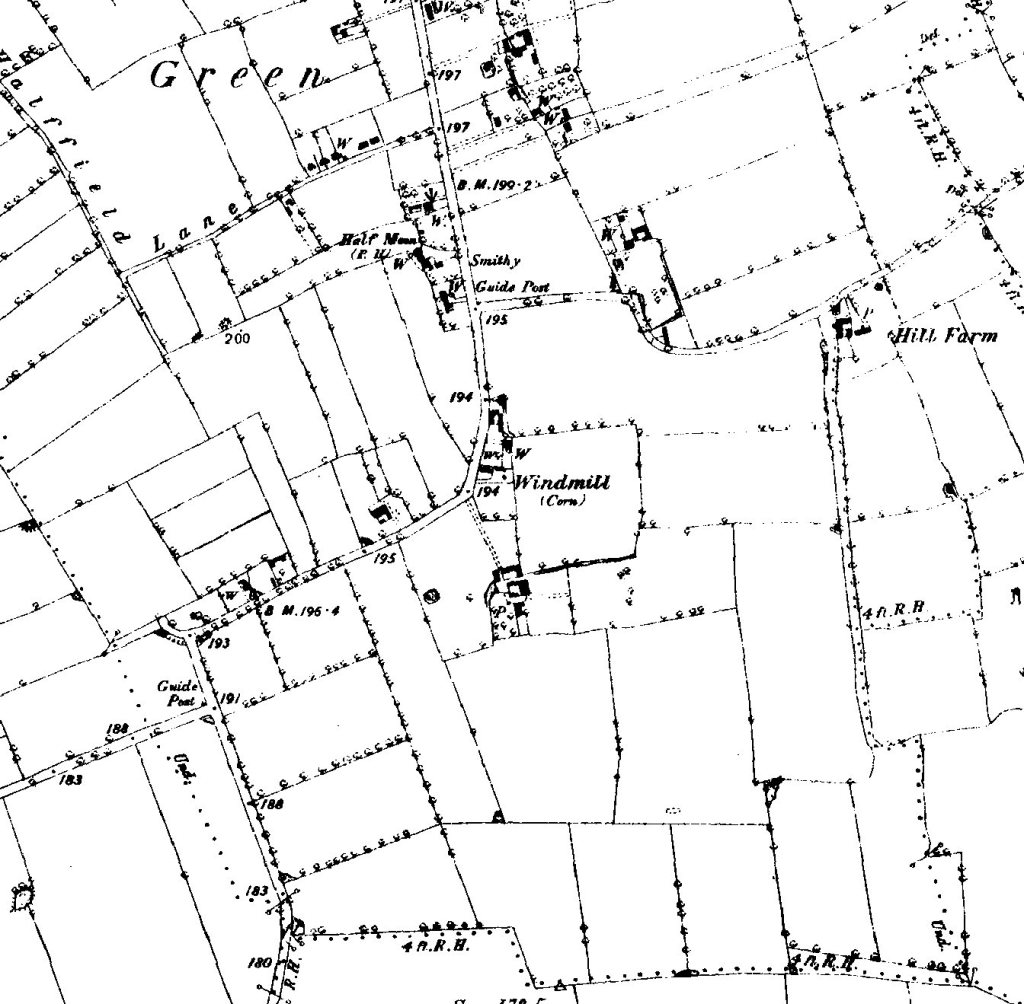
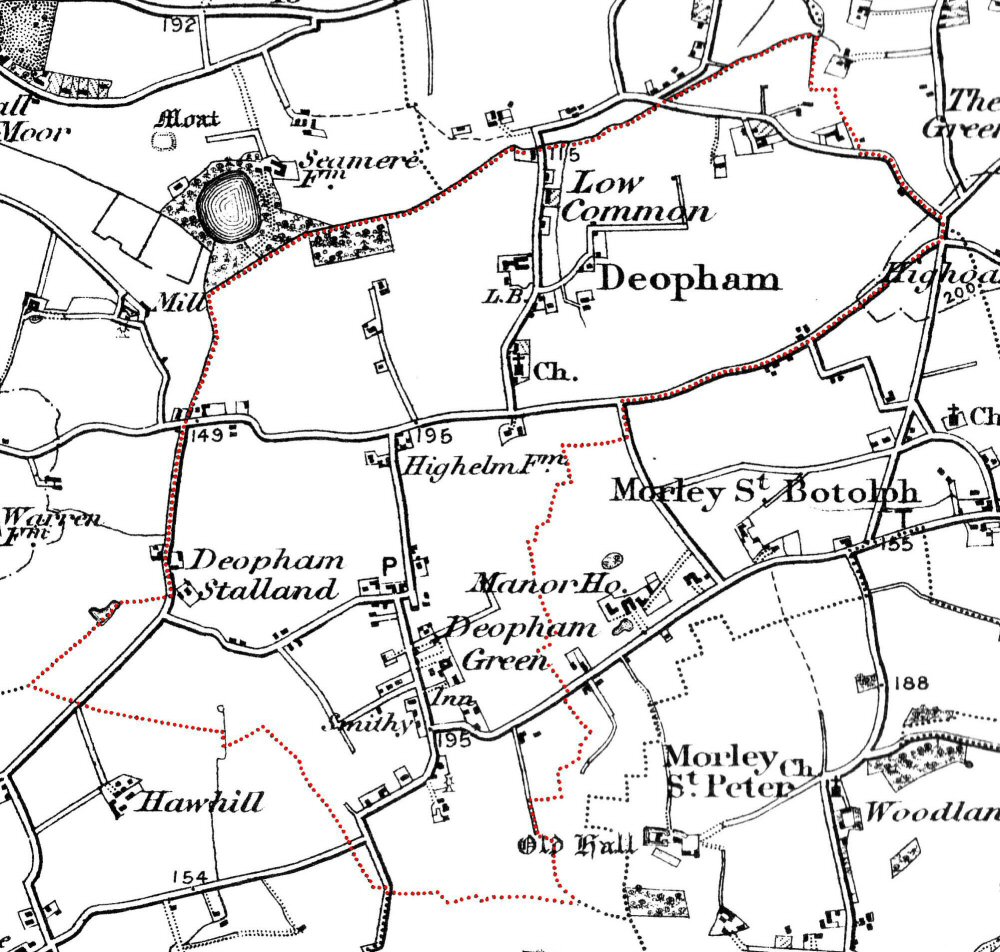
1883
1883 OS Map. The right hand image shows the area around Low Common in more detail. Click on an image to open it in more detail, then double click to zoom in.
1892
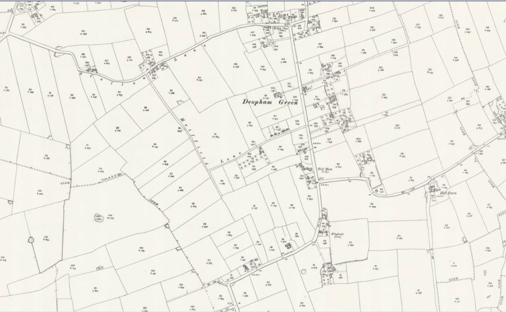
1892 Deopham Green
Thanks to Phil Long for this map
The following maps are from an agreement dated 1892 for William Allen to take on the lease of Hall Farm (now known as Crown Farm). The document is behind glass so difficult to photograph clearly; furthermore, it was folded in half before framing so not all is visible.
There is more information on the context of these maps on the Crown Farm page.
Click on an image to open it in more detail, then double click to zoom in.


Thanks to Michael Allen for sight of this in October 2022.
1892 High Elm:
Thanks to Phil Long for this map
1892 Low Common:
Thanks to Phil Long for this map
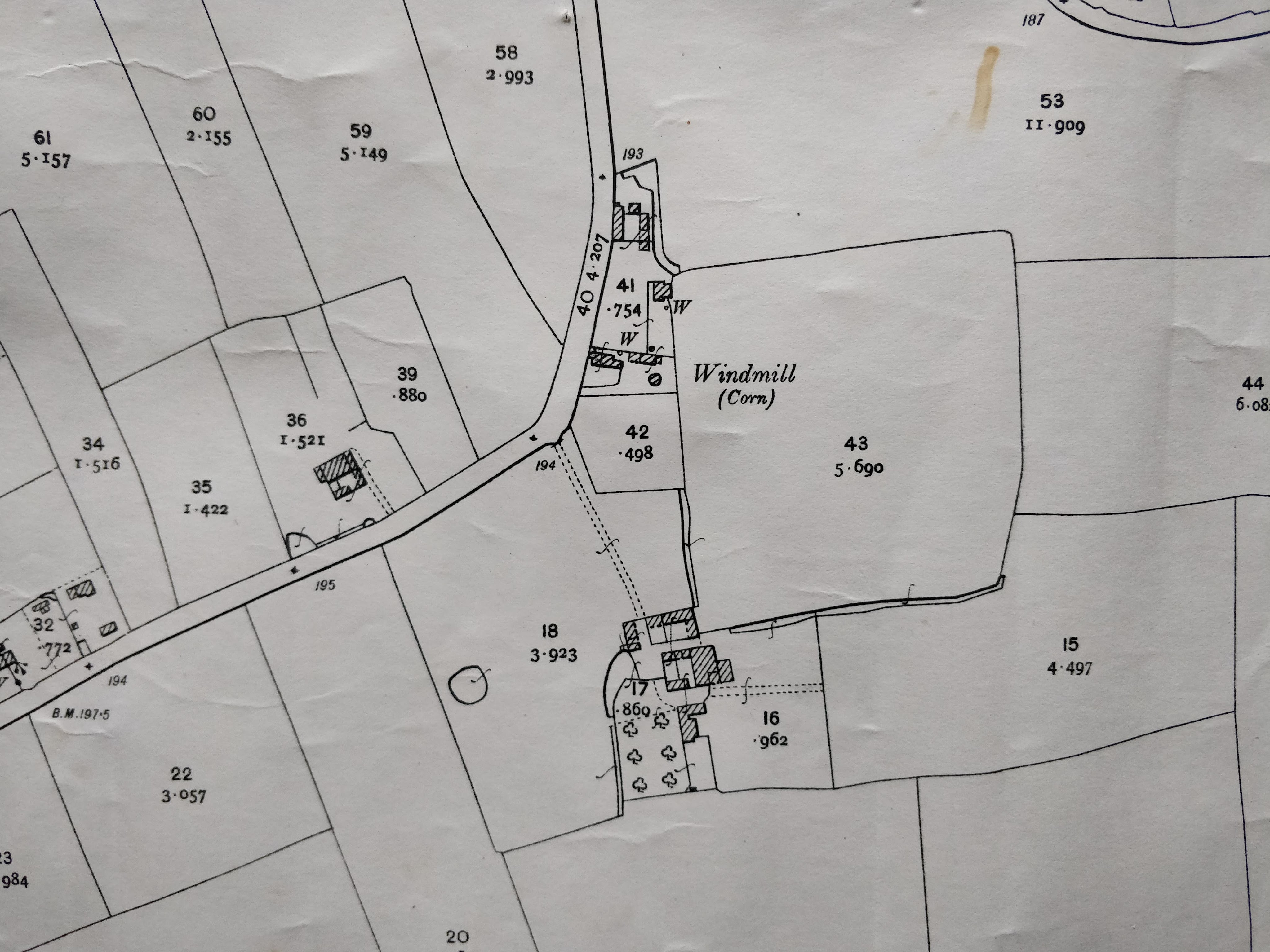
1892 South Hill:
Thanks to Phil Long for this map
1892 Stalland & Hingham Road:
Thanks to Phil Long for this map
1906
The following map of Deopham Green can be opened in greater detail, using a new tab, here. The Low Common area is available here, and the Victoria Lane area here.
The following is an extract showing the area around Mill Farm:
1907
1907 Ordnance Survey:
Thanks to Sarah Raper for sight of this map
1908
Thanks to Phil Long for this map
Airfield Location Plan:
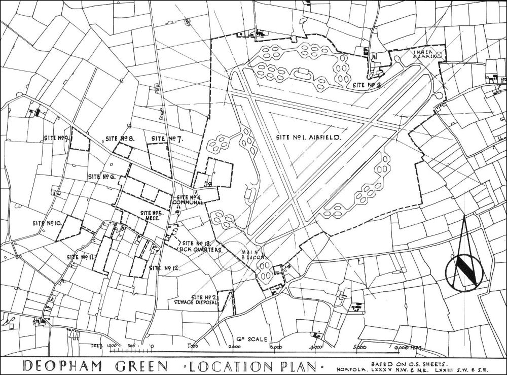
Thanks to Phil Long for this map
1945
Deopham Airfield Details.
See below for key to buildings.
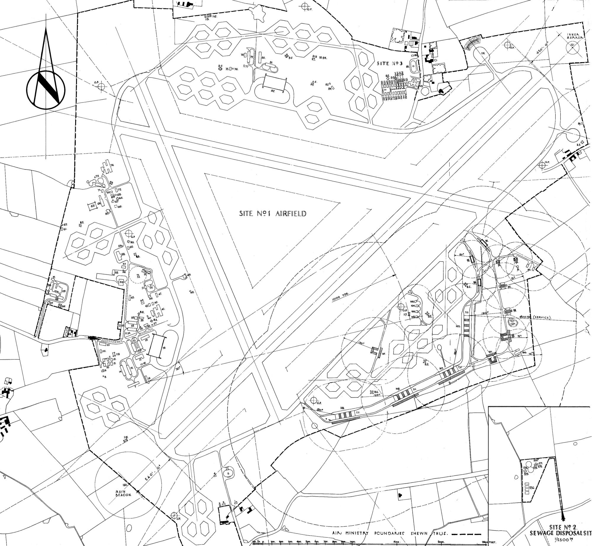
Thanks to Phil Long for this map.
Key to Detailed Airfield Map:
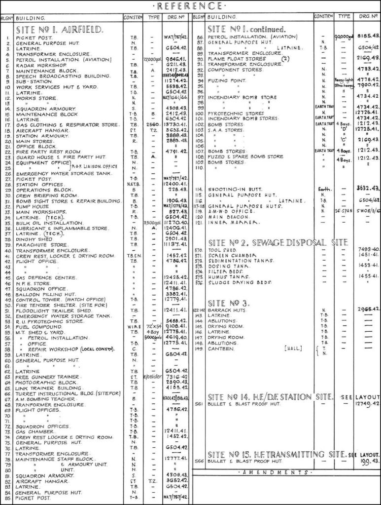
Thanks to Phil Long for this index.
1959
Ordnance survey 1959:

Thanks to Sarah Raper for the loan of this map.
2005
2005 Ordnance Survey – High Elm:
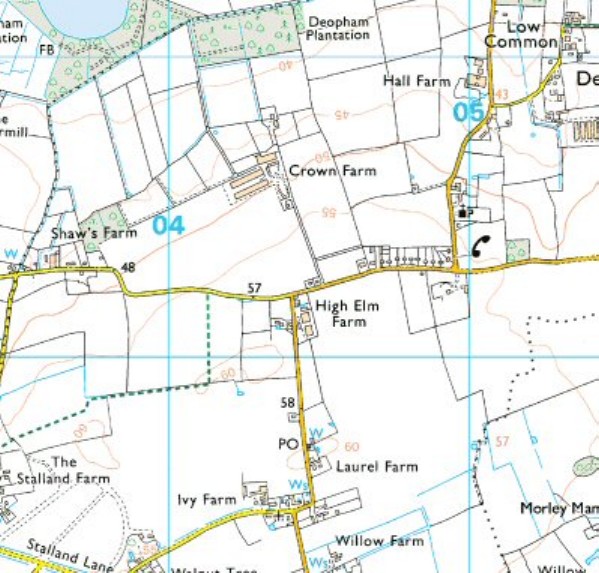
Thanks to Phil Long for this map
2005 Ordnance Survey – Low Common:
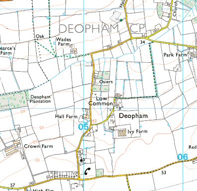
Thanks to Phil Long for this map
2005 Ordnance Survey – Low Common East
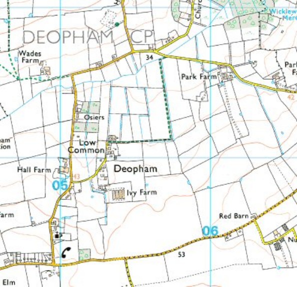
Thanks to Phil Long for this map
2005 Ordnance Survey – South Hill:
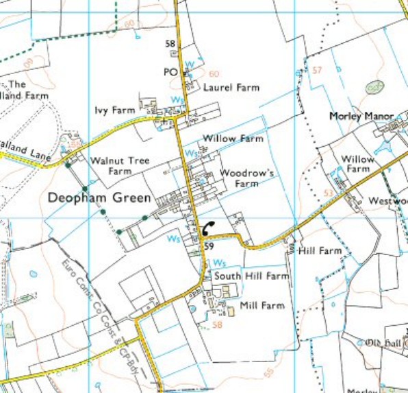
Thanks to Phil Long for this map
2005 Ordnance Survey – The Stalland:
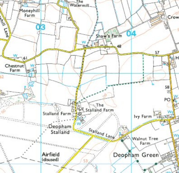
Thanks to Phil Long for this map
Deopham Today
| Date | Change |
|---|---|
| 17/8/25 | Replaced Faden’s 1797 map |
| 15/4/24 | 1813 map enlarged |
| 28/12/23 | Minor reformatting |
| 28/8/23 | Link to 1906 Victoria Lane area |
| 26/7/23 | Added link to 1906 Low Common Map |
| 30/8/22 | Published |
