Contents
1843 Tithe Survey
The following extract from the 1843 Tithe Map shows the extent of the farm owned and occupied by John Fenix outlined in green. He lived in farm 104 – now known as South Cottage. The full tithe analysis of John Fenix’s lands is available here. John Fenix Junior lived in Farm 112.
The area outlined in red was at this time owned by Rowing Brasnett’s executors, but farmed by John Fenix. The full tithe analysis of Rowing Brasnett’s lands is available here.
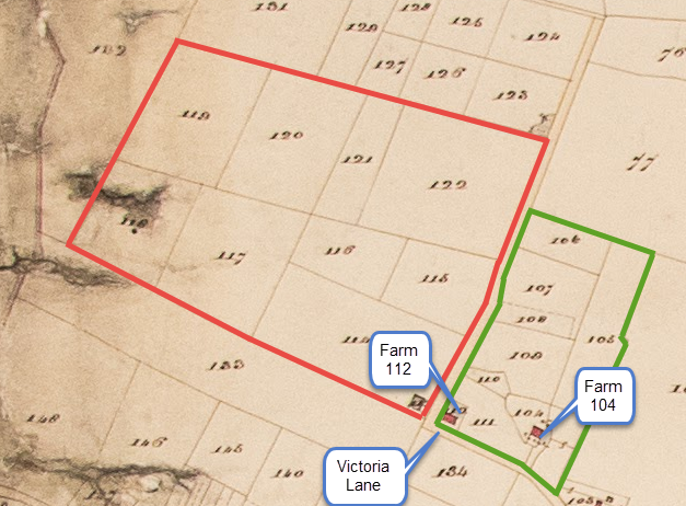
All rights reserved by Norfolk Record Office who hold the original; their ref is NRO DN/TA 743
1941
See here for details of Home Farm at the time of the 1941 Farm Survey. This shows that the owner and farmer at the time was Mr. Samuel P. Stone.
1943
The following particulars relate to the sale of the farm by “Mr S. Phoenix Stone (who is retiring from Farming)”:

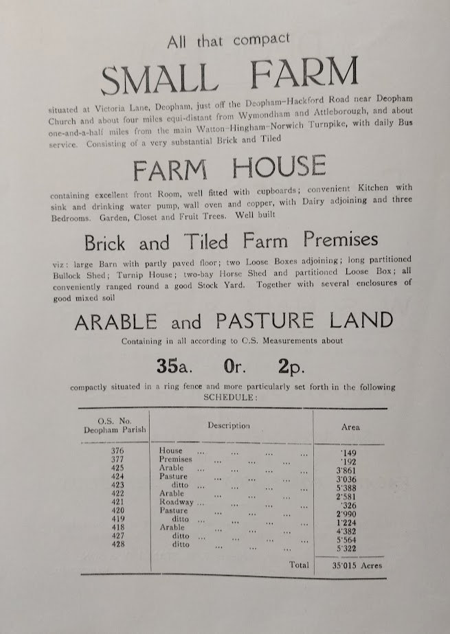

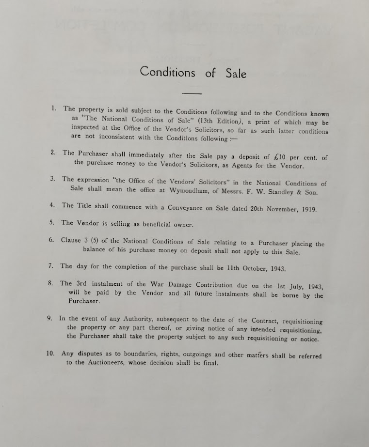
Reproduced by courtesy of Wymondham Town Archive; their ref BF61.
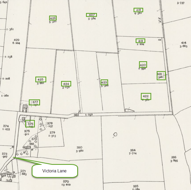
The second page of the above description lists the fields and property included in the sale by reference to the 1906 Ordnance Survey Map. The extract below shows the land detailed in the sales particulars:
1954
The machinery and tools were offered for sale at auction on behalf of Mrs. E.A.M. Standley.
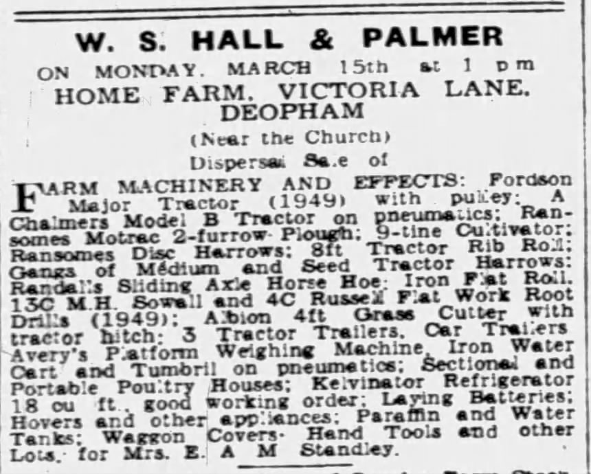
Eastern Daily Press, March 13th 1954
1969
The farm was purchased by Mr Bruce Catmur; at this time it comprised 55 acres.
2025
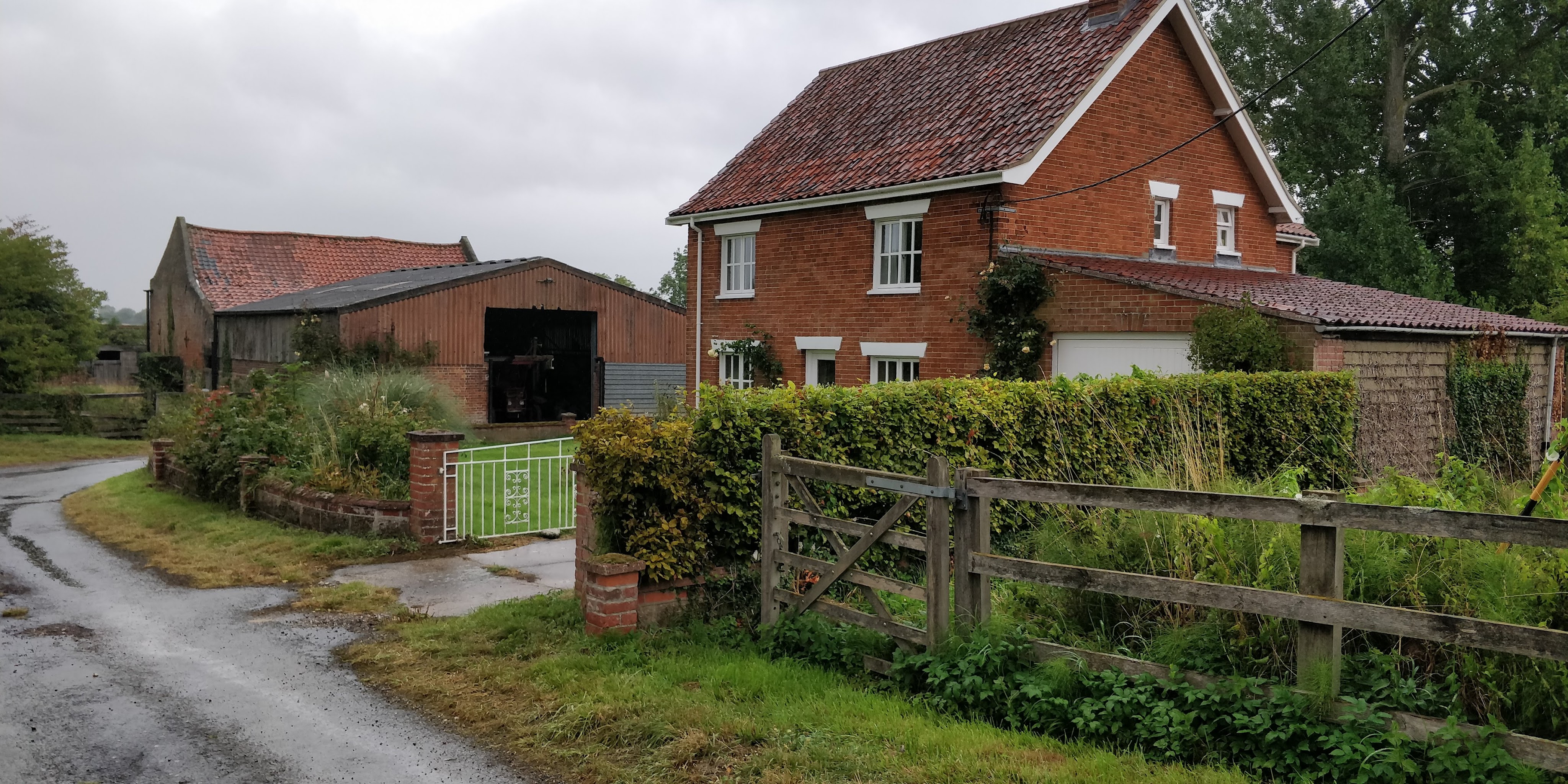
Photo: G. Sankey, 8/2025
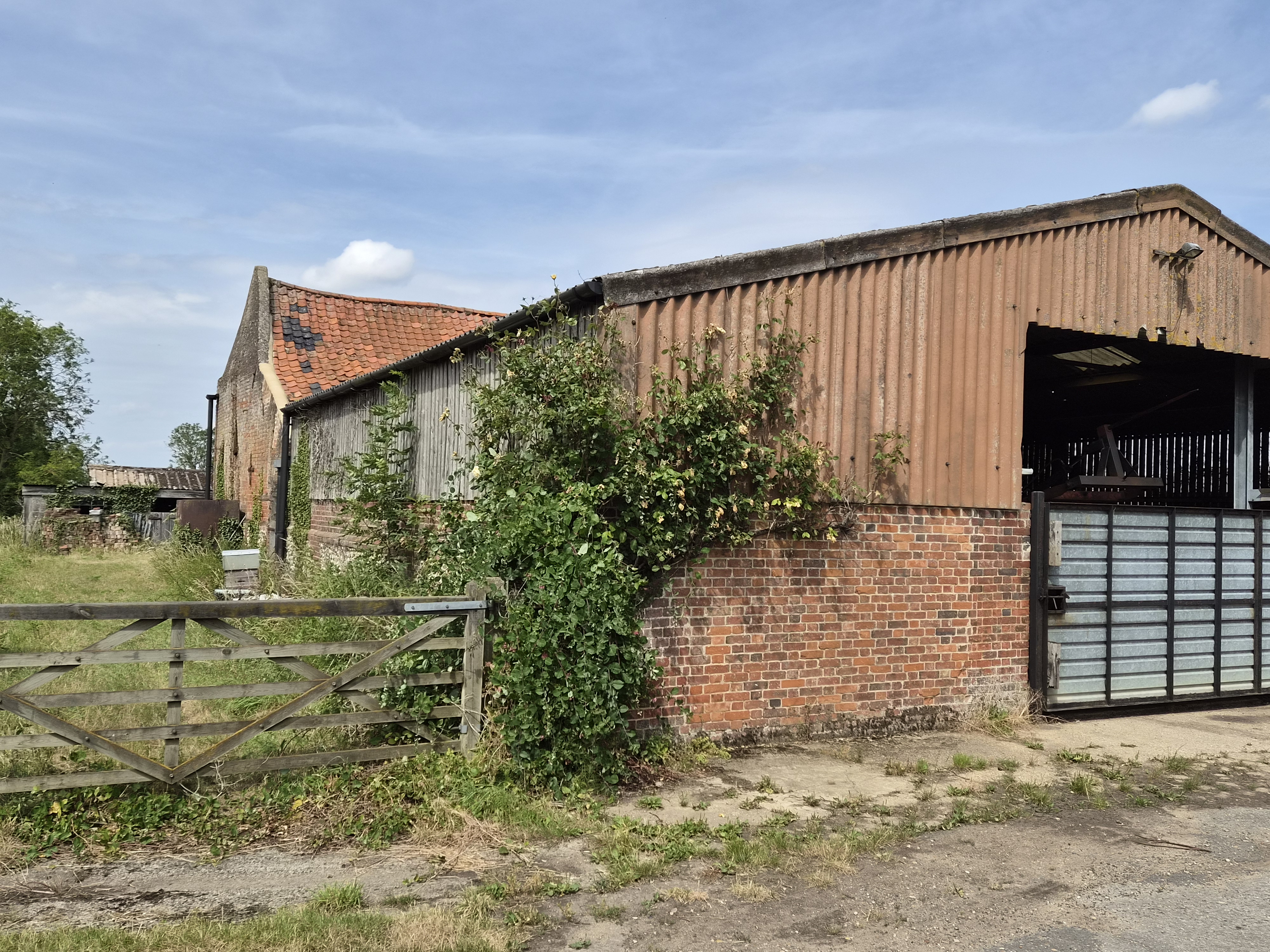
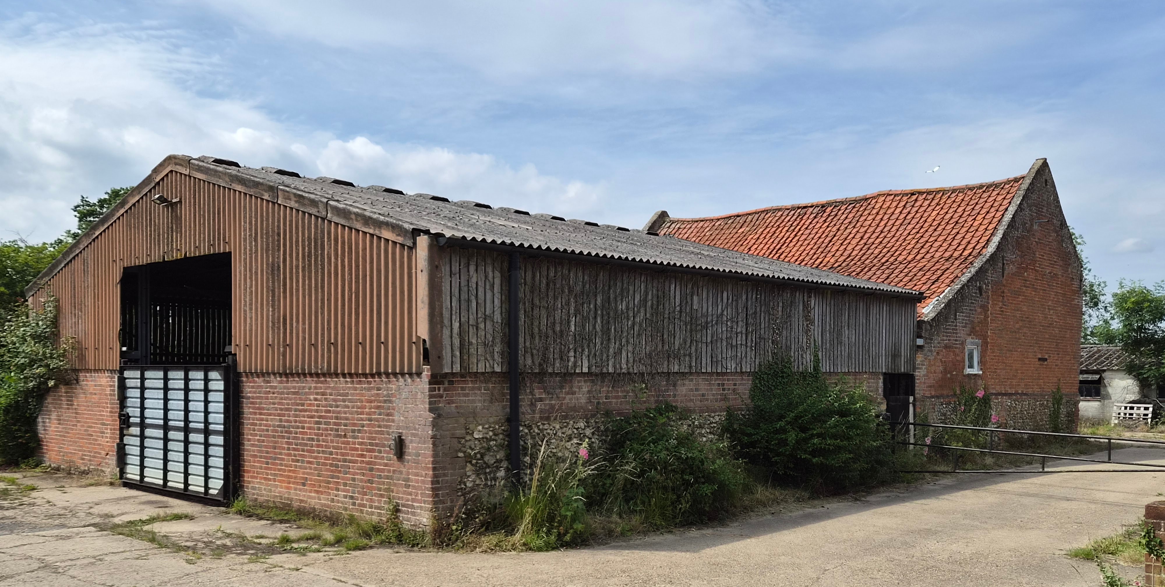
Photos: G.Sankey, 7/2026
Navigation
| Date | Change |
|---|---|
| 29/9/26 | 1954 auction |
| 12/7/26 | 1843 Tithe information |
| 29/8/25 | 2025 photo |
| 30/8/23 | Added Mr Bruce Catmur |
| 28/8/23 | Published |

