Contents
1814 Inclosures
The 1814 Inclosures map for Deopham recorded Mill Farm as being in the ownership of John Browne, Esquire, and prior to that of Sparkhall. It was shown as being copyhold of the Manor of Shadwells otherwise Cockerells in Morley.

All rights reserved by Norfolk Record Office who hold the original; their ref is NRO C/Sca 2/86
The description of piece no 106 in the accompanying text reads as follows:
One other piece of Land marked on the map hereto annexed No 106 containing eight acres one rood and twenty four perches with a Messuage and other Buildings standing thereon, bounded by the Attleburgh Road in part north, by land allotted to George Hubbard purchased of us in part East and in further part North by the said Land and other Land allotted to the said George Hubbard in part West, by the next described allotment on the remaining part of the North, by Land allotted to the said John Browne on the remaining part of the East, wholly South and on the remaining part of the west.
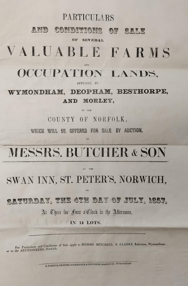
1857 Sale

This version was from Anne Edwards

This revised version is from the Wymondham Town Archive
Courtesy Wymondham Town Archive, their ref BF61
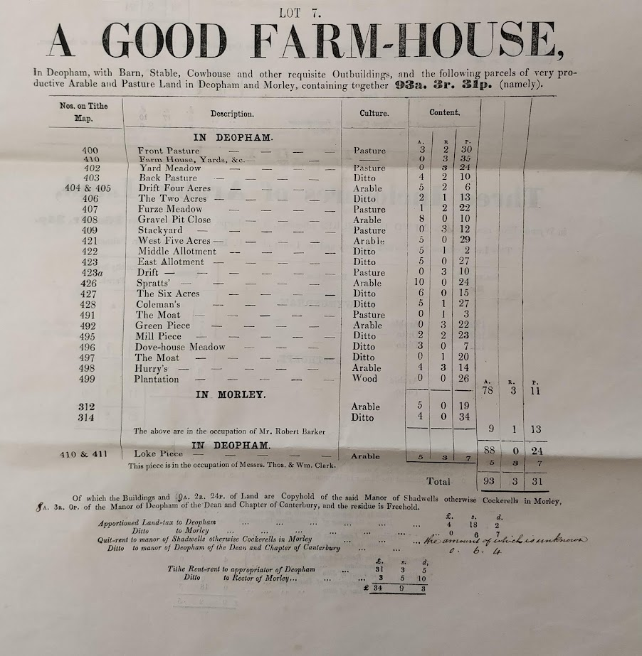
| Piece no on Tithe Map | Description | Culture | Content a-r-p |
|---|---|---|---|
| 400 | Front Pasture | Pasture | 3-2-30 |
| 410 | Farm House, Yards etc | – | 0-3-35 |
| 402 | Yard Meadow | Pasture | 0-3-24 |
| 403 | Back Pasture | “ | 4-2-10 |
| 404 & 405 | Drift Four Acres | Arable | 5-2-6 |
| 406 | The Two Acres | “ | 2-1-13 |
| 407 | Furze Meadow | Pasture | 1-2-22 |
| 408 | Gravel Pit Close | Arable | 8-0-10 |
| 409 | Stackyard | Pasture | 0-3-12 |
| 421 | West Five Acres | Arable | 5-0-29 |
| 422 | Middle Allotment | “ | 5-1-2 |
| 423 | East Allotment | “ | 5-0-27 |
| 423a | Drift | Pasture | 0-3-10 |
| 426 | Spratts’ | Arable | 10-0-34 |
| 427 | The Six Acres | “ | 6-0-15 |
| 428 | Coleman’s | “ | 5-1-27 |
| 491 | The Moat | Pasture | 0-1-3 |
| 492 | Green Piece | Arable | 0-3-22 |
| 495 | Mill Piece | “ | 2-2-23 |
| 496 | Dove House Meadow | “ | 3-0-7 |
| 497 | The Moat | “ | 0-1-20 |
| 498 | Hurry’s | Arable | 4-3-14 |
| 499 | Plantation | Wood | 0-0-26 |
| – | Total | – | 78-3-11 |
Many of the plots listed in the sales particulars above can be identified on the extract from the tithe map below:

All rights reserved by Norfolk Record Office who hold the original; their ref is NRO DN/TA 743
Hannah Clarke
Hannah Clarke was referenced in the 1881 Census as the wife of Alfred Clarke, a “farmer of 94 acres employing 3 men and 1 boy”. The 94 acres mentioned corresponds to the 93 acres 3 roods shown on the above 1857 sales particulars.
The 1888 Directory listed Hannah Clarke as a farmer in her own right; likewise the 1892 Directory listed her again as a farmer, but stated that the location was Mill Farm. The same entry appeared in the 1900 Directory. In the 1911 census she was described as being a “retired farmer’s wife” and was living on her own on The Green in Deopham at the age of 70.

With thanks to Jenny Porter for sight of this card.
1941 Farm Survey
Details of the 1941 Farm Survey for Mill Farm are available here.
| Date | Change |
|---|---|
| 27/8/25 | Tabulated 1857 list of premises |
| 21/7/25 | Hannah Clarke |
| 6/10/23 | Early version of 1857 particulars |
| 5/8/23 | Published |
