Contents
1941 Farm Survey
See here for details of the farming activities of Sandpit Farm at the time of the 1941 Farm Survey.
1959 Sale of Farm
The following advertisements appeared in the Eastern Daily Press regarding the disposal of assets on behalf of the late Mr. A. J. Stone.
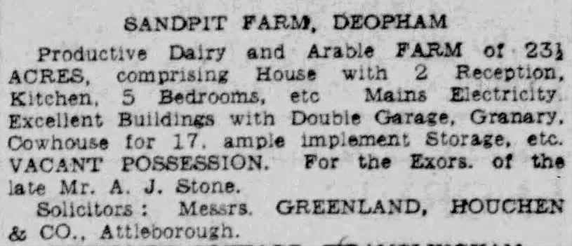
Eastern Daily Press, August 17th 1959
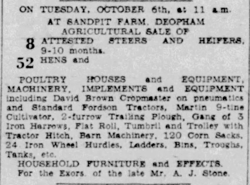
Eastern Daily Press, September 30th 1959
1961
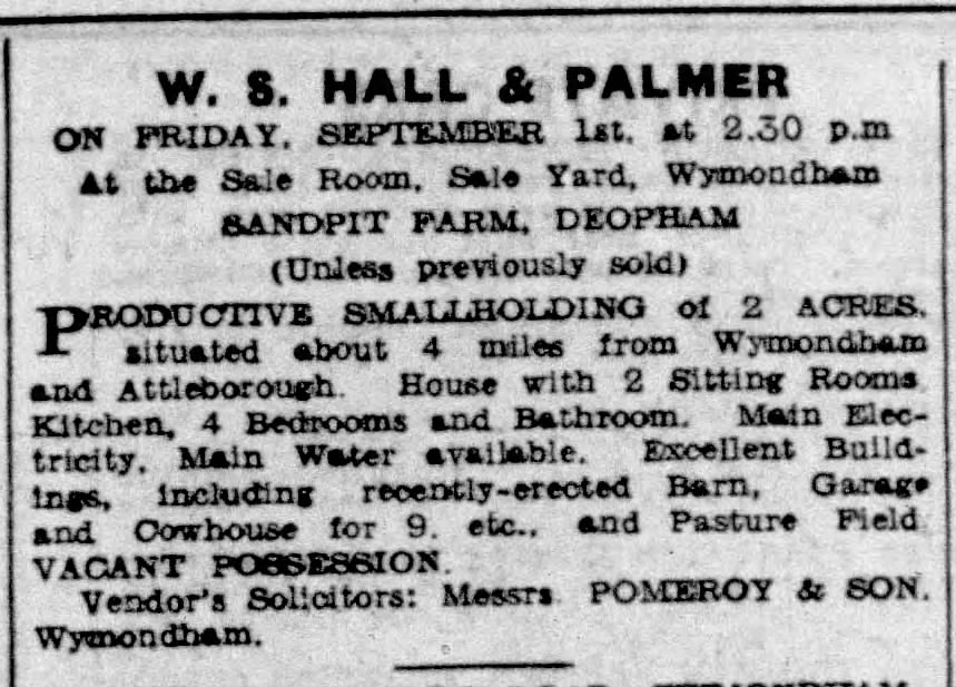
Eastern Daily Press, August 12th 1961
2002
In 2002 planning reference 2002/1567 was submitted by NFM Properties in Norwich requesting permission to erect a replacement building and four additional properties. The site known as Sandpit Farm at this time included the adjacent area known as the Coal Yard.
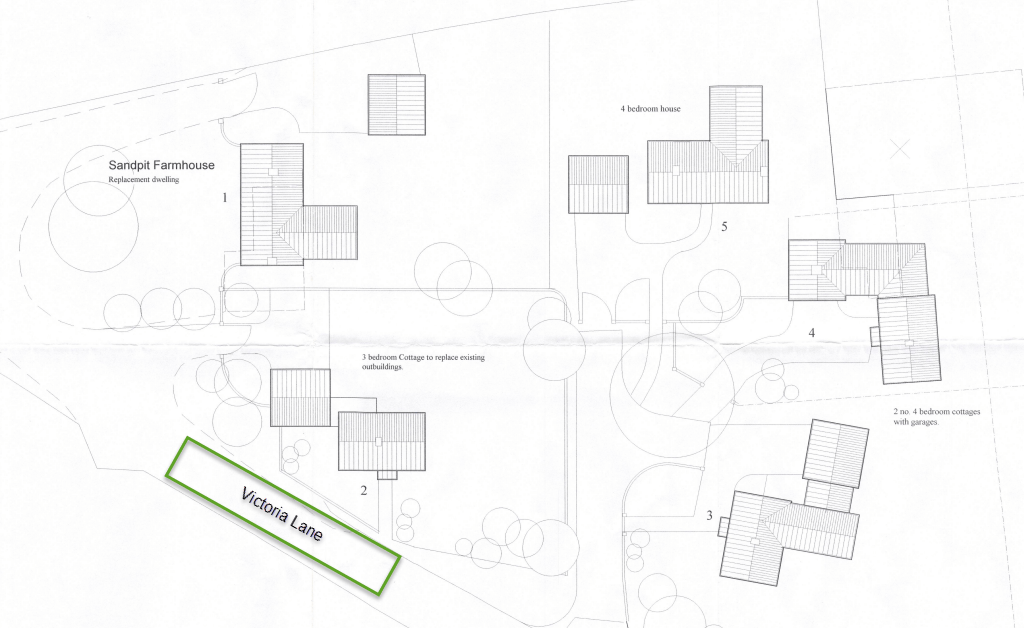
Drawing: K.J. Cole
The application was rejected in October 2002 for the following reasons:
1. The site is outside any development limits. The erection of 5 new dwellings on this site, in the open countryside, would be contrary to the provisions of Policy H8 of the the Norfolk Structure Plan and Policy RUR6 of the South Norfolk Local Plan.
2. The development of this site for residential purposes, adjacent to existing poultry houses would be detrimental to the amenities of future occupants of the proposed dwellings and therefore contrary to Policies BENXX and BENYY of the South Norfolk Local Plan.
2003
In 2003 a planning application reference 2003/0885 was submitted for the erection of a replacement dwelling and associated garage.
Full permission for this development was given in June 2003.
One of the conditions of the approval was:
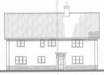
Drawing: K.J. Cole
The building gives evidence of being a three-cell lobby entrance house as as such, in accordance with Planning Policy Guidance 15 and Policy RUR7 of the South Norfolk Local Plan, a programme of archaeological works should be carried out for the recording of this building, before it is demolished.
Images of the Farmhouse in 2004 Prior to Demolition
In 2004 a survey was carried out of the old farm prior to its demolition. The full report is included below. The following photographs have been extracted from that document:
South elevation looking north-east:

South elevation looking north-west:

East end of the north elevation:

Penn, K. and Smith, R. (2004). Building Survey and Photographic Record of Sandpit Farmhouse, Deopham, Norfolk. NAU Archaeology. https://doi.org/10.5284/1001382.
Fireplaces


It can be seen that both of these fireplaces have been reduced in size. It is likely that the reduction took place with the arrival of coal. Warde & Williamson observed that the large fireplaces “were largely designed for burning wood and similar organic fuels: coal does not burn well in these circumstances, as anyone who has tried will appreciate. The shift to hearths and stacks more suited to burning coal, and the resulting changes in the design of houses, appear to have occurred at different rates in different areas.”1
The full report from 2004
2005
In September 2005 a planning application was made by Dunnella requesting permission for banger racing for up to 14 vehicles at any one time on the site known as Sandpit Farm. At this time, the site included the adjacent area known as the Coal Yard.
This application was rejected on October 12th 2005 for the following reasons:
The site is situated in a rural location, where Policy ENV8 seeks to restrict development to that which is appropriate to such a location. Policy IMP9 seeks to safeguard the amenity of neighbouring properties, and Policy IMP10 aims to minimise noise disturbance. While the banger racing is proposed on a hobby basis, this takes place on a team basis, with upto 7 cars in use at a time. These cars have a limited life by virtue of the nature of the racing and this results in a frequent turnover in vehicles, requiring regular delivery, and disposal of vehicles. In addition, given that this is an after hours type of hobby, it extends the hours of use of the site resulting in noise disturbance, which is detrimental to the amenity of neighbouring properties and the countryside in general. The proposal is therefore contrary to Policies ENV8, IMP9 and IMP 10 of the South Norfolk Local Plan 2003.
Google Earth Images

1999

October 5th 2003

September 11th 2006: the new house had been constructed.
2026

Photo: G. Sankey 7/2026
Footnotes
- Fuel supply and agriculture in post-medieval England,
by Paul Warde and Tom Williamson, pg 76 ↩︎
Navigation
| Date | Change |
|---|---|
| 23/9/26 | Planning details |
| 31/7/26 | Published |

