Contents
- 1814
- 1843
- 1857
- 1922
- 1922 – Purchase by Walter Charles Phoenix
- 1923 – Enfranchisement of Copyhold lands
- 1935 – Agreement to let the Farm
- 1941
- Construction
- Navigation
1814
The following extract from the 1814 post-inclosures map shows the area around the Stalland Farm; the areas shaded in yellow are Copyhold – either of the Manor of Deopham Hall or of the Manor of Deopham of the Dean and Chapter of Canterbury:

All rights reserved by Norfolk Record Office who hold the original; their ref is NRO C/Sca 2/86
One harsh aspect of the Inclosures Act was that anyone who was found to have been “squatting” on the commons for less than 30 years lost whatever improvements (including their homes) that had been built on the common lands. These were sold by the Commissioners and either the proceeds were set against that person’s entitlement, or if there was no entitlement, the sale proceeds went towards the general expenses of the Commissioners.
There are details of an encroachment at the Stalland here.
1843
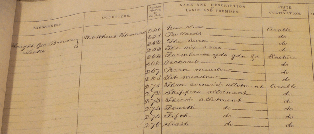
The following have been extracted from the 1843 tithe map and its corresponding analysis:
All rights reserved by Norfolk Record Office who hold the original; their ref is NRO PD 485/28

All rights reserved by Norfolk Record Office who hold the original; their ref is NRO DN/TA 743
1857

This initial version was supplied by Anne Edwards.

This revised version came from the Wymondham Town Archive
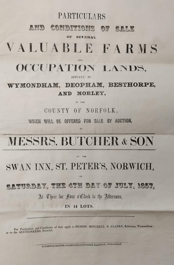
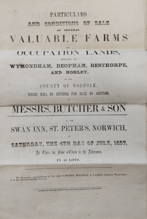


Courtesy Wymondham Town Archive, their ref BF61
The particulars of “Lot 1” in the above documents list eight plots identified and numbered according to the tithe map. An extract from that map of 1843 shows the location of each of these plots:-

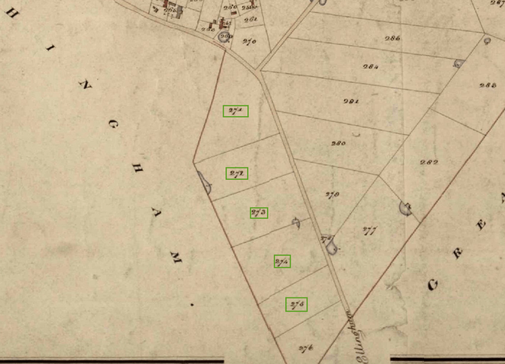
Lots 2 to 4 comprise 6 pieces of land on the opposite side of the road towards Great Ellingham:-

These six plots were purchased by Mr. William Spruce of Hingham:-

Courtesy Wymondham Town Archive, their ref BF61
1922


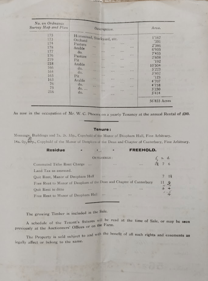
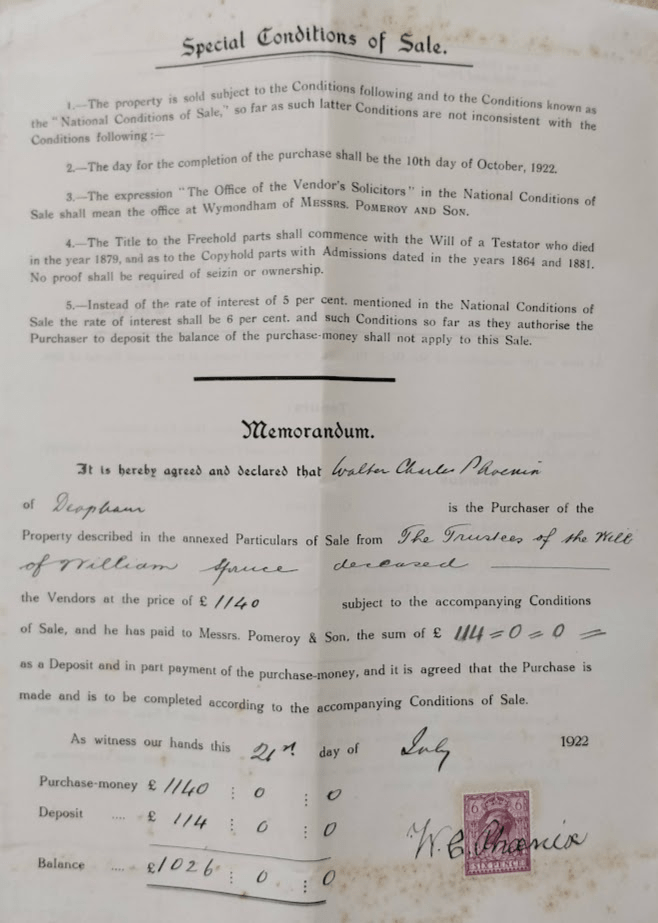


1922 – Purchase by Walter Charles Phoenix
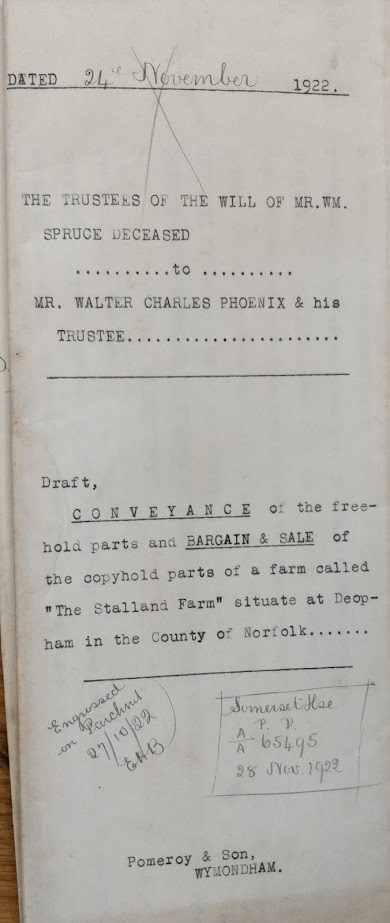
Courtesy Wymondham Town Archive, their ref BF 61.
1923 – Enfranchisement of Copyhold lands
When Walter Charles Phoenix purchased The Stalland Farm in 1922, three pieces of land were copyhold of the Manor of Deopham of the Dean & Chapter of Canterbury, and one piece was copyhold of the Manor of Deopham Hall. These were held in trust by Gertrude Helen Phoenix (Walter Charles Phoenix’s daughter) until the enfranchisement had been completed. Enfranchisement was the process by which the copyholder was able to buy out the Manor and remove all manorial constraints on the land.
There are documents relating to the enfranchisement of these four pieces of land here, along with extracts from the 1814 map showing their locations. Once this process had been completed, Gertrude Phoenix passed ownership of the released copyhold land to Walter Phoenix.
1935 – Agreement to let the Farm
An agreement was signed with Mr. Walter Brunning Phoenix on September 12th 1935 whereby the latter would pay a rent of £80 every 6 months in return for which he would occupy the farmhouse and farm the 56 acres 3 roods and 17 perches.
1941
Details of The Stalland Farm at the time of the 1941 Farm Survey can be found here.
Construction
The following photograph shows The Stalland Farm during building works with the outer brickwork removed. Behind this is a wall of clay lump. There must be several buildings in Deopham which appear to be brick built, but which have mud walls behind the brick outer skin.
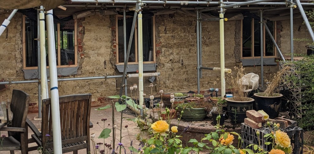
Photo: Sarah Raper
Navigation
| Date | Change |
|---|---|
| 3/4/26 | Mud brick wall |
| 14/11/24 | Corrected typo regarding purchaser in 1922 |
| 7/11/24 | Encroachment |
| 30/10/24 | Enfranchisements |
| 8/10/24 | 1935 letting agreement |
| 6/10/23 | Early version of 1857 sale particulars |
| 20/8/23 | Additional details of the 1857 transactions |
| 19/8/23 | 1922/1923 transactions |
| 1/8/23 | Published |
