Also spelt
Bylam Lane, Boylam Lane, Bileham Lane, Belon
See the separate page for Bylam Falgate
Contents
- Note
- Origin of the name
- Location
- References to Baylam Lane
- Stopping up of Baylam Lane
- Footnotes
- Navigation
Note
It has been assumed – for the time being – that all the variants of the name listed at the top of this page refer to the same thoroughfare. This assumption will require review as more data is collected.
Origin of the name
Bilam/Bylam
The “-ham” part of the name derives from the Old English hām = homestead, settlement or holding1;
the Bila or Bala element would have been the family name so Bylam would be the homestead or land associated with a person called Bila/Bala (or something similar).
The variants in the spelling are in part due to the phonetic spelling rather than any fixed spellings.
Location
1813 Map of the estate belonging to Lord Wodehouse
The following extract shows the lane marked with an identifier of “40”. The accompanying index describes “40” as “Part of Baylam Lane”. (The whole of this map is available here.)
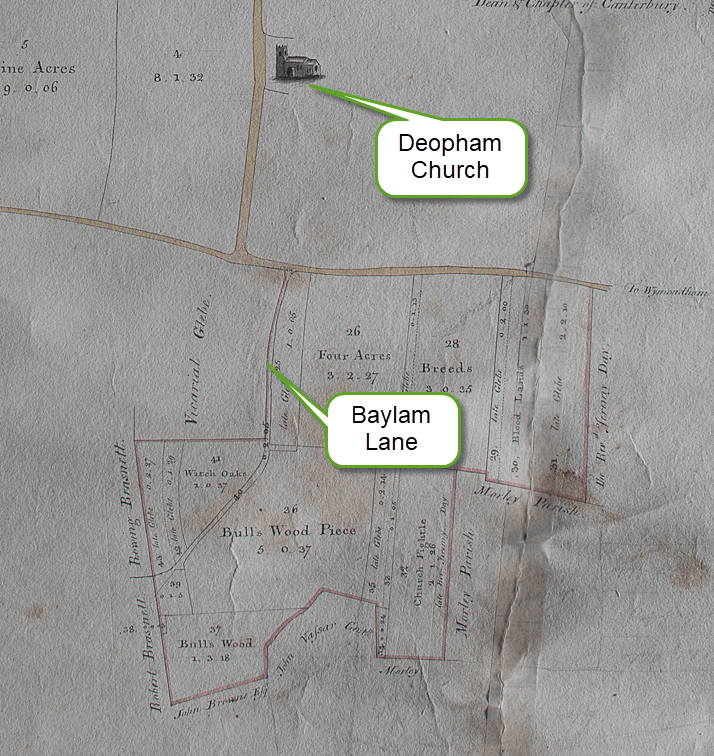
With thanks to Michael Allen for allowing sight of this map.
1814 Inclosures Map
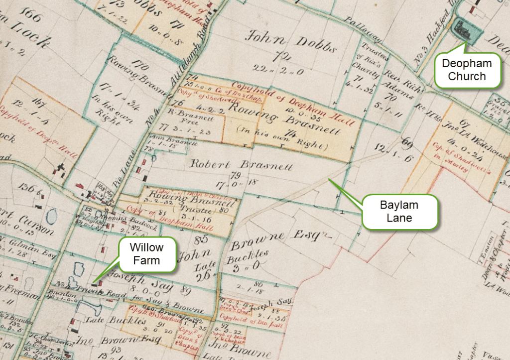
All rights reserved by Norfolk Record Office who hold the original; their ref is NRO C/Sca 2/86
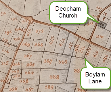
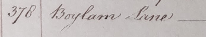
1815 Survey
In the 1815 survey of Deopham there was still a stump of north end the Lane. On the map it is identified as “378” which in the text is described as Boylam Lane. It was recorded as being owned by Lord Wodehouse and occupied by Garrett Oddin Taylor.
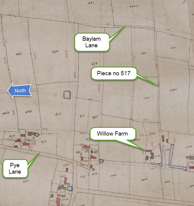
1842 Map
The 1842 map on which the 1843 Tithe Map was based shows that the access lane running east-west past Willow Farm was called Cock Lane: piece no 517 is described as “Cock Lane” in the Tithe Analysis.
N.B. North is to the left on this map.
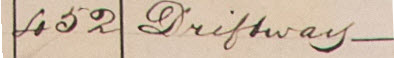
1843 Tithe Map
By 1843 the northern stump of the old Baylam Lane was labelled “Driftway” in the accompanying analysis. Lord Wodehouse was again shown as the owner.
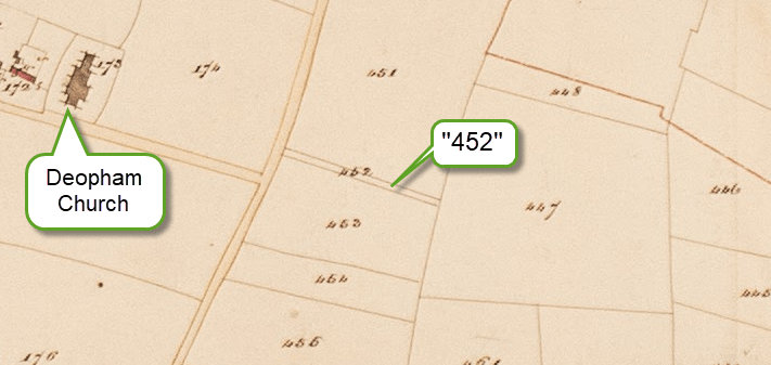
All rights reserved by Norfolk Record Office who hold the original; their ref is NRO DN/TA 743
1884 O.S. Map
By the time that the survey for this map was carried out, the fields along the old Baylam Lane had all been amalgamated into one single open area. The stump that continued to be necessary in 1843 was no longer necessary. Nevertheless, the line of the stump continued to be visible.
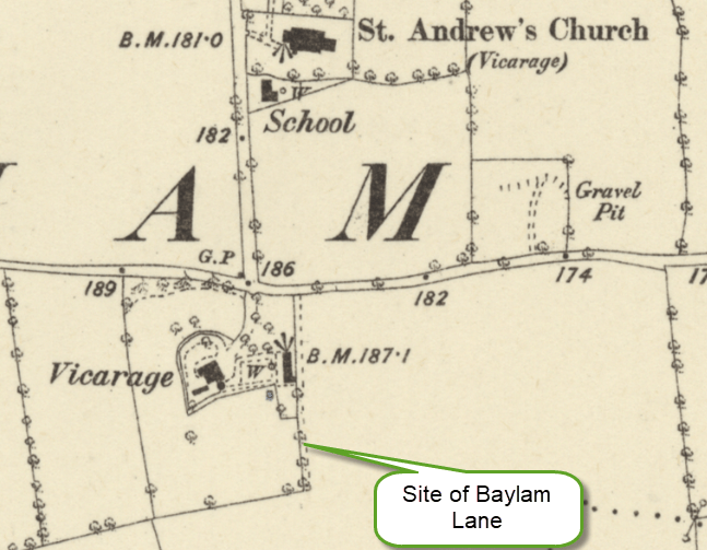
Reproduced with the permission of the National Library of Scotland
References to Baylam Lane
The lane is often used as a landmark by which to identify plots of land. The following is a selection of a few examples of references to Baylam Lane under its various spellings.
| Context | Year | Links and examples |
|---|---|---|
| 3 roods in Deopham between land of Martin Sedley, esquire, East & North, Bylam Lane, West, Henry Hynde, South. | 1630 | Court of the Manor of Shadwells otherwise Cockerells October 1630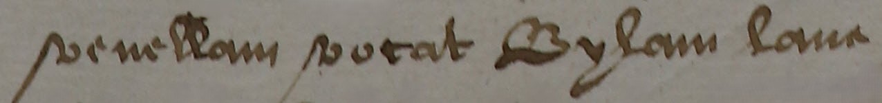 |
| Wee punish Edmond Burman, Robert Blumfield, Robert Oakley, Francis Thilthorpe, Thomas Fyson and John Bubbin for Not cutting their Rowes & Storeing up their Ditches in the Cock Lane & Belon Lane & paine them 40s a peece if it be not mended within sixe weekes. | 1678 | Court of the Manor of Deopham of the Dean & Chapter of Canterbury October 1678 |
| 3 acres & 3 roods of land Bileham Lane, East. | 1690 | Court of the Manor of Deopham of the Dean & Chapter of Canterbury 1690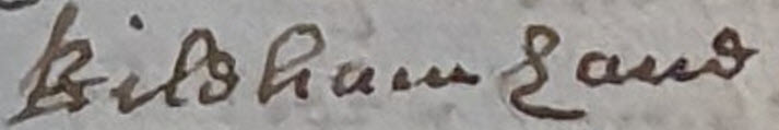 |
| Morley Pightle between land of Robert Ockley, William Sedley, South, Baylam Lane, West. | 1715 | Court of the Manor of Deopham of the Dean & Chapter of Canterbury December 1715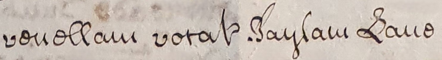 |
| 3 roods in Deopham between land late of Martin Sedley, Esquire, East, Bylam Lane, West, Martin Sedley, North, Henry Hind, South | 1775 |  Court of the Manor of Shadwells otherwise Cockerells June 1775 |
Stopping up of Baylam Lane
The following announcement was placed by the Inclosure Commissioners in the Norfolk Chronicle published on February 27th 1813 (see here for a copy of the original):
DEOPHAM INCLOSURE
Baylam Lane to be stopped up.
WE, the undersigned JOHN DUGMORE, WILLIAM UNTHANK, and JOHN MITCHELL, the Commissioners appointed to carry into execution the Act of Parliament entitled “An Act for Inclosing Lands in the parish of Deopham, in the county of Norfolk,” do hereby give notice that the road called Baylam Lane, which was set out and appointed by us, and published and described on our Map as the fifth public road, was at the Meeting appointed for the hearing of objections to the Public Roads in Deopham aforesaid, stopped up and directed to be discontinued, and that in consequence of such stopping up and discontinuance, the said road, called Baylam Lane, hath been allotted in severalty to certain Proprietors of Estates, in Deopham aforesaid, who are hereby authorised to take possession of the specific parts thereof, which are so allotted to them respectively on the eleventh day of October next.
Dated this 20th day of February, 18152.
J. DUGMORE
WM. UNTHANK
JOHN MITCHELL
Commissioners.
GILMAN, Solicitor.
Footnotes
- See also the name Deopham. ↩︎
- The announcement appears to read 1815 (see here) but this must be a misprint since the edition in which it appears is definitely dated February 27th 1813. ↩︎
Navigation
| Date | Change |
|---|---|
| 24/7/26 | Bylam Falgate moved to separate page |
| 22/6/26 | Cock Lane |
| 30/4/26 | Origins of the name |
| 31/12/25 | Published |
