Contents
Introduction
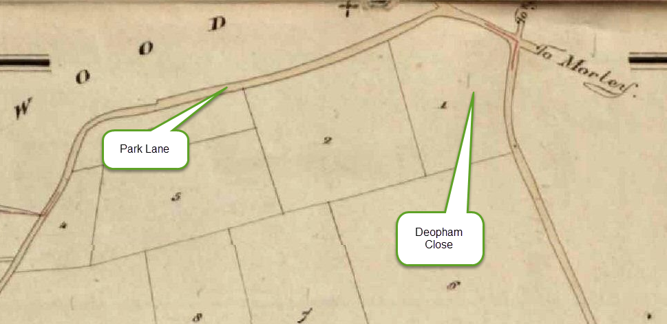
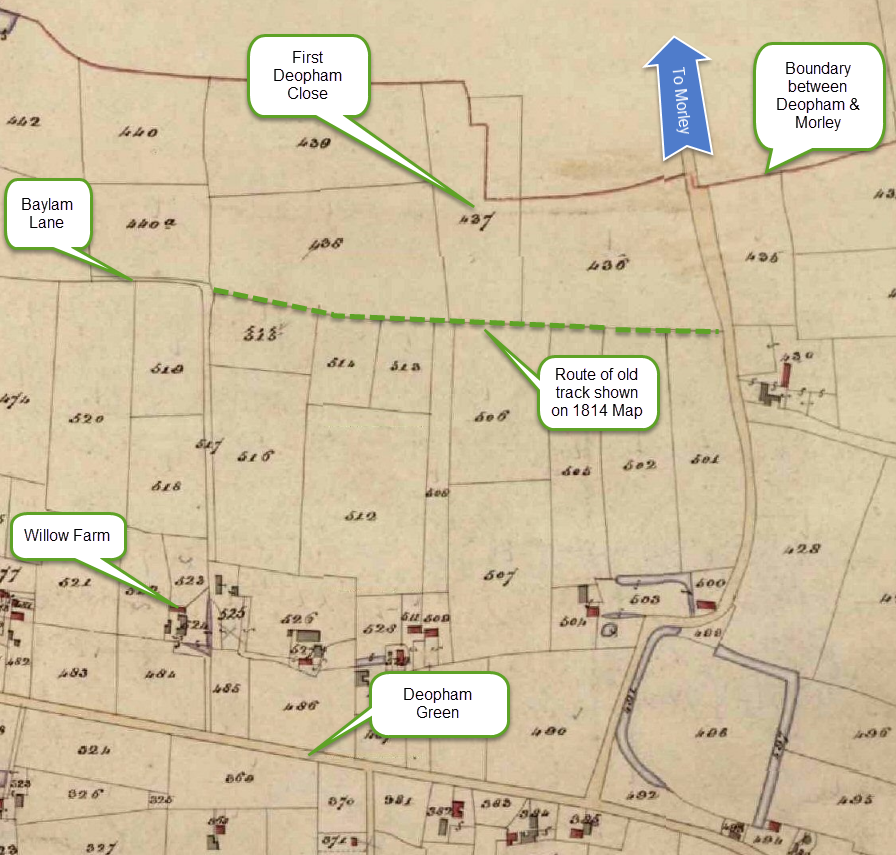
There have been two fields called “Deopham Close”; these were:-
- A field at the west end of Park Lane, close to the junction with the Wymondham Road;
- A field to the east of Deopham Green.
It was left to the context for earlier inhabitants of the village to identify which of the two was in focus.
Helpfully, the 1843 tithe analysis and accompanying map identified the first as “Deopham Close” – piece no 1 – and the second as “First Deopham Close” – piece no 437.
Park Lane’s Deopham Close
Location
The area of piece no 1 was recorded as 4a 1r 24p and can be seen on the following extract from the corresponding tithe map:
All rights reserved by Norfolk Record Office who hold the original; their ref is NRO DN/TA 743
Later developments
The deeds of Park View Farm refer to it as being on the site known as Deopham Close, although the plot being referred to is clearly that which is numbered “2” on the 1843 map shown above. At some point, the name had moved one field along Park Lane.
Deopham Green’s Deopham Close
Location
The area of piece no 437 was recorded as 3a 3r 7p. It is shown on the following extract from the 1843 tithe map:
All rights reserved by Norfolk Record Office who hold the original; their ref is NRO DN/TA 743
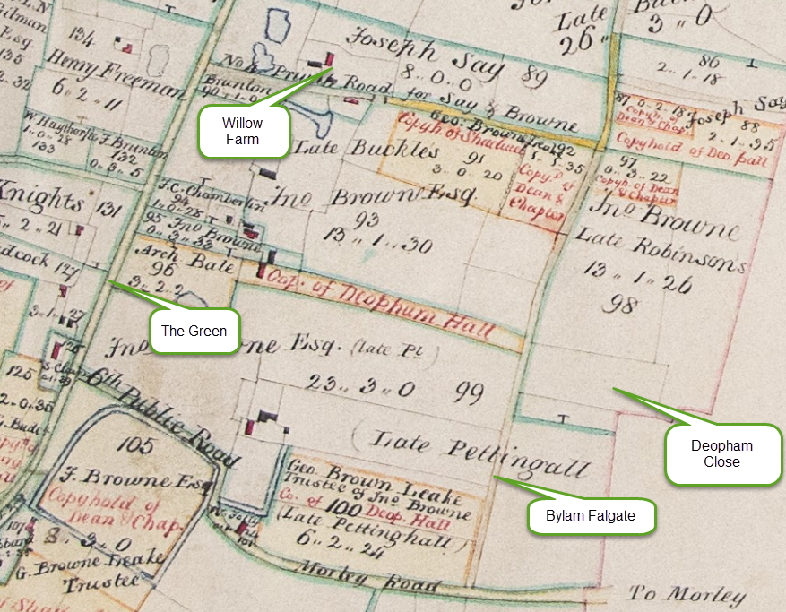
The route of the old track shown on the earlier 1814 Inclosures Map appears to be the track referred to as Bylam Falgate in the old Manorial Court records:-
Navigation
| Date | Change |
|---|---|
| 24/7/26 | Published |

