Note: This page relates to Hall Farm as it is so known in 2024. The Farm now known as Crown Farm was previously called Hall Farm.
Contents
- 1813 Estate Plan
- 1814 Inclosures Map
- 1941 Farm Survey
- 2002 Sale of the Farmhouse and barns
- 2003 Aerial View
1813 Estate Plan
In 1813, the fields making up Hall Farm and belonging to Lord Wodehouse were shown on the following estate map; the land acquired as allotments during the Inclosures process are already included in this plan (pieces 11-14 & 16-19).

Thanks to Michael Allen for allowing access to this plan.
| No | Parcel | Acres | Roods | Perches |
|---|---|---|---|---|
| 1 | Farm House, Outbuildings, Barn, Stables, Yards, Gardens and Orchard | 1 | 0 | 29 |
| 2 | The Carr | 3 | 1 | 16 |
| 3 | Home Pasture | 13 | 3 | 02 |
| 4 | – | 8 | 1 | 32 |
| 5 | Nine Acres | 9 | 0 | 06 |
| 6 | – (late Amyas) | 1 | 3 | 03 |
| 7 | – (Ditto) | 0 | 0 | 32 |
| 8 | Ten Acres | 9 | 0 | 0 |
| 9 | Nine Acres | 9 | 3 | 21 |
| 10 | – | 7 | 0 | 38 |
| 11 | Part of the Common Allotment | 9 | 3 | 21 |
| 12 | – Ditto | 8 | 0 | 07 |
| 13 | – Ditto | 9 | 1 | 24 |
| 14 | – Ditto | 7 | 2 | 32 |
| 15 | Home Plow’d Piece | 11 | 0 | 04 |
| 16 | Part of the Common Allotment | 9 | 1 | 11 |
| 17 | – Ditto | 12 | 1 | 39 |
| 18 | – Ditto | 10 | 1 | 36 |
| 19 | – Ditto | 1 | 1 | 34 |
| 20 | Piggett’s Pightle | 1 | 24 | |
| 21 | Cottage, Yard and Garden | 1 | 02 | |
| 22 | Pightle | 2 | 05 | |
| 23 | Piggett’s Pasture | 3 | 0 | 14 |
| 24 | – Ditto | 5 | 2 | 16 |
| 25 | Cross Ways’ Pightle (late Glebe) | 1 | 0 | 05 |
| 26 | Four Acres | 3 | 2 | 27 |
| 27 | Part of Breeds (late Glebe) | 1 | 13 | |
| 28 | Remaining Part of Ditto | 3 | 0 | 35 |
| 29 | Part of Blond Lands | 2 | 00 | |
| 30 | Remaining Part of Ditto | 1 | 1 | 30 |
| 31 | – (late Glebe) | 2 | 2 | 10 |
| 32 | Church Pightle (late Revd Jeremy Dey) | 2 | 1 | 26 |
| 33 | Part of Bull’s Wood | 1 | 05 | |
| 34 | Bull’s | 24 | ||
| 35 | Remaining part of Bull’s Wood (late Glebe) | 2 | 14 | |
| 36 | Bull’s Wood Piece | 5 | 0 | 37 |
| 37 | Bull’s Wood | 1 | 3 | 18 |
| 38 | Part of the Hundred Acres (late Browne) | 03 | ||
| 39 | Remaining Part of Ditto (*late Amyas & Glebe) | 1 | 05 | |
| 40 | Part of Baylam Lane | 2 | 05 | |
| 41 | Watch Oaks | 1 | 0 | 37 |
| 42 | A Land in Cock Field (late Glebe) | 1 | 29 | |
| 43 | – Ditto (late Rowing Brasnett) | 1 | 27 | |
| Total | 179 | 3 | 38 |
1814 Inclosures Map
Following the implementation of the 1812 Inclosures Act, the Wodehouse & Hall Farm property was shown on the 1814 map as follows:-
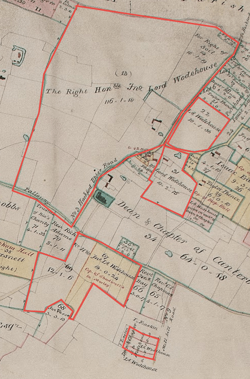
All rights reserved by Norfolk Record Office who hold the original; their ref is NRO C/Sca 2/86
The above 1814 map can be summarised as follows:
| Piece No | acres | roods | perches |
|---|---|---|---|
| 13 | 116 | 1 | 18 |
| 22 | 10 | 1 | 36 |
| 31 | 10 | 2 | 15 |
| 67 | 14 | 0 | 24 |
| 69 | 12 | 1 | 6 |
| ex Dean & Chapter | 0 | 2 | 8 |
| ex Dean & Chapter | 1 | 0 | 30 |
| Total | 165 | 2 | 17 |
1941 Farm Survey
Details of Hall Farm at the time of the 1941 Farm Survey can be found here.
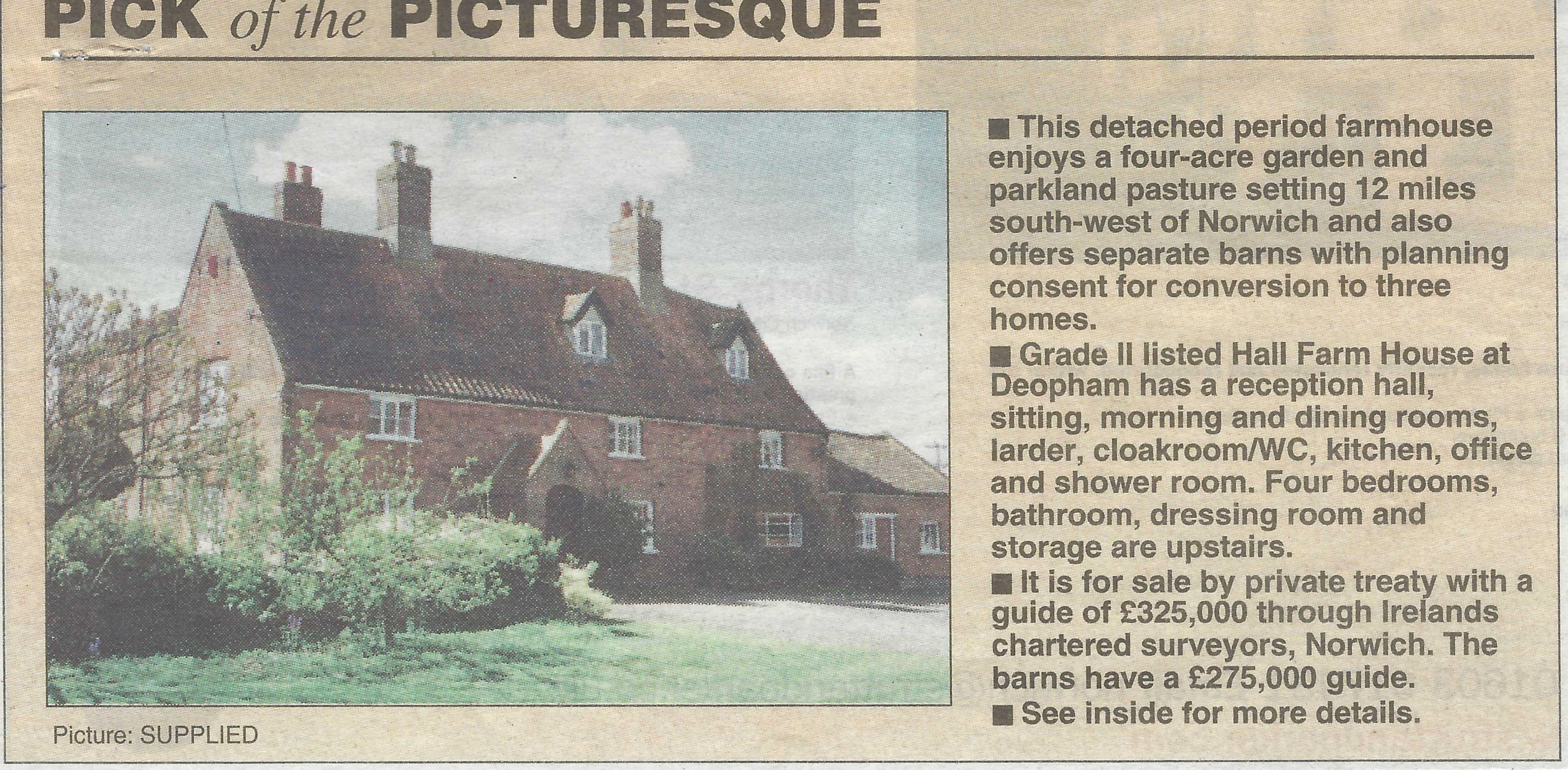
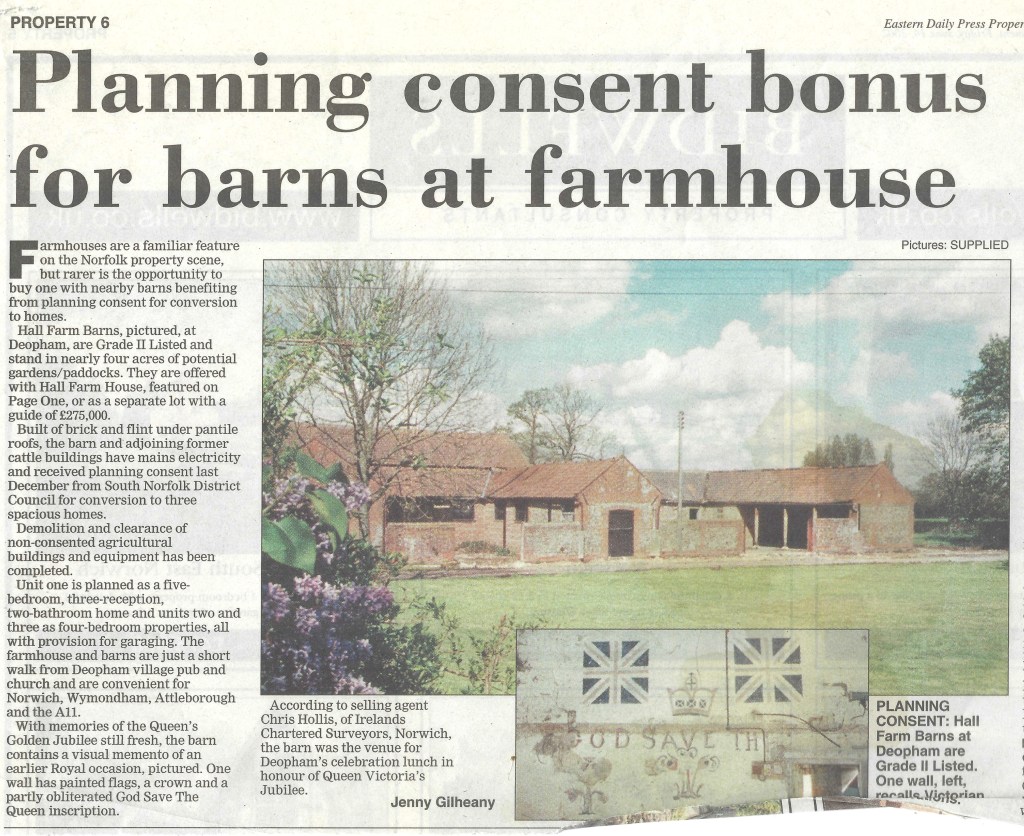
2002 Sale of the Farmhouse and barns
The following two articles appeared in the EDP published on June 14th 2002:
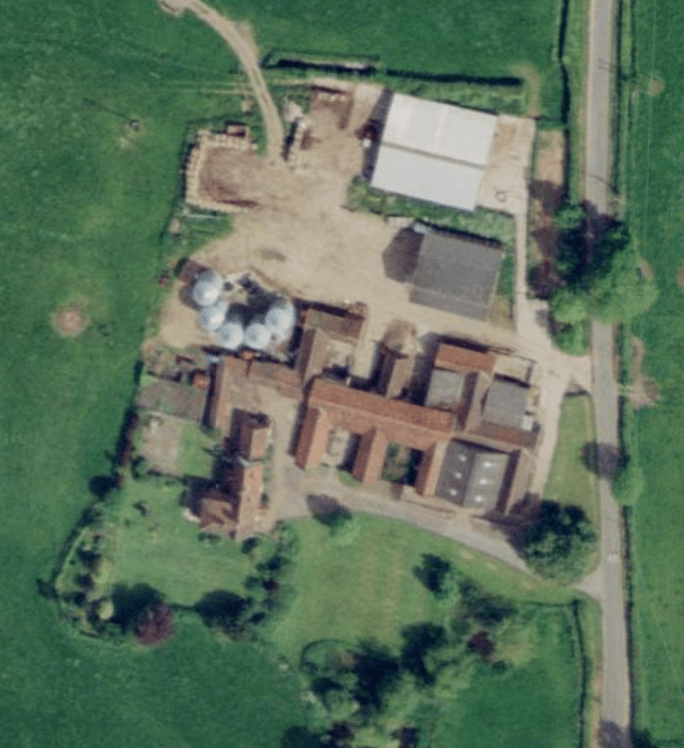
2003 Aerial View
The following image from Google Earth taken in 2003 shows Hall Farm with its outbuildings, including silos and a large Atcost barn, before it was redeveloped.
| Date | Change |
|---|---|
| 20/6/26 | 2002 EDP |
| 19/3/26 | Tabulated 1814 acreage |
| 30/10/25 | Google Earth image |
| 15/4/24 | Published |
