Also spelt South Hill, Southill
Contents
Introduction
South Hill can refer to
- South Hill Common which ceased to exist after the Inclosure legislation was implemented in 1814;
- South Hill Farm for which at least two locations have existed;
- South Hill has a general name for the southern end of the village.
Location
South Hill Common
After Inclosure – 1814
The following extract from the 1814 Inclosures Map shows the area which the Commissioners described as South Hill Common, and which they sold in four 5 acre plots:-
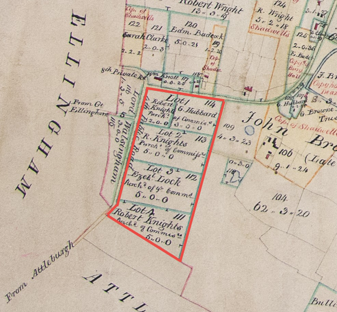
All rights reserved by Norfolk Record Office who hold the original; their ref is NRO C/Sca 2/86
South Hill – 1815
The Survey of Deopham published in 1815 describes the following pieces of land as being parts of South Hill. Piece no 453 looks isolated on this plan: it is not explicitly described as being part of South Hill: the description is “Allotment purchased of the Commissioners”. The above 1814 map included it as part of the sale of South Hill Common.
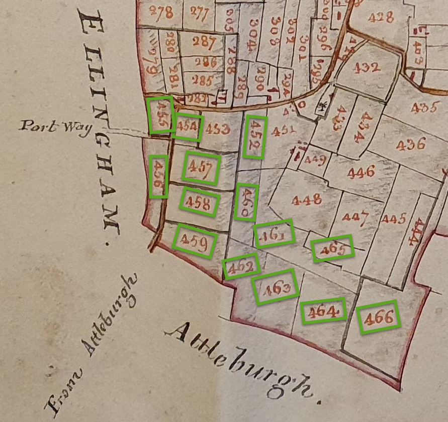
Reproduced courtesy of the Chapter of Canterbury; their ref 183720-17
The following table shows the data recorded in the 1815 Survey for the South Hill pieces of land:
| Arable | Pasture | ||||||
| Reference | Description | Acres | Roods | Perches | Acres | Roods | Perches |
| 452 | Part of South Hill | 2 | 2 | 10 | |||
| 453 | Allotment purchased of the Commissioners | 3 | 0 | 0 | |||
| 454 | Allotment on South Hill Common purchased of the Commissioners | 2 | 0 | 0 | |||
| 455 | Allotment on South-hill Common | 1 | 3 | 5 | |||
| 456 | Allotment on South-hill Common | 3 | 0 | 0 | |||
| 457 | Allotment on South Hill Common purchased of the Commissioners | 5 | 0 | 0 | |||
| 458 | Allotment on South Hill Common purchased of the Commissioners | 5 | 0 | 0 | |||
| 459 | Allotment on South Hill Common purchased of the Commissioners | 5 | 0 | 0 | |||
| 460 | Part of South Hill | 3 | 0 | 12 | |||
| 461 | Frontage to Nos 448&465 (South Hill) | 6 | 0 | 2 | |||
| 462 | West Part of South Hill next Attleburgh | 5 | 0 | 24 | |||
| 463 | Middle Part of South Hill next Attleburgh | 5 | 0 | 17 | |||
| 464 | East Part of South Hill next Attleburgh | 6 | 3 | 2 | |||
| 465 | South Hill Pightle | 2 | 2 | 6 | |||
| 466 | Allotment on South Hill Common | 9 | 3 | 26 | |||
South Hill Farm – 1941
The location of South Hill Farm has been fluid over the years, and hasn’t coincided with the earlier definition of South Hill Common at the time of the Inclosures.
In 1941 the Ministry of Agriculture and Fisheries carried out a survey of all farms to be used as a basis for post-war planning. South Hill Farm is shown in purple on the map below and is labelled 194/29; it was at this time on the opposite side of the Attleborough Road to the South Hill Common area defined above.
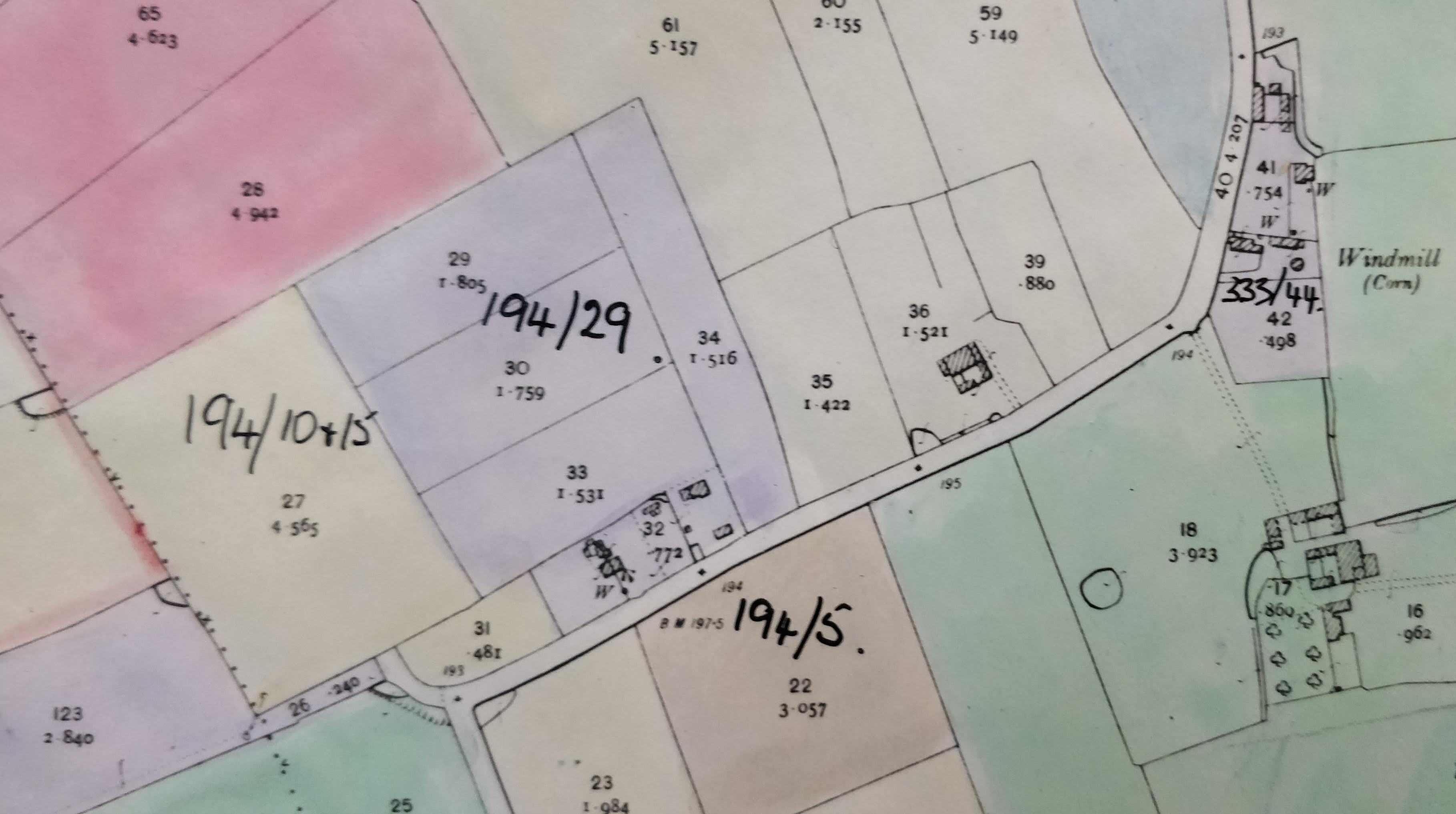
© National Archives, Kew. Their refs: MAF 73/28/73+85
Auction of Stock and Equipment 1952
Thomas Gaze and Son placed the following advertisement in the Auctions section:
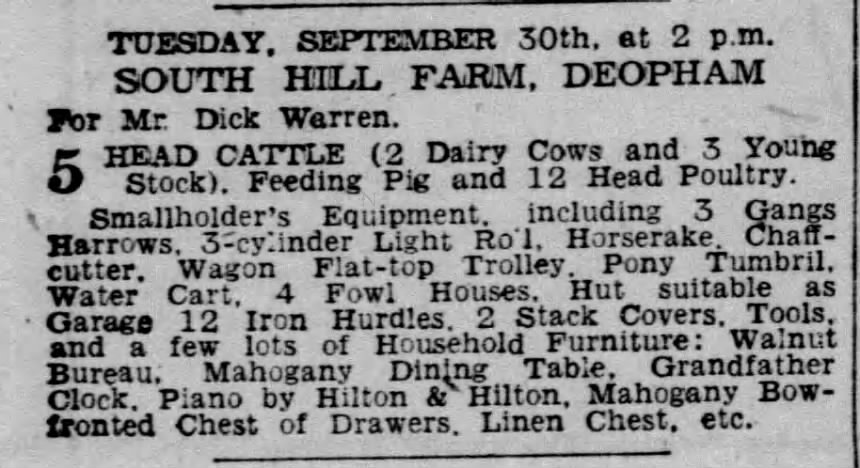
Eastern Daily Press, September 19th 1952
South Hill Farmhouse – 2026
In 2026, South Hill Farmhouse is located north of Mill Farm on the Attleborough Road.
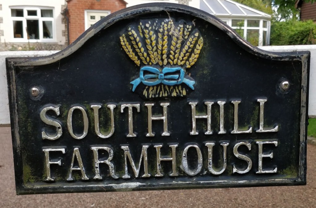
Photo: G. Sankey, 8/2023
Navigation
| Date | Change |
|---|---|
| 11/10/26 | 1952 advert |
| 24/6/26 | Published |

