Also spelt
Pallow Way, Pallough Waye
Contents
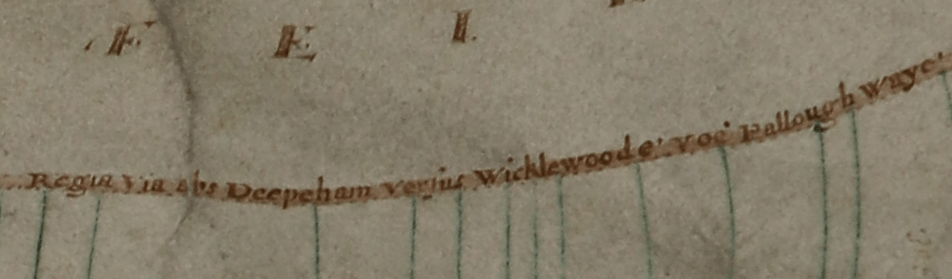
1629 Morley Map
The map of Morley commissioned by Martin Sedley in 1629 recorded three routes running through that parish and continuing into Deopham.
The northernmost of these was labelled in Latin “Regia Via abs Deepeham versus Wicklewoode voc Pallough Waye” – i.e. “The Royal Way (or King’s Highway) from Deopham to Wicklewood called Pallow Way”.
1814 Post Inclosures Map
The 1814 map drawn up when the Inclosures legislation was implemented in 1814 recorded the Palloway as the following extract shows; this is now known as Vicarage Road.
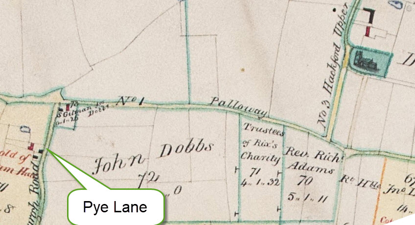
All rights reserved by Norfolk Record Office who hold the original; their ref is NRO C/Sca 2/86
Manorial Courts
All three of the major Manors with land in Deopham (Deopham of the Dean & Chapter of Canterbury, Deopham Hall & Shadwells otherwise Cockerells of Morley) use the Pallow Way as a reference point when defining the location of a piece of land.
The following example is taken from the Court of the Manor of Deopham Hall held on July 17th 1722:
An inclosure called Church Close containing 11 acres in Deopham between land of the Dean & Chapter of Canterbury, West,
king’s highway & land of this Manor, East,
abutts Pallow way, South.
Navigation
| Date | Change |
|---|---|
| 22/3/26 | Published |
