Contents
1843 – Tithe Map
At the time of the 1843 tithe analysis, the following group of pieces made up the entity occupied by Thomas Leeder. It was owned, along with other property, by George Knight. Piece number 527 is the farmhouse now referred to as Woodrow’s Farmhouse. It included the Pettingalls farmhouse (number 504):
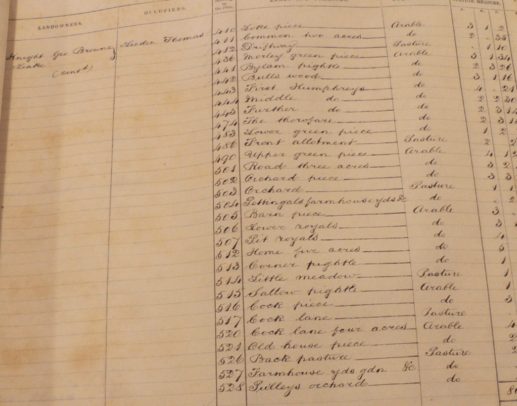
All rights reserved by Norfolk Record Office who hold the original; their ref is NRO PD 485/28
The total area listed above as comprising one farm is 80 acres. The pieces listed in the above schedule are indicated in green on the following extract from the corresponding tithe map:
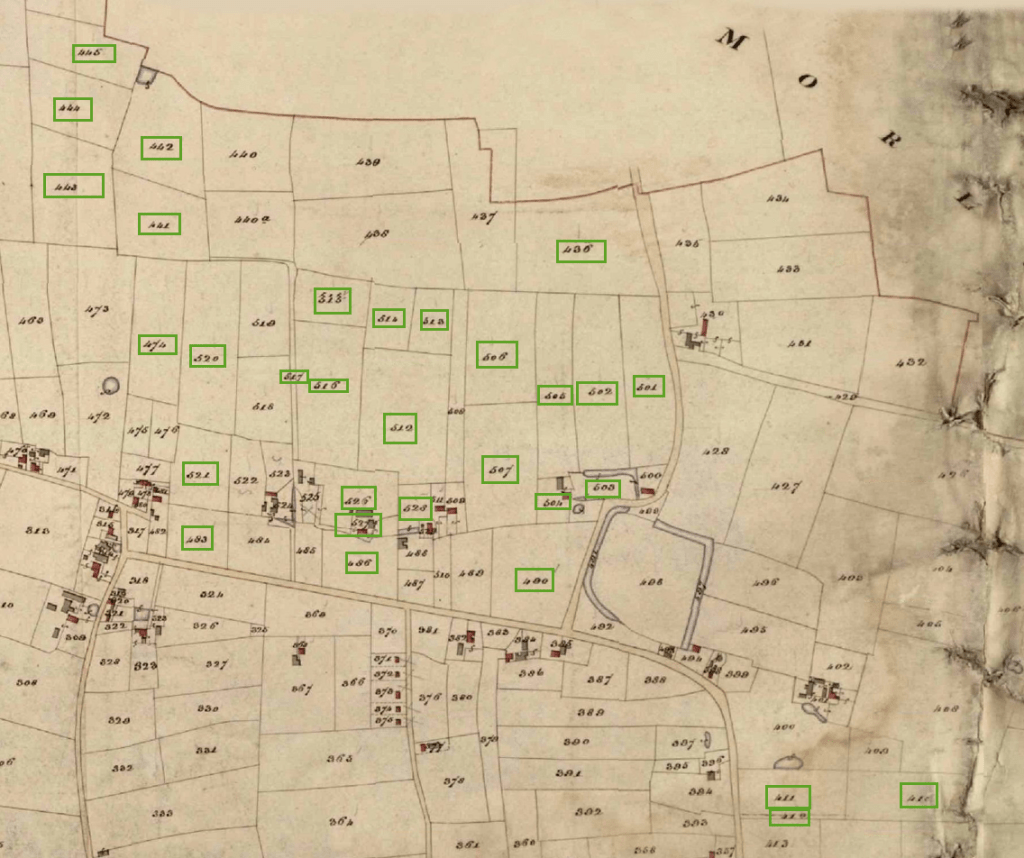
All rights reserved by Norfolk Record Office who hold the original; their ref is NRO DN/TA 743
1857 – Sale

This initial version was supplied by Anne Edwards.

This revised version came from the Wymondham Town Archive
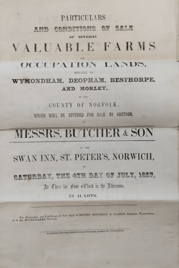
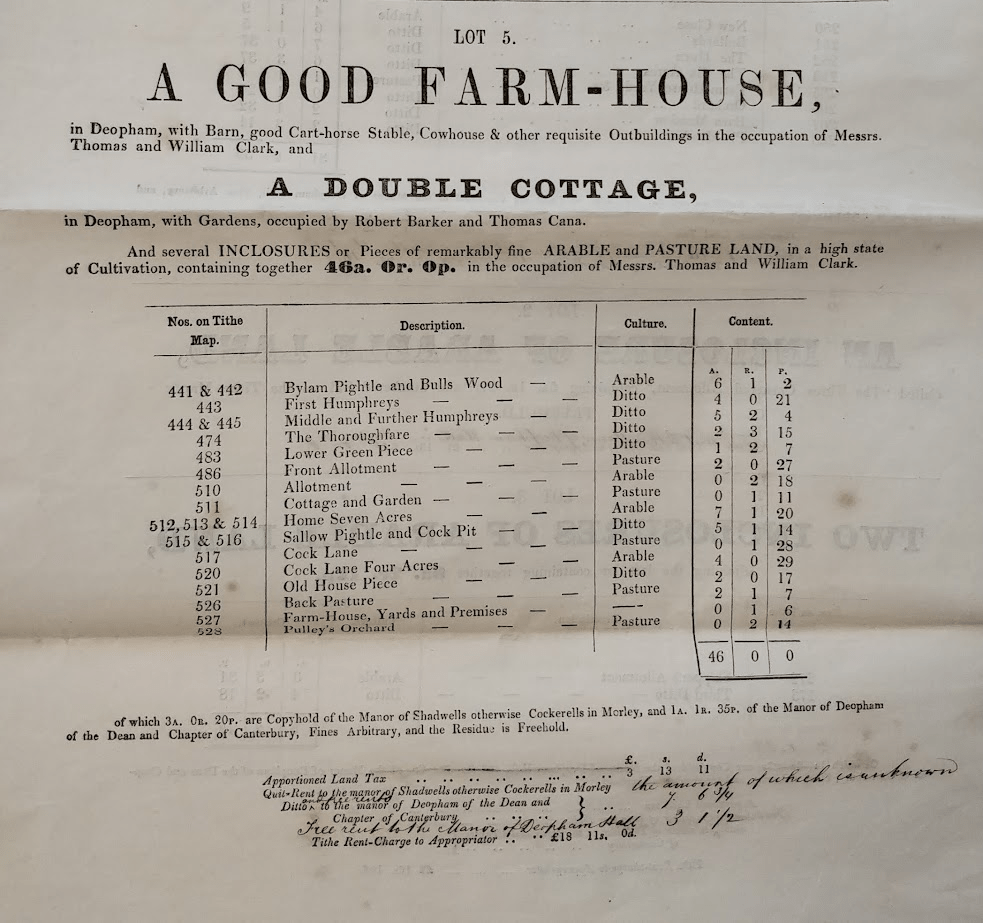
Lots 1-4 related to The Stalland Farm and land around it. Lot 5 is defined below:
Courtesy Wymondham Town Archive, their ref BF 61.
The plot numbers listed above can be seen on the following extract from the 1843 tithe map:
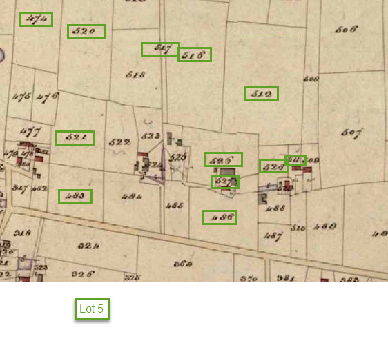
All rights reserved by Norfolk Record Office who hold the original; their ref is NRO DN/TA 743
Lot 5, as shown below, was purchased by James Shickle of Elsing for £2,330:
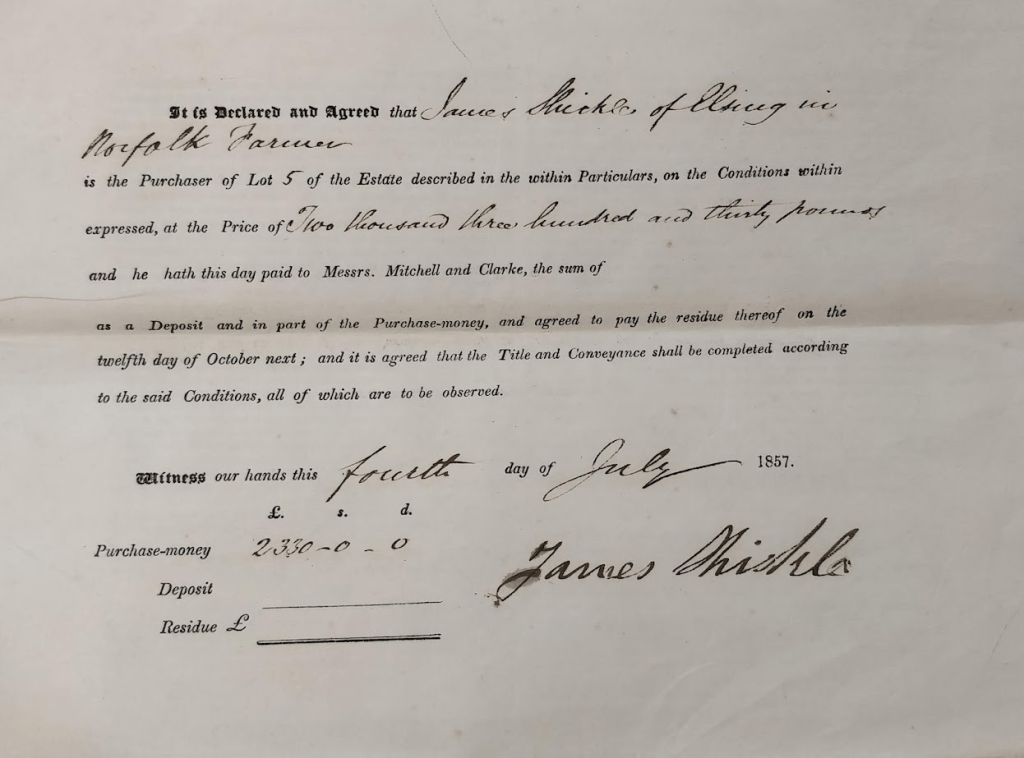
Courtesy Wymondham Town Archive, their ref BF 61.
1899 – Fire
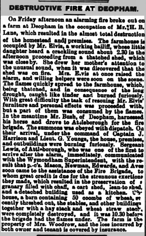
Norwich Mercury June 24th, 1899
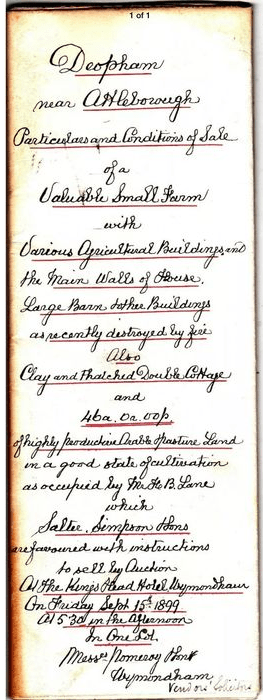
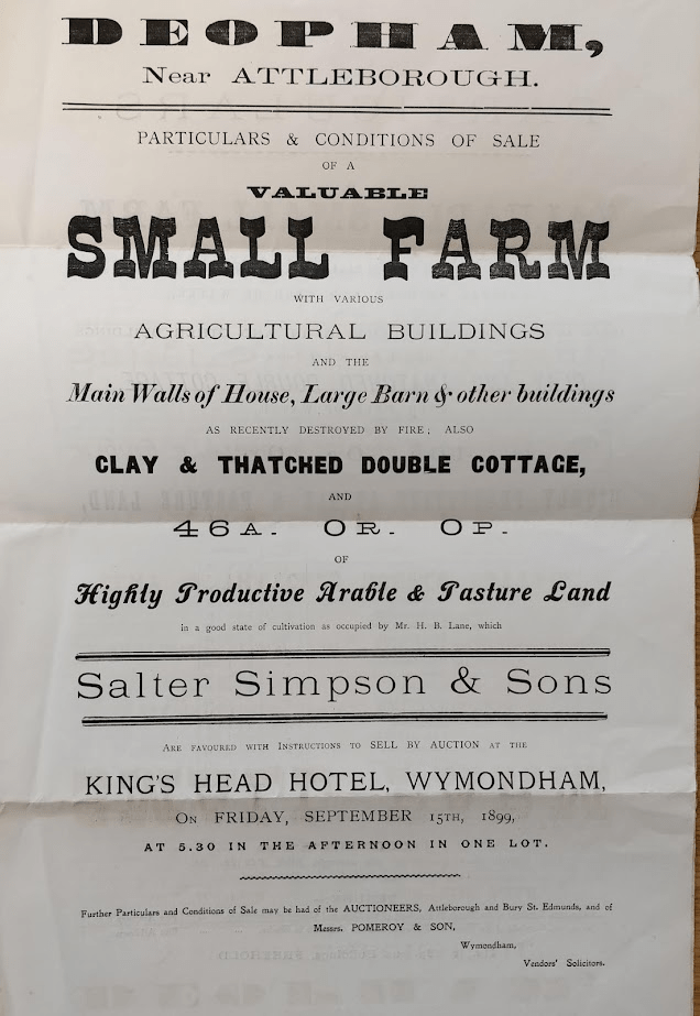
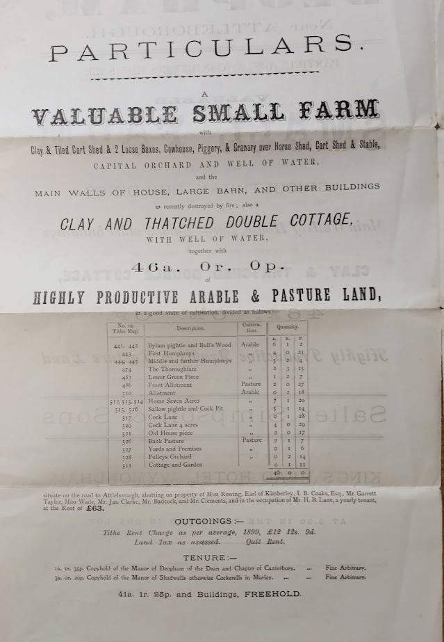
1899 Auction
The following document, advertised for sale on eBay, is a draft for the printed sale particulars. The final printed document follows below.

All rights reserved by Norfolk Record Office who hold the original; their ref is NRO DN/TA 743
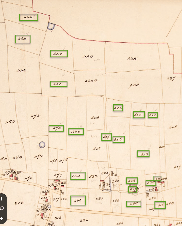
The plots listed above can be located on the tithe map as follows:
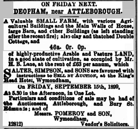
Norwich Mercury, September 9th, 1899
Purchase by Mr. David Woodrow
The farm was sold at this auction on September 15th 1899 to David Woodrow, farmer, of Great Ellingham for £975:
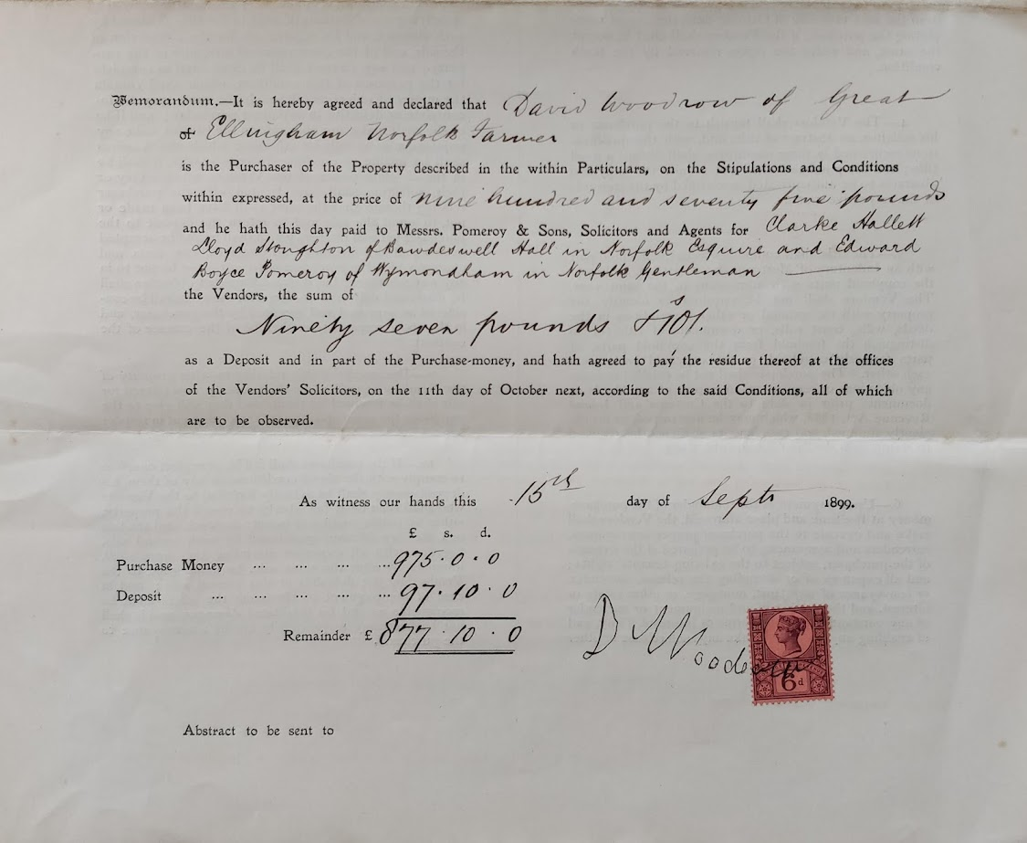
Reproduced with permission from the Wymondham Archive; their ref is BF61.
1911 Census
The above references to the farm do not give it a name. The 1911 census refers to the farm as The Green Farm. The 1921 census unfortunately does not include property names. The farm was still called Green Farm in 1967 .
| Date | Change |
|---|---|
| 30/10/23 | Plan of 1899 sale |
| 6/10/23 | Early version of 1857 sale particulars |
| 13/9/23 | Shickle purchase document |
| 28/8/23 | Further particulars of the 1899 sale |
| 21/8/23 | Published |
