Other spellings: Hurry’s
Contents
Introduction
There are several mentions of “Urry’s” in the Manorial Court Rolls in the context of identifying a piece of land by reference to its proximity to this property.
On the other hand, there are two references to “Hurry’s”, but considering the fluidity of spelling there is a very high probability that Urry’s and Hurry’s are one and the same. It is tempting to imagine that the “H” was dropped as time went on, but the usage shows Urry’s to be an older form dating at least from the seventeenth century, whereas Hurry’s does not appear until the nineteenth century.
Origin of the Name
Bodleian Library Charters
The Bodleian library index1 shows that they have a group of charters relating to Deopham three of which relate to the Urry family – father and son. It seems unlikely that this is the land later known as Urry’s since the plot described below is not bounded by any thoroughfares. It does show however that the Urry family had an early presence in the village.
1. John, son of Ralph Urry of Depeham, grants to the prior and convent of Christ Church, Canterbury, in frankalmoigne2, that mill which Ralph his father gave to him in the tenement of Depeham, namely that which is situated in ‘Maydenho,’ between the land of Richard, son of Avicia, towards the west, and the land of David Ram towards the east, and between the land of the said John towards the north and south.
2. Ralph Urry of Depeham confirms the above donation.
3. Ralph Urry of Depeham undertakes that whereas the prior and convent of Christ Church, Canterbury, have granted to him the lands which William, son of Urric le Breton, held of Henry de Rya by the service of 2s. in Depeham, he will not buy, claim or appropriate any land belonging to their demesne in Depeham.
Hurry Genealogy
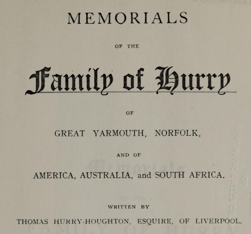
The Hurry family published a book in 1926 detailing their genealogy. The following link to Deopham appears on page 7 of this volume; there is no more direct connection to the village:
It is recorded in the Register of the Priors of Norwich, that in 1267 Sir Ralf Urri, of Deepham, Knight, gave to Nicholas, Prior of Norwich, and his convent, a piece of land at Wicklewood, in Norfolk, for “ the good of his own and his father’s soul.” It appears also that Ralf Urri, Clerk, in 1362, was Senescal de Lenn, or Steward to the Bishop of Norwich at Lynn Regis, in Norfolk ; and that in 1372 Richard Urri filled the same office.
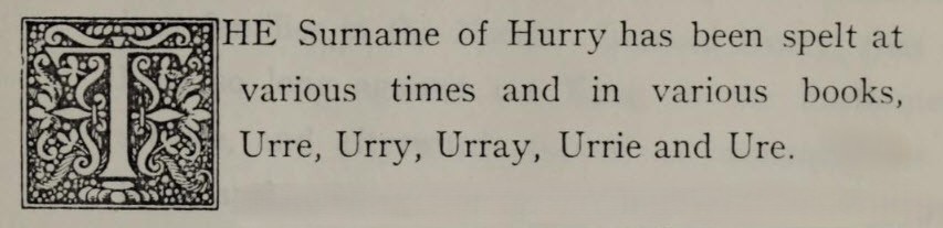
It is significant that on the first page of this text the following comment on spellings was recorded:
Location
1815 Survey
The 1815 survey of Deopham was based on the following map; the accompanying text lists piece no 432 as “Hurry’s with Moat”.
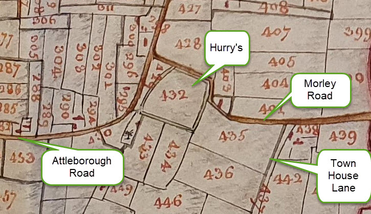
Reproduced courtesy of the Chapter of Canterbury; their ref 183720-17

1843 Tithes
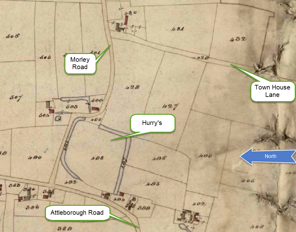

All rights reserved by Norfolk Record Office who hold the original; their ref is NRO DN/TA 743
Usage to Define an Adjacent Field
The Court of the Manor of Deopham of the Dean & Chapter of Canterbury April 24th 1689 defines a piece of land of 2½ acres as follows:
by the King’s Highway called Hunsgreen from Deopham Towngreen to Morley Green, North,
Abutts Snaylgate Lane, now called the Townhouse Lane, East;
land of Miles Hobart called Urrys, West;
Applying the above locations, the land so defined is therefore piece no 435 on the following map extract:
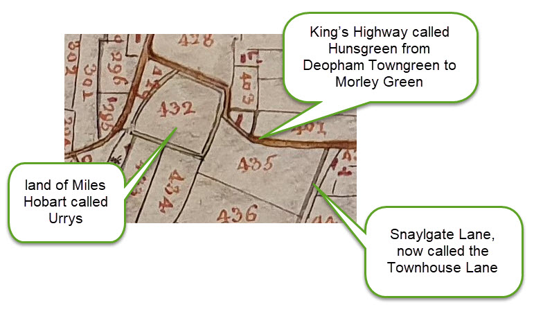
This definition of the 2½ acres is used repeatedly until the inclosures reorganisation of 1814 when it came to be known simply as “Piece no 105”. This carried on until the Court of October 31st 1900 when the enfranchisement was formalised so the land no longer appeared in Manorial Court Rolls.

All rights reserved by Norfolk Record Office who hold the original; their ref is NRO C/Sca 2/86
History
The record of the Court held on May 6th 1622 described Urrys as manorial woodland.
Footnotes
- Reference MS. Rolls Kent 1. ↩︎
- Frankalmoigne was an arrangement whereby land was given to the church in return for prayers being made for the donor’s sole after his death. ↩︎
Navigation
| Date | Change |
|---|---|
| 28/5/26 | Published |

