The photos etc. below are grouped by the road in which they are located. Current road names, current place names and current spellings have been used. The links below can be used as shortcuts to skip to the location of interest:-
Places by Road Name
Places in Alphabetical Order
- Blacksmiths Arms
- Church Farmhouse
- Crown Farm
- Crown Farm Cottages
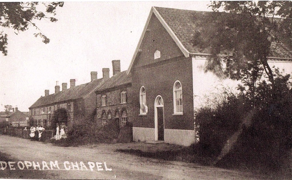
- Deopham Green Chapel
- Deopham House
- Gillaine, The Green
- Green Farm
- Half Moon Public House
- Halffield Lane Cottages
- Hall Farm
- High Elm Farm
- Hill Farm
- Holmsleigh
- Home Farm
- Ivy Cottage
- Jabula
- Jubilee Cottages
- Keeper’s Cottage
- Laurel Farm
- Low Common Bridge
- Low Common Chapel
- Low Common Cottages
- Mill Farm
- Next Door
- Park Farm
- Park Lane Bridge
- Park Lane Farm
- Park View Farm
- Pettingall’s Farm
- Pine Tree House
- Postmill
- Red Barn Farm
- Red Brick House
- Riverside
- Sandpit Farm
- Shaw’s Farm
- Shiralee
- South Cottage
- Springfields
- Stalland Lane
- Sturman’s Pumps
- Sunnyside Farm
- The Cottage
- The Cottage, 1, The Green
- The Grange
- The Mill
- The Old Tin School
- The Pastures
- The Post Office
- The Stalland Farm
- The Vicarage
- The Willows
- Threeways, The Green
- Threeways Cottage, The Green
- Treesdown
- Valley Dale
- Victoria Inn
- Walnut Tree Farm
- West View (Low Common)
- West View Cottages (Morley Road)
- White Cottages
- Willow Farm
- Woodrow’s Farm
Attleborough Road
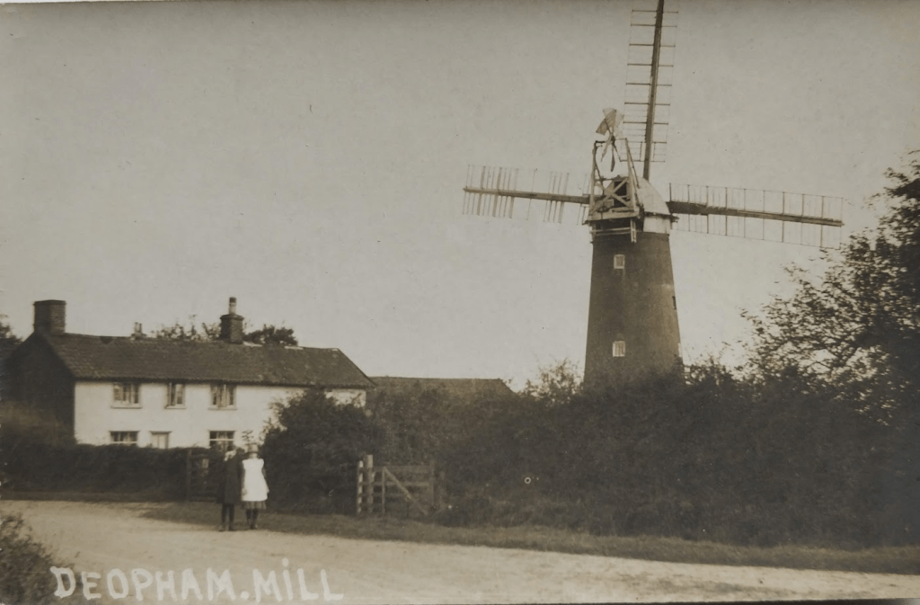
The Mill
This Tower Mill was located at the South Hill end of Deopham. It was in use from 1830 until about 1923.

Photo supplied by Phil Long.

Photo supplied by Carol Ewin.
This photo shows the other side of the sails:
Many thanks to Anne Edwards for sight of this photo.

Photo supplied by Carol Ewin.
There is more information on the history of the mill here.
Mill Farm
Details of the history of Mill Farm are available here.
Details of the 1941 Farm Survey for Mill Farm are available here.
Church Road
The Church
The following postcard is postmarked 1906. It is curious that this postcard was posted in London and sent to an address in Essex.
Click on an image to see it in greater detail.


Thanks to Sue and Jerry Boniwell for the loan of this item.
In the following image, the trees to the south of the church have been felled:

Photo: Wendy Eastell
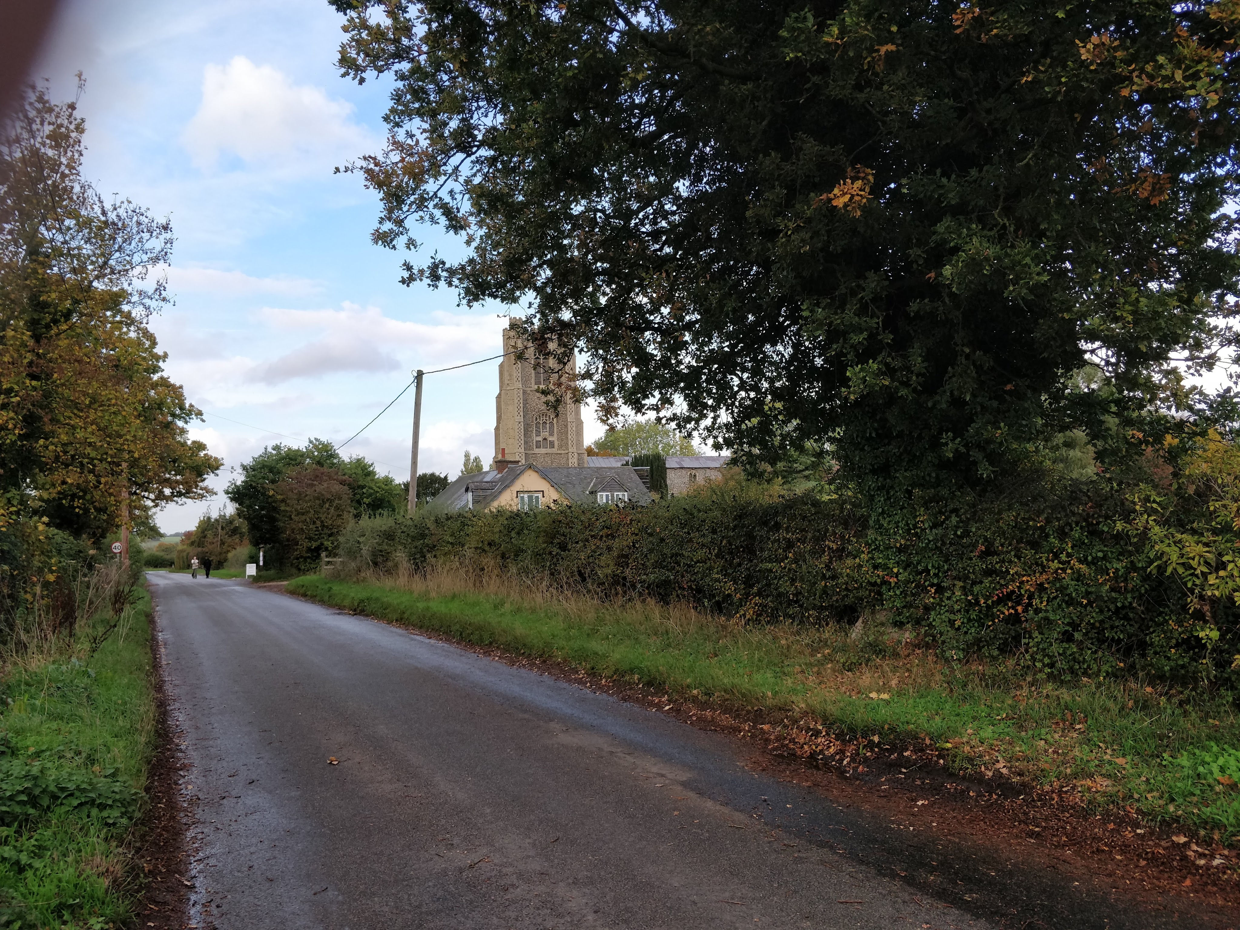
The same view (almost) in October, 2022:
Photo: G. Sankey
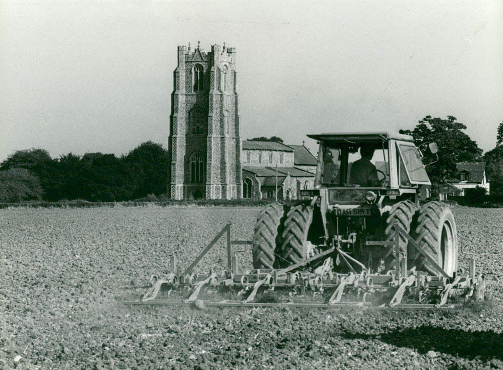
The above photograph appeared in the EDP in October 1985. Michael Allen has identified the scene as showing a Massey Ferguson tractor owned by Hall Farm. Roger Cullum, who worked for Hall Farm for over twenty years, was carrying out the spring harrowing shown in this view.

There are many more photos of the church here.
Church Farmhouse
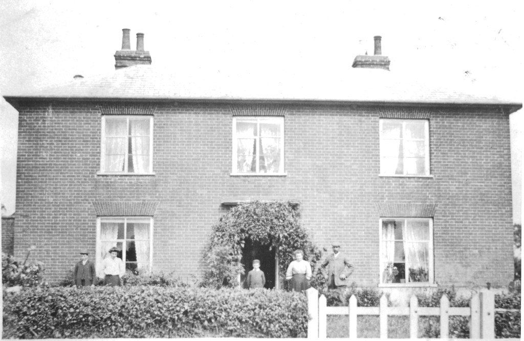
The following photo shows Church Farmhouse with sheep on the front lawn:-
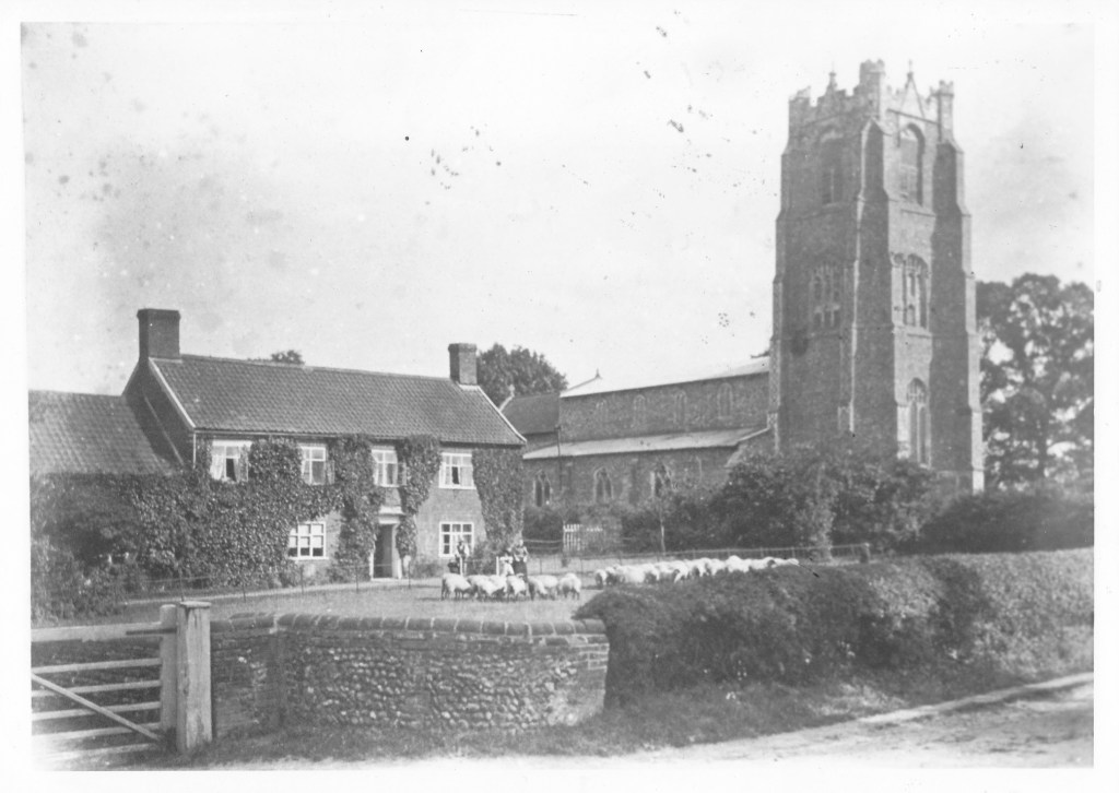
Photo supplied by Michael Allen.
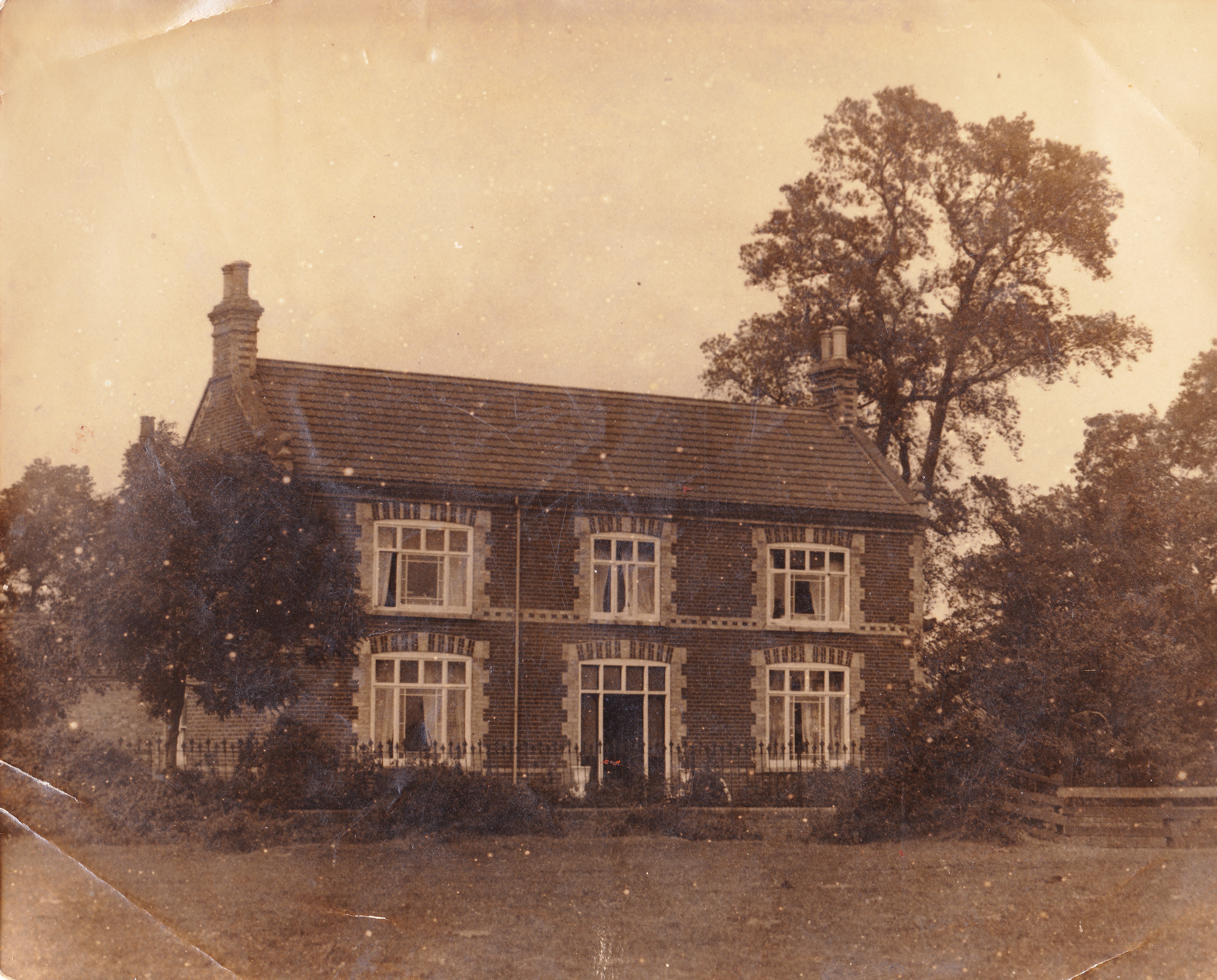
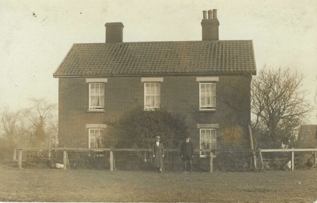
The following photograph is believed to date from around 1920:

With thanks to Elaine Peacock for sight of this photograph.
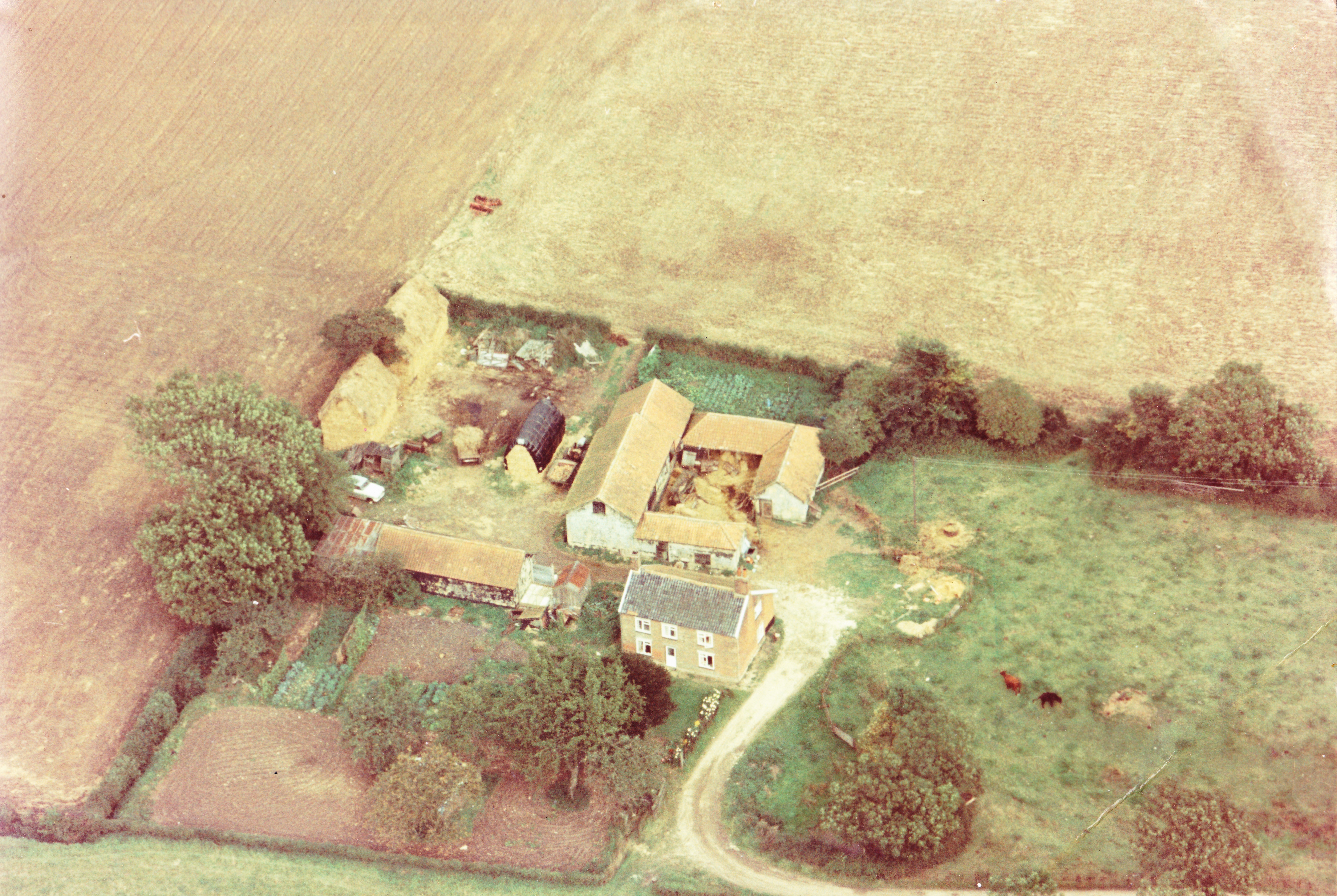
The next photograph shows Church Farmhouse around 1980. Outbuildings were still standing right up to the edge of the road:

Photo supplied by G Sankey.
There is more on the history of Church Farm here.
Details of Church Farm at the time of the 1941 Farm Survey can be found here.
Hall Farm

From a print belonging to Michael Allen.
Hall Farm a little later than the photo above:

From an image forwarded by Jacky Phoenix.
The following photograph shows Hall Farm in the background. The horseman has not been identified.
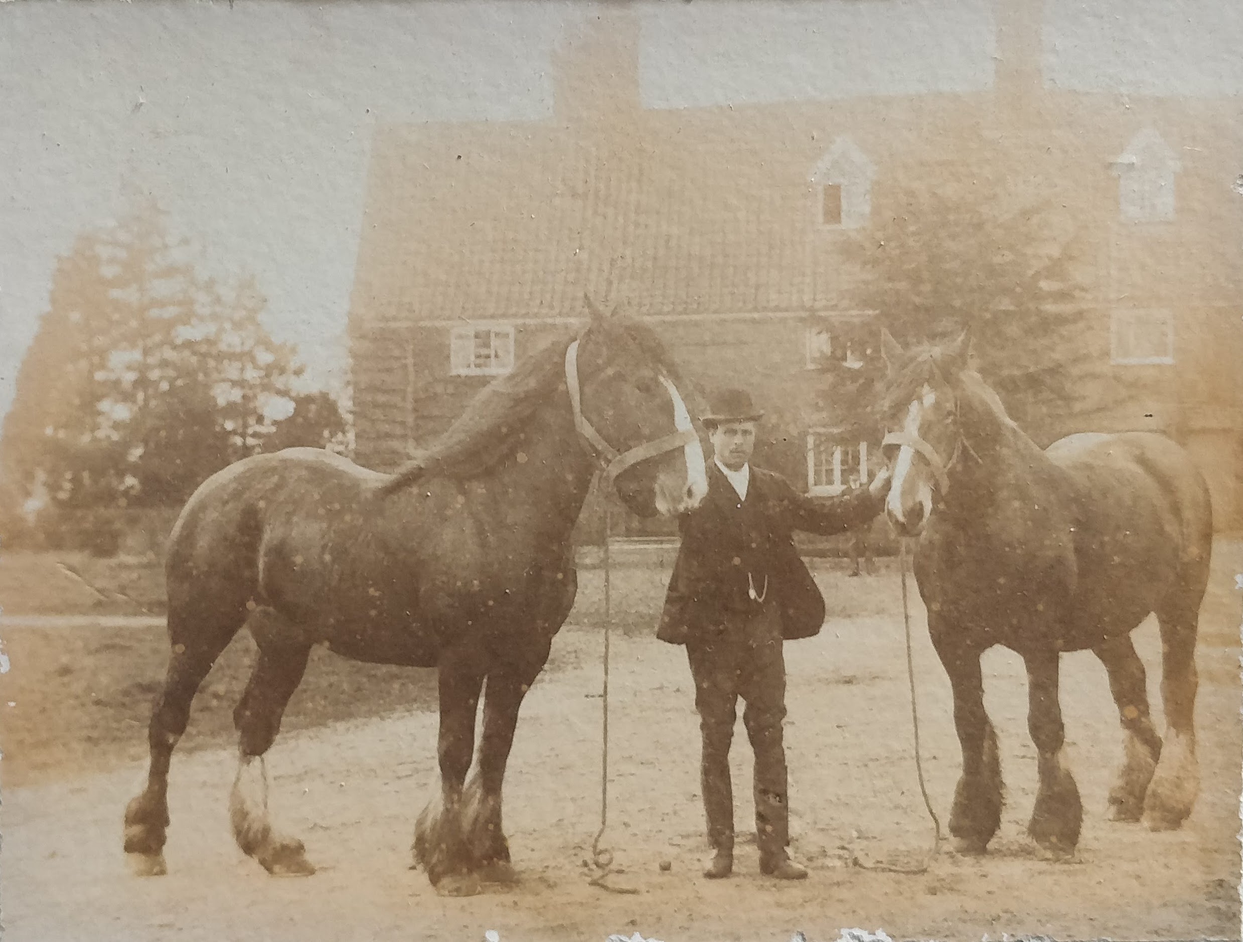
Thanks to Gwen Rostron for sight of this photo.
The following photo was also taken in front of Hall Farm; the men have not been identified.
(Note the dog in the barrel against the house wall!)

Thanks to Gwen Rostron for sight of this photo.
There is more historical information on Hall Farm here.
Details of Hall Farm at the time of the 1941 Farm Survey can be found here.
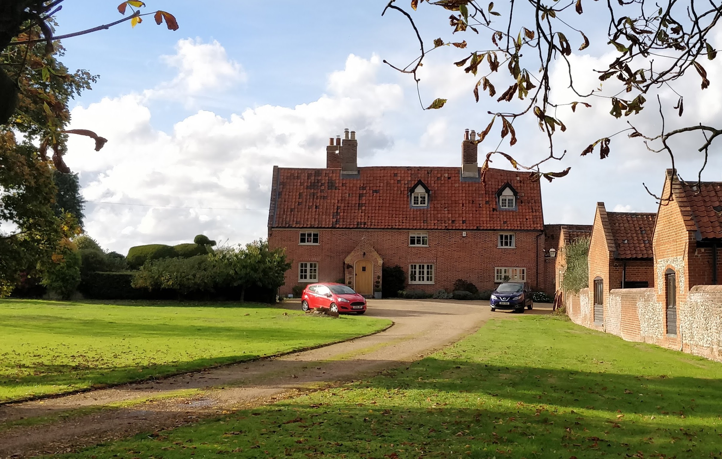
Hall Farm, October 2022
Photo: G. Sankey
There are photos of the demise in 2023 of the Hall Farm chestnut here.
Next Door
There is information on the home called “Next Door” here.
Springfields
There is information on Springfields here.
Victoria Inn
Most of the photographs and information relating to the Victoria Inn can be found on the “pubs” page here.
This following photo shows the hunt meeting outside The Victoria Inn. There is no date for this image, although motor enthusiasts might be able to make a suggestion. There is a chauffeur stood by the vehicle on the left.
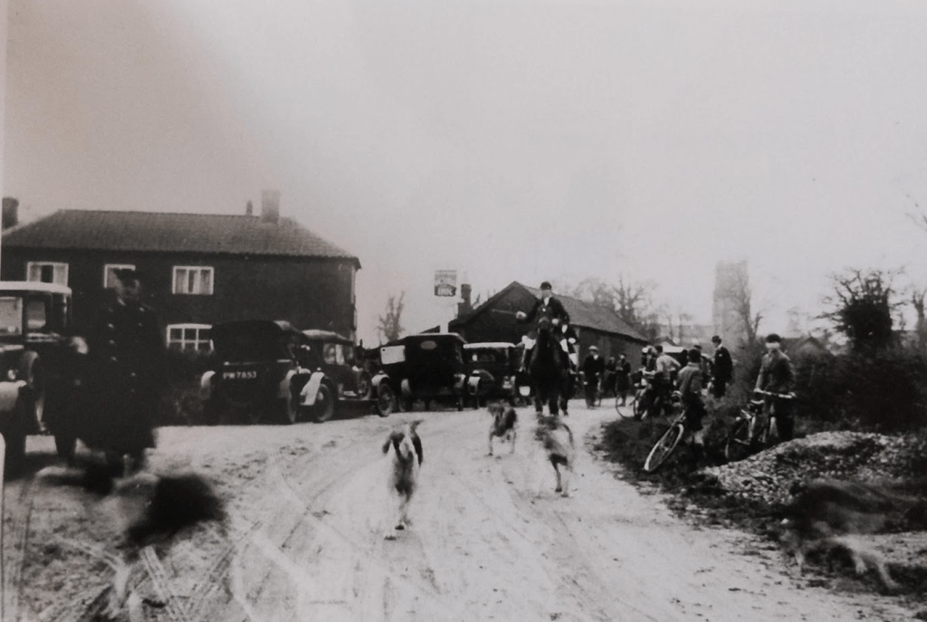
Thanks to Martin Jeffery for sight of this photo.
Halffield Lane
Halffield Lane Cottages
There is a history of these cottages here.
Low Common
Holmsleigh
There is information on the home called “Holmsleigh” here.
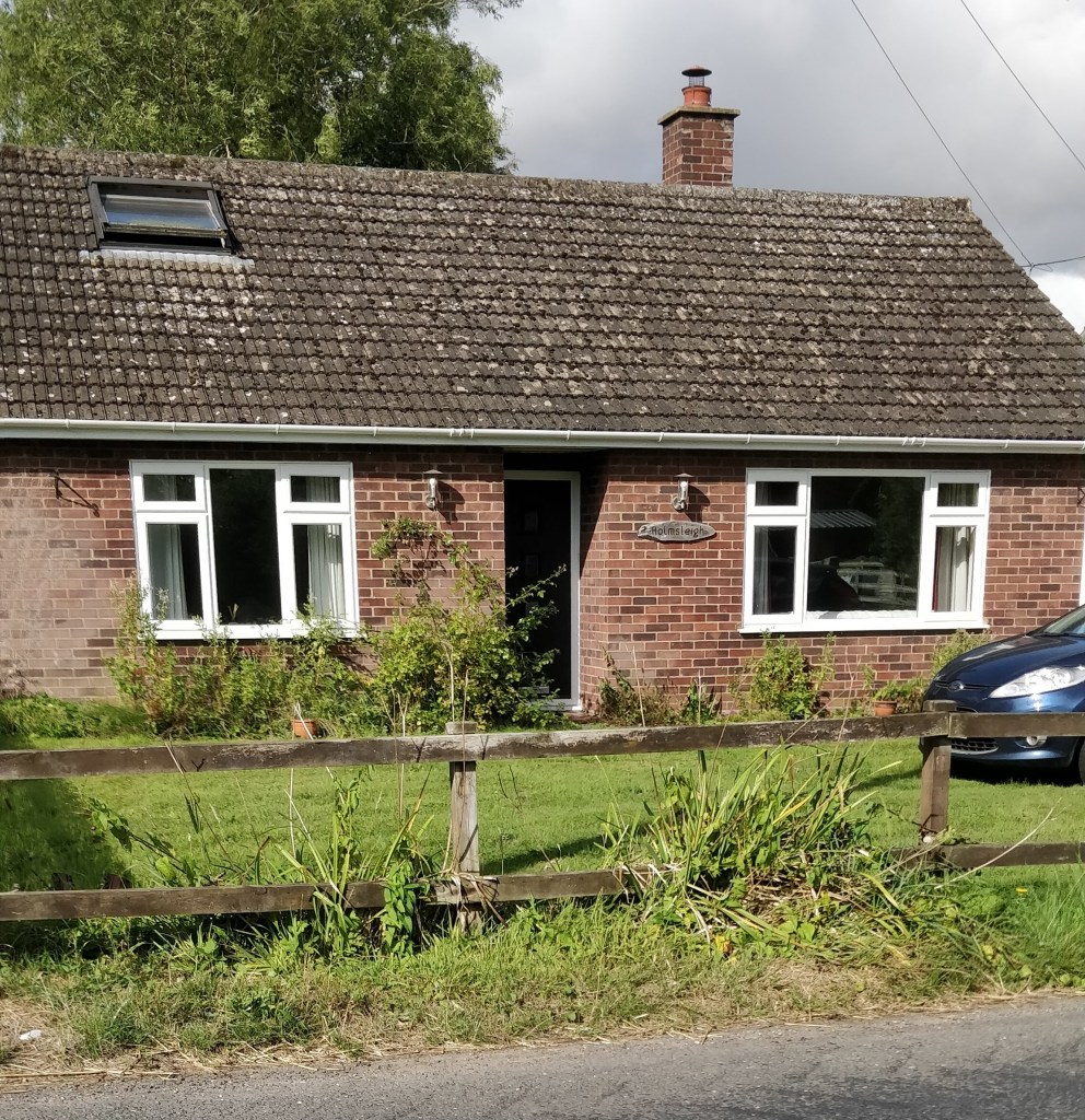
Photo: G.Sankey, 9/2024
Jabula
“Jabula” was previously known as “West View”; see here for its history.
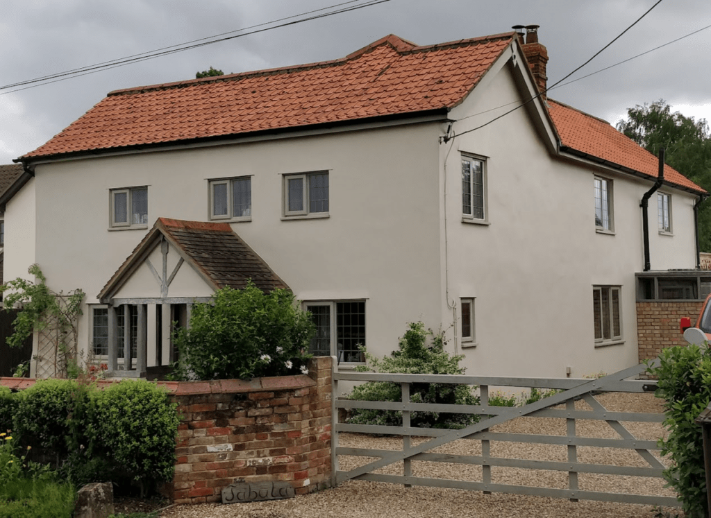
Photo: G Sankey, 7/2023
Low Common Chapel
Thanks to Jacky Phoenix and Glenys Brown for this image.
There is further information on this chapel here.
Photo: G Sankey
Site of the chapel, Oct 2022
Low Common Cottages
The following photograph shows the Low Common cottages c. 1980. Note the hand pump which used to serve the cottages that stood in front of the present homes.
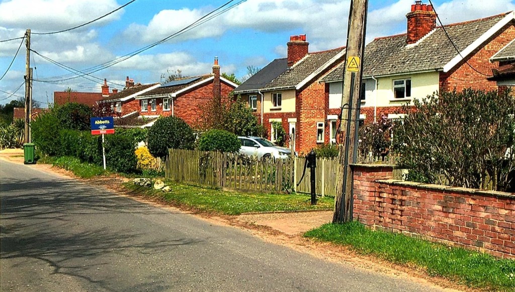
Image supplied by Jacky Phoenix
Close-up of the pump that used to serve the cottages beyond the chapel.

Photo: G Sankey, Oct 2022
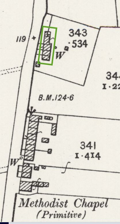
The cottages in the chapel photograph were demolished in 1932. The details of the specification and the contract for this destruction are available here. These documents make clear that the well shown with the hand pump in these pictures must be carefully protected, as also the new cottages that had been built behind the old homes. The following extract from a 1906 Ordnance Survey map shows the location of these cottages outlined in green:
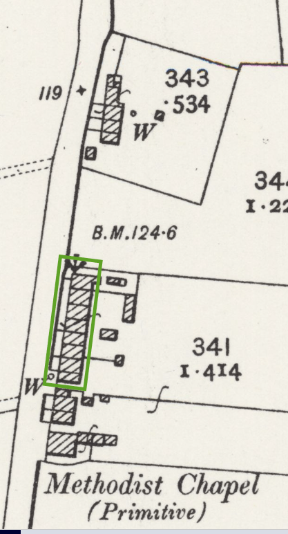
There was a second group of cottages north of the above group (as one travels towards the stream and its bridge). These are outlined in green on the following extract from a 1906 Ordnance Survey map:
The following photograph shows the cottages in the area outlined in green above; they have now been demolished.

Thanks to Michael Allen for allowing me to scan his copy of this image.
Low Common Bridge
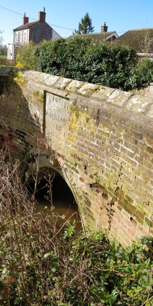
The much worn inscription reads:
DEOPHAM and HACKFORD 1818
LA …..
…. FRANCIS1
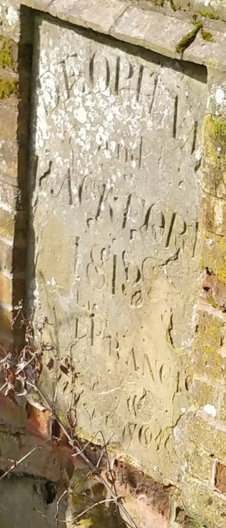
Photos: G. Sankey 3/2024
Pine Tree House
There is information on the home called “Pine Tree House” here.

Photo: G. Sankey, 9/2024
Riverside
There is information on the home called “Riverside” here.

Photo: G. Sankey, 9/2024
The Willows
There is information on the home called “The Willows” here.
Millhill Lane
Postmill
The name of the road and some ancient documents are all that remain to indicate the presence of a mill in Millhill Lane in the 14th century. Its location along the road has not been determined. There is a little information here.
Miscellaneous

Morley Road
Hill Farm

The black & white photo above was made available by Christine Bell.
Hill Farm, Morley Road.
The colour photo shows the farmhouse in July 2023.

Photo: G. Sankey 7/2023
There are details of the 1941 Farm Survey for Hill Farm here.
Pettingalls Farm
With thanks to Elaine Peacock for sight of this photograph.

Photo: G. Sankey 7/2023
There are details of the history of Pettingalls Farm here.
West View Cottages
There is a page on West View Cottages here.
Park Lane
Park Lane Bridge
There is information on the history of Park Lane Bridge here.
Park Farm
There is information on the history of Park Farm here.
There are details of the 1941 Farm Survey for Park Farm here.
Park Lane Farm
There is information on Park Lane Farm here.
There are details of the 1941 Farm Survey for Park Lane Farm here.
Park View Farm
There is information on the history of Park View Farm here.
There are details of the 1941 Farm Survey for Park View Farm here.
Pye Lane
High Elm Farm
With thanks to Elaine Peacock for sight of this undated photograph.
There is information on the history of High Elm Farm here.
The details of the 1941 farm survey for High Elm Farm can be seen here.
Keeper’s Cottage
There is information on the history of Keeper’s Cottage here.
Photo: Alison Downes
Laurel Farm
The following photograph of Laurel Farm shows members of the Hurrell Family:
Robert & Eleanor plus Percy, Mildred & Frank:
With thanks to Elaine Peacock for sight of this photograph.
For more information on the history of Laurel Farm, see here.
For details of the farm at the time of the 1941 farm survey, see here.
Laurel Farm in August 2023:

Photo G. Sankey
The Old Tin School

Photo: G. Sankey, 3/2025
There is information on the history of this school with photos here.
The Cottage

Photo supplied by Phil Long.
This cottage is nestled between the Post Office and Laurel Farm. At the time of the above photograph, c. 1911, it was the home of sisters Alice and Ellen Fendick.
For more information on the history of The Cottage, see here.
The Cottage in August 2023
Photo: G. Sankey

The Post Office

Photo: Wendy Eastell
The Post Office c. 1910:

Image from https://thestampbook.co.uk/
The Post Office (a little later than the above photo: the creeper has advanced further!):

Photo supplied by Steve Allen
Stalland Lane
Green Farm
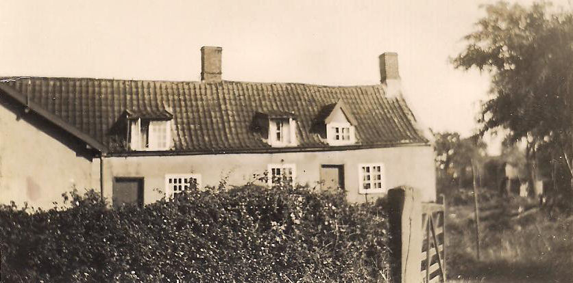
William and Julia Turner, who ran the Post Office, moved to Green Farm about 1890. Some time later they also owned the cottage next door, which later became Deopham’s ‘petrol station’.
At the time this photo was taken, about 1911, the cottage was occupied by the local blacksmith Walter Whittleton and his wife Julia (née Turner).
Sturman’s Pumps
The following photo shows “Jimmy” Sturman tending to his Esso petrol pumps. The cottage was also a general store which included bicycle repairs.
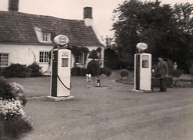
Photo supplied by Phil Long.
Sturman’s pumps and the Blacksmith’s Arms. The shop was run by Hettie and Jimmy Sturman.
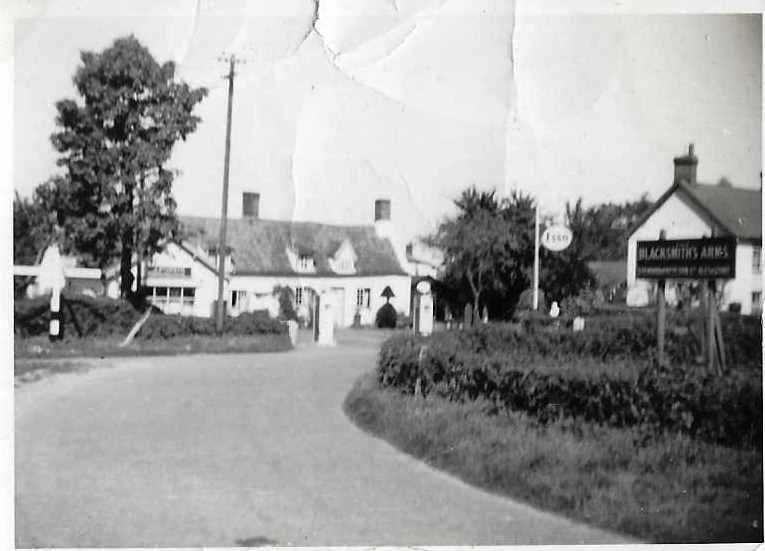
Photo supplied by Wendy Eastell.
There is only one arm on the signpost in this photograph and that points to Hingham.

Photo: Anne Edwards
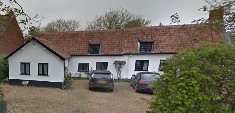
Sturman’s Pumps 2012
Ivy Cottage
Ivy Cottage is located next to Deopham Green Chapel. It was once occupied by Daphne Fincham, now Daphne Mott.

Map: © Ordnance Survey

Photo: Anne Edwards
The following photograph was taken in August 1995:

Photo: Steve Allen
There is more information on the history Ivy Cottage here.
Deopham Green Chapel
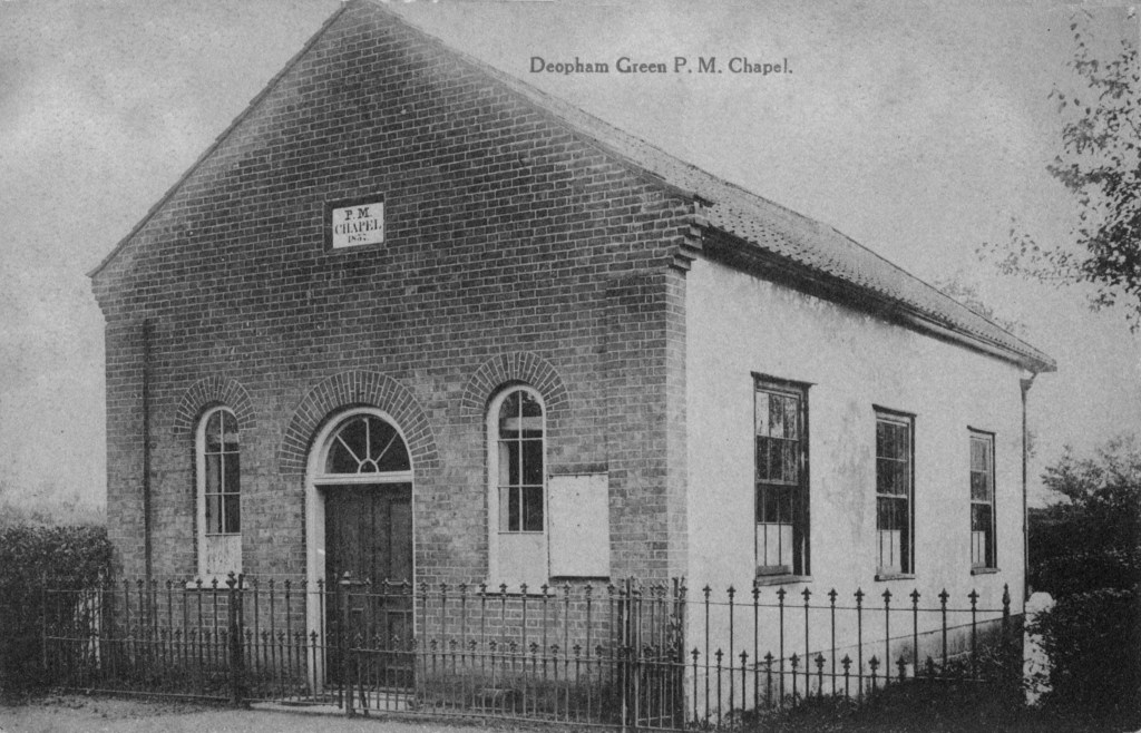
There are more old photos of the Deopham Green Chapel and its history here.
Walnut Tree Farm
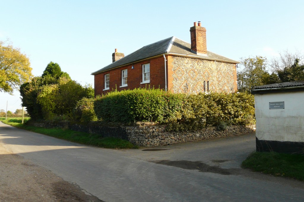
Photo: Phil Long, 2007
There are details of the history of Walnut Tree Farm here.
The Green
Blacksmiths Arms
The 1939 Register recorded Jack Wilkinson living nearby and Harry Rudrum living in the Blacksmiths Arms.

Photo supplied by Martin Jeffery
The following photograph shows a similar view in April 2024:

Photo: G. Sankey, 4/2024
There is more information on the Blacksmiths Arms on the Pubs page.
Gillaine, The Green
Information on Gillaine, The Green, can be seen here.
Half Moon Public House
There is information on the history of the Half Moon Public House here.
Jubilee Cottages
The road frontage of Jubilee Cottages:

The washhouse at No 1 Jubilee Cottrages:

With thanks to Jenny Porter (granddaughter of Amy Phoenix-Stone) for sight of these photographs
There are more photographs of the Jubilee Cottages here and more information on their history here.
Saunders, Grocer and Draper
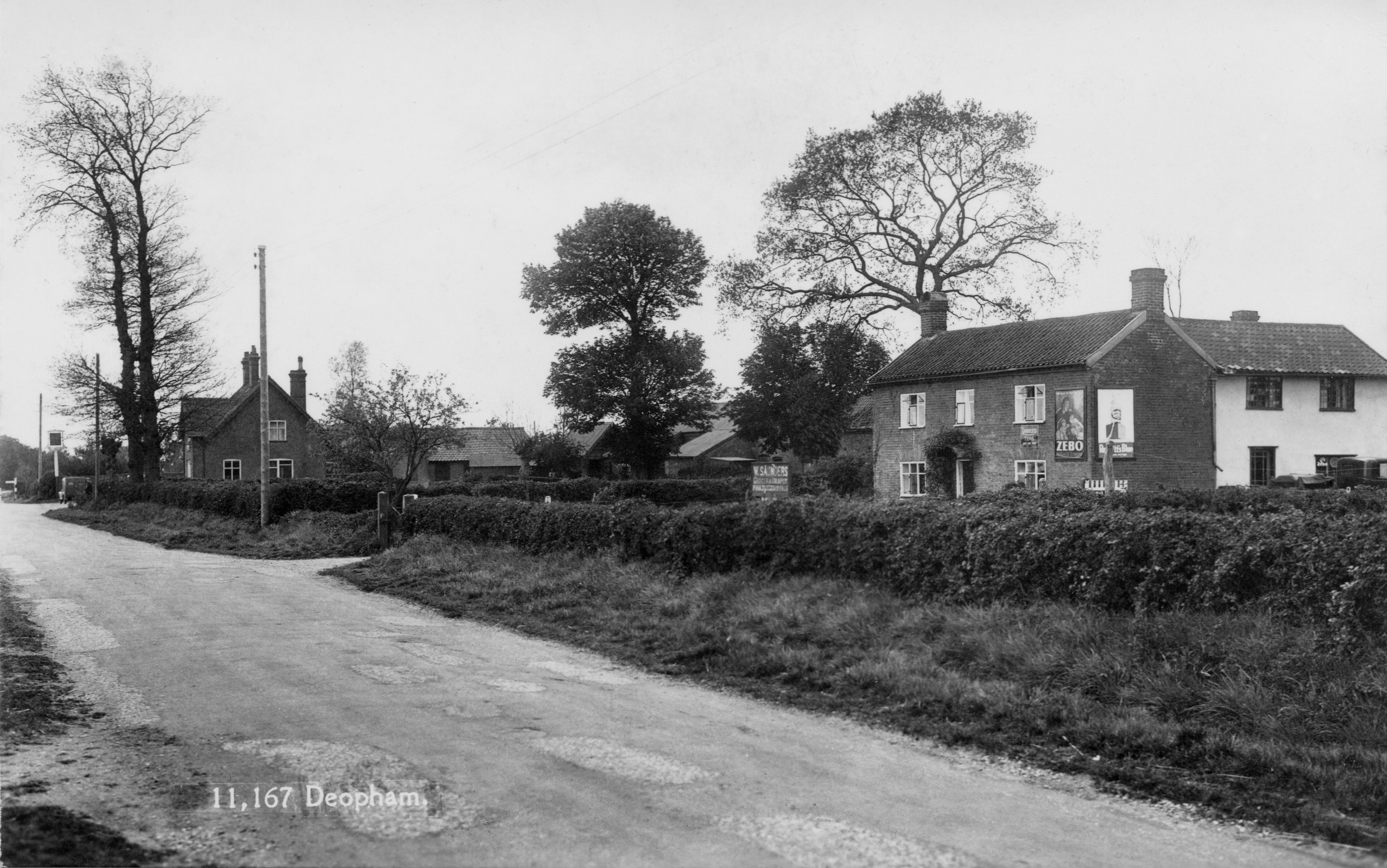
The sign by the hedge says:-
“W. Saunders, Grocer and Draper”.
The Half Moon pub is in the distance to the left of the photo.
Photo supplied by Steve Allen
Shiralee
Information on Shiralee can be seen here.
The Cottage, 1, The Green
Information on The Cottage, 1, The Green, can be seen here.
Threeways, The Green
Information on Threeways, The Green, can be seen here.
Threeways Cottage, The Green
Information on Threeways Cottage, The Green, can be seen here.
White Cottages
Information on the White Cottages is available here.
Willow Farm
The following image shows Willow Farm with Margaret Fulcher by the front door; the photo is understood to date from the early 1980s.

There is also a photo taken around 1907 of the Fulcher family in front of the farmhouse here.
The following picture shows Ken and Sue Bassett (the owners at that time) in front of Willow Farm with Maureen Briggs (a relation of the Fulchers); the photo was take in 2009. Following this visit by the Mr & Mrs Briggs, Ken Bassett wrote up the following notes.

Both of the above photos were supplied by Jane Murray
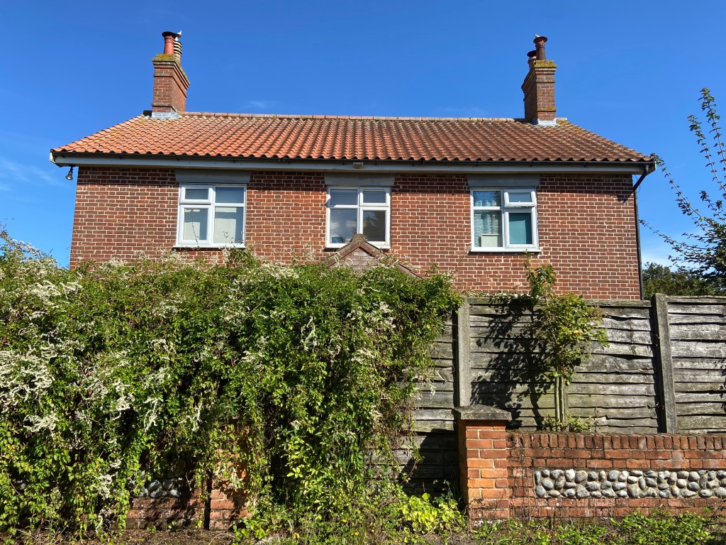
Photo: Jane Murray, September 2023
Woodrow’s Farm
The following photograph shows Woodrow’s Farm around 1921 with David Woodrow and Amy Phoenix-Stone. Amy and her husband Harry lived with David Woodrow; Amy cooked & cleaned.
With thanks to Jenny Porter for supplying this photo and the context.
There are details of the history of Woodrow’s Farm here.
The Stalland
(also referred to as the Stolland)
Red Brick House
The following image of the house is dated around 1983/4:

Thanks to Steve Mahoney for access to this photo
There are details of the history associated with Red Brick House, previously known as Stalland Farm, also known as Deopham Apiaries, here.
Stalland Pit

The Stalland Farm
There are details of the history of the Stalland Farm here.
Details of The Stalland Farm at the time of the 1941 Farm Survey can be found here.
Stalland Cottage

© Norfolk Museums Service
A family group including agricultural union member Herbert Coldham, outside his cottage at Stolland Pit, Deopham. Taken in the 1920s. The cottage belonged to the Leverett family, for whom Mr. Coldham worked.
Vicarage Road
Council Houses
The east end of Vicarage Road in the 1950s:

Photo supplied by Steve Allen
Crown Farm
There is information on Crown Farm here.
Crown Farm Cottages
There is information on the Crown Farm Cottages here.
Deopham House
Deopham House was the village school prior to its being sold in 1984:

Photo: Irelands

Google Street View, August 2023
There is information on the history of this school here.
Red Barn Farm
The following photograph is undated but shows Mildred Cooper and Ken.

With thanks to Elaine Peacock for sight of this undated photograph.
The details of the 1941 farm survey for Red Barn Farm can be seen here.
Shaws Farm
The following photo of Shaws Farm was taken by Richard Long in about 1958. Phil Long says that his brother took this photo standing on top of a straw stack, and that it is probably their mother standing in front of the garage calling him to come down!
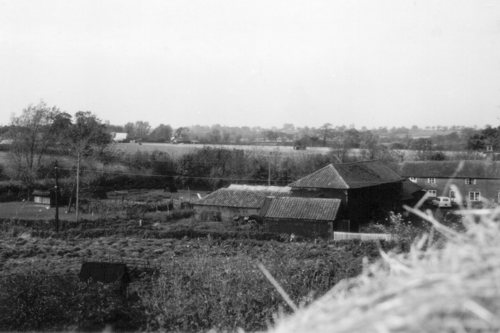
Photo supplied by Phil Long.
The survey of Shaws Farm in 1941 and what was being farmed is available here.
Information on the history of Shaw’s Farm can be found here.
Sunnyside Farm
The following photo from the early 1900s shows Sunnyside with Elizabeth Leverett. There are more details on the Deopham People page.
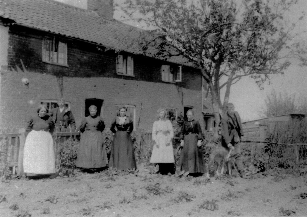
Photo supplied by Phil Long.
This farm lies to the Hingham side of the parish boundary, but in the past it included land on both sides of the boundary between Deopham and Hingham. Royal Mail regard the farm as having a Deopham postal address. There are details of the farm’s history here.
The Grange
There is information on The Grange, previously the parish vicarage, here.
The Pastures
There is information on the history of The Pastures here.
Valley Dale
There is information on the history of Valley Dale here.
Victoria Lane
Home Farm
See here for a history of Home Farm.
See here for details of the farming activities of Home Farm at the time of the 1941 Farm Survey.
Sandpit Farm
See here for details of the farming activities of Sandpit Farm at the time of the 1941 Farm Survey.
South Cottage
There are details of the history of South Cottage here.
Treesdown
There is a page for Treesdown here.
Footnotes
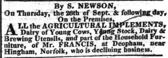
- The Norfolk Chronicle of September 14th 1833 carried an advert for the sale of the property of a Mr. Francis who was “declining business”:
↩︎
| Date | Change |
|---|---|
| 24/2/26 | Crown Farm Cottages |
| 30/11/25 | 1983 photo of Red Brick House |
| 23/9/25 | Homes on The Green |
| 29/8/25 | Sandpit farm & Treesdown |
| 30/6/25 | Shiralee; link to Stalland Lane page |
| 26/6/25 | Woodrow’s Farm photo |
| 7/6/25 | The Willows |
| 14/4/25 | The Old School changed to Deopham House; Low Common Chapel link corrected |
| 19/3/25 | History of Shaw’s Farm moved to separate page |
| 5/3/25 | Keeper’s Cottage |
| 25/2/25 | Walnut Tree Farm 2007 photo |
| 12/2/25 | Red Brick House |
| 18/11/24 | Shaw’s Farm 1901 sale link |
| 10/11/24 | Photos of High Elm Farm, Laurel Farm, Pettingalls, Church Farm and Red Barn Farm |
| 7/10/24 | Sunnyside & Shaws Farm moved to Vicarage Rd; added link to Valley Dale page. |
| 30/9/24 | Low Common: Pine Tree House, Holmsleigh & Riverside |
| 21/8/24 | Walnut Tree Farm |
| 29/4/24 | Park Lane Bridge |
| 27/3/24 | Low Common Bridge |
| 25/3/24 | Mill details moved to a separate page; Old Blacksmiths Arms photo |
| 17/3/24 | Adverts of 1828, 1830 & 1833 for the Mill |
| 31/12/23 | Crown Farm |
| 20/12/23 | Nextdoor, Springfields, The Grange |
| 14/12/23 | Horses in front of Hall Farm; Sunnyside Farm |
| 22/11/23 | Park Lane Farm |
| 4/11/23 | White Cottages |
| 31/10/23 | West View Cottages |
| 25/10/23 | Jolly Cottages |
| 3/10/23 | Ivy Cottage photos; link from Park Farm to 1941 survey; link to Halffield Lane cottages; Sunnyside Hingham. |
| 29/9/23 | Wendy Eastell’s photo of Post Office and Church Road |
| 28/9/23 | Anne Edwards’ photos of Sturman’s pumps and The Mill |
| 22/9/23 | Hall Farm chestnut |
| 20/9/23 | Link to High Elm Farm history |
| 18/9/23 | Sharper copy of the hunt outside Victoria; Park Farm |
| 7/9/23 | Photos of Willow Farm |
| 30/8/23 | Link to specification for demolition of Low Common cottages. |
| 28/8/23 | Home Farm |
| 25/8/23 | Link to Church Farm history |
| 21/8/23 | South Cottage and Woodrow’s Farm |
| 17/8/23 | Alphabetical index by place |
| 16/8/23 | Links to information on Laurel Farm, The Cottage & Willow Farm |
| 12/8/23 | The Cottage sales particulars 1951 |
| 8/8/23 | Shaws Farm |
| 5/8/23 | Sales particulars for Mill Farm |
| 2/8/23 | 2023 picture of West View |
| 1/8/23 | The Stalland sales particulars, 1857; links to mill website pages |
| 28/7/23 | Pettingalls Farm; new photo of Hill Farm as it is now; West View 1947 |
| 27/7/23 | Sales particulars of Park Farm & West View; |
| 26/7/23 | Mill sales particulars |
| 10/6/23 | Description to view of tractor harrowing near the church |
| 6/6/23 | Photo of tractor harrowing near the church |
| 31/5/23 | Photo of Church Farmhouse with outbuildings |
| 6/9/22 | Published |
